“Dreams and goals define life. When dreams change to goals, the small talk ends and the work begins…There are short-term, medium-term, and long-term goals, each with their own degree of complications to test one’s resolve. Once goal-orientated, you control your life. A round-trip motorcycle trip to South America has always been a dream for me. However, when it became a goal, it evolved into an exercise in discipline and perseverance. I knew it would be a tough challenge and prepared for the inevitable obstacles. Now my dream ride has become a test of the human spirit and personal development. — Glenn Heggstad, “Two Wheels through Terror”.
I made it home on the 18th. The trip from Punta Arenas to Santiago to Houston to Chicago had only one hiccup. When I booked the flight out of Punta Arenas back in December, I reserved a seat on a flight that was leaving at 2:54. What I failed to realize is that LATAM’s reservation system was working on 24-hour clock, so my flight was leaving at 2:54 AM!!! It never crossed my mind that this small an airport would be scheduling flights out at 2:54 in the morning. I got on a 2:45 PM flight by going standby. It was clear sailing after that.
I’m very glad to be back home and reconnecting with Kathy and the rest of my family.
Now comes an interesting challenge for me…figuring out the next step in my life. I accomplished one very important objective on my journey: I put sufficient time and distance between leaving my job at Horizon and now. As a result, I believe I’m in a good position to make the best decision possible about where I should spend my time and effort at this point in my life and what my new priorities should be. I’m going to take the next couple to three weeks to sort this out. With social distancing practices in place, I should have plenty of time and opportunity to accomplish this…ugh!
I’d like to thank the following people for making my adventure possible and/or contributing to it.
Kathy and my family – for putting up with my craziness in deciding to do it, planning it out and then putting up with my absence (maybe the last bit was more of an advantage for them)!!!
RIDE Adventures: https://www.rideadv.com/. RIDE Adventures guided the Pucon to Ushuaia section of the trip, which was 17 days. Eric Lange, who I believe is the owner, and I chatted a number of times and he helped organize my thoughts and direct me towards the trip I booked. Christine was also a big help. Eric Thomson, our guide and leader, was a joy every day on the trip with translation help, local knowledge, great tips, funny stories, entertaining meals… Eric is a great character and someone I will never forget. He will go the distance for anyone on the road, as I have seen him do multiple times. I will be back with RIDE Adventures for additional trips in the future.
The client group on the Pucon to Ushuaia leg of my trip was fantastic. Thank you to Gary and Liana, Kevin and Jane, JD, Craig, Mike, Phil, John and Randy. Great to get to know all of you and I hope our paths cross again someday. I would love to ride with you again!!!
Earth River Expeditions: https://www.earthriver.com/. The eight day Rio Futaleufu rafting trip was organized and guided by Earth River. Eric Hertz runs Earth River out of NJ, I believe, and his two sons, Cade and Teal, were our guides along with Umberto and Kyle. They were a great team providing advice, laughs, protection, info and enjoyment. I plan on working with Earth River again sometime in the future.
The client group I was with on the Fu was a wonderful collection of people from all walks of life and geographies. It’s always a risk going on a guided trip with a group of strangers, but in this case, it was a delight! Thanks again to Gail, Barb, Elaine, Dan, Jay, Cheryl, Tom, Crystel and Keith. It was a pleasure spending a week with you on the river!
RawHyde Adventures: https://rawhyde-offroad.com/. I took a three day off-road motorcycle riding course and then a two day trip into the Mojave Desert with Owen and Rob (my coaches) and a great group of people to learn how to ride a motorcycle off-road and in the conditions I was anticipating would exist on my itinerary. Thank God I did this. I would have either been seriously injured or dead without having taken this step. RawHyde is a great group located in Castaic, CA and I highly recommend them. Also, thanks to Bob Clark at Motoworks in Chicago for pointing me to RawHyde.
Ride-Chile: http://www.ride-chile.com/. I rented the BMW from Ride-Chile and they did a great job of working with me and addressing my needs for the middle three weeks of my trip. Ana was a joy to work with and helped out anyway that was possible.
Luciano. I met Luciano on 2/17 under a highway sign in the Atacama Desert. He took me under his wing and helped me out for several days thereafter. Luciano, who is from Argentina, wants to ride Route 66, and hopefully, I’ll be able to be his partner on doing so in the future.
Jose, who I also me on 2/17 under the highway sign, was a joy to be with for several days.
Pedro, who I met on the road and had a nice lunch with. I hope to see you when you ride through Chicago for a tour of the Blues bars in the area.
The two men who helped pull my motorcycle out of the Rio Santa Maria outside of San Jose, Argentina.
All the folks at Horizon Therapeutics. I would not have been able to take the time to embark on this adventure without their contribution to building a great company and allow me to benefit from their efforts.
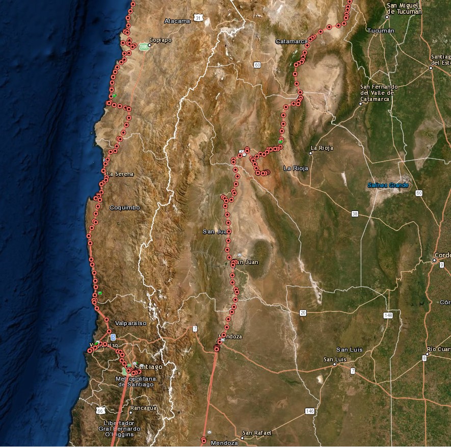
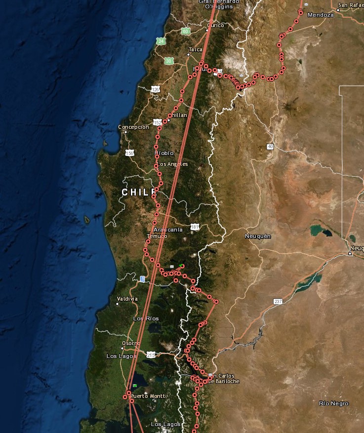
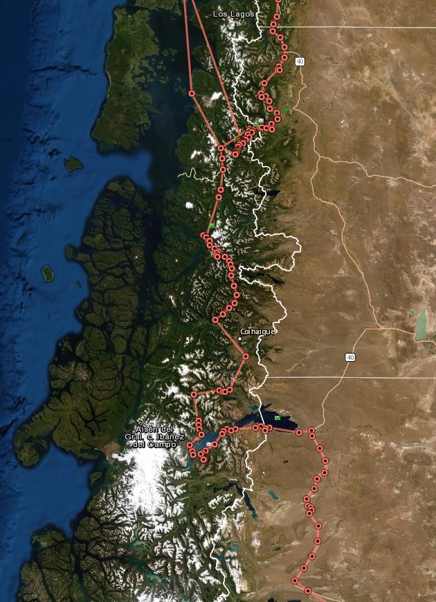
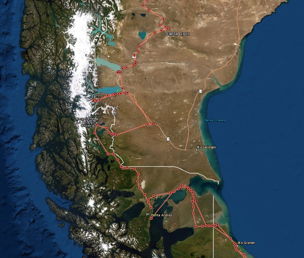
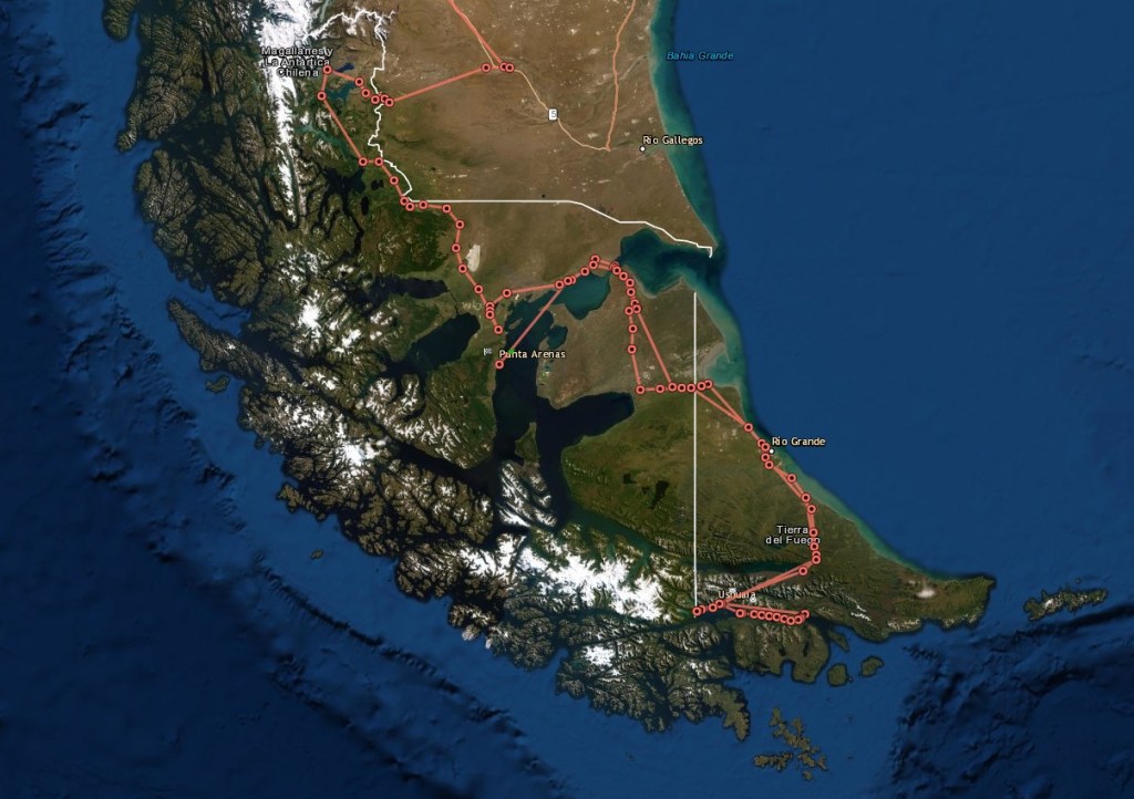
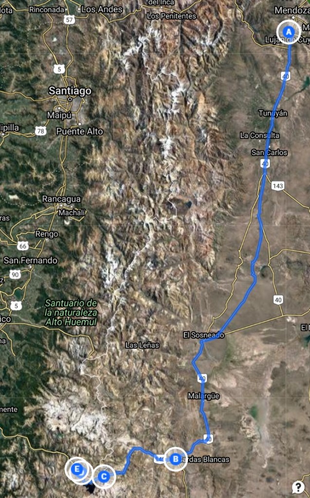
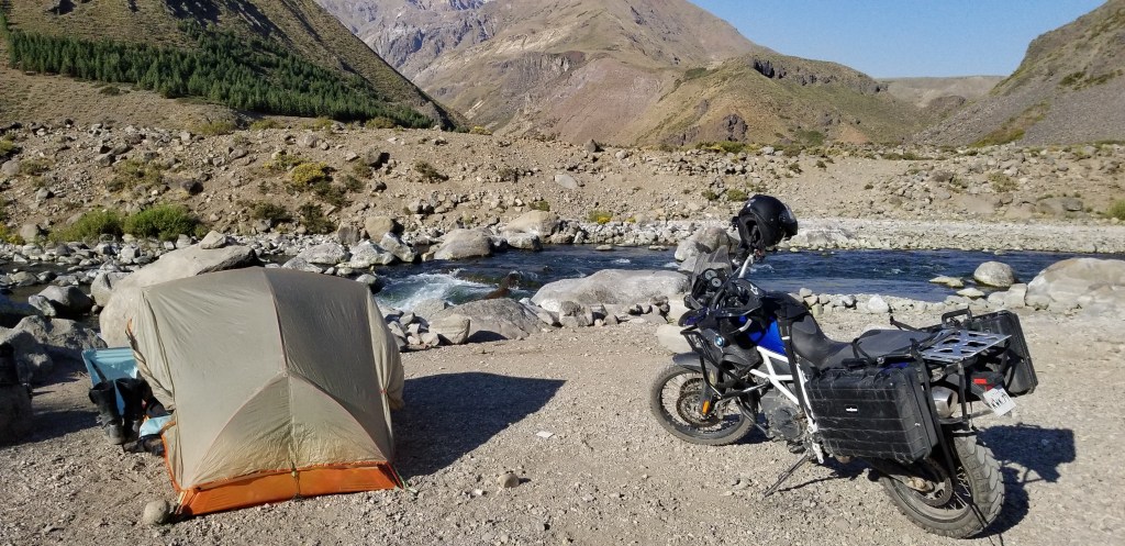
Below is a the GPS track of my trip. I used a SPOT Hero device, which recorded my location every 30 minutes or so for the length of the trip. I divided the map into six sections to provide sufficient resolution. After 6,700 miles on two motorcycles and eight days whitewater rafting later, I’m very grateful to have had the opportunity to experience all the people, places and adventures. Hopefully, there will be more adventures in the future…Peru, Bolivia, Brazil, Paraguay, Uruguay and Ecuador are at the top of my list, but this time with Kathy…stay tuned….
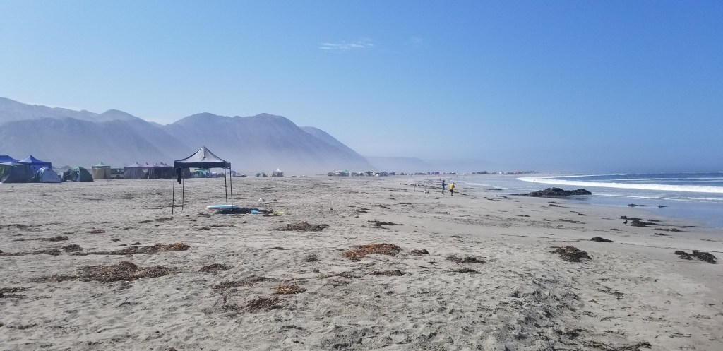
The below photo of Gary and Liana, just about says it all!!!
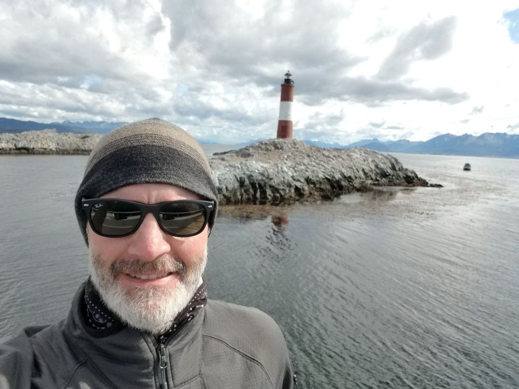
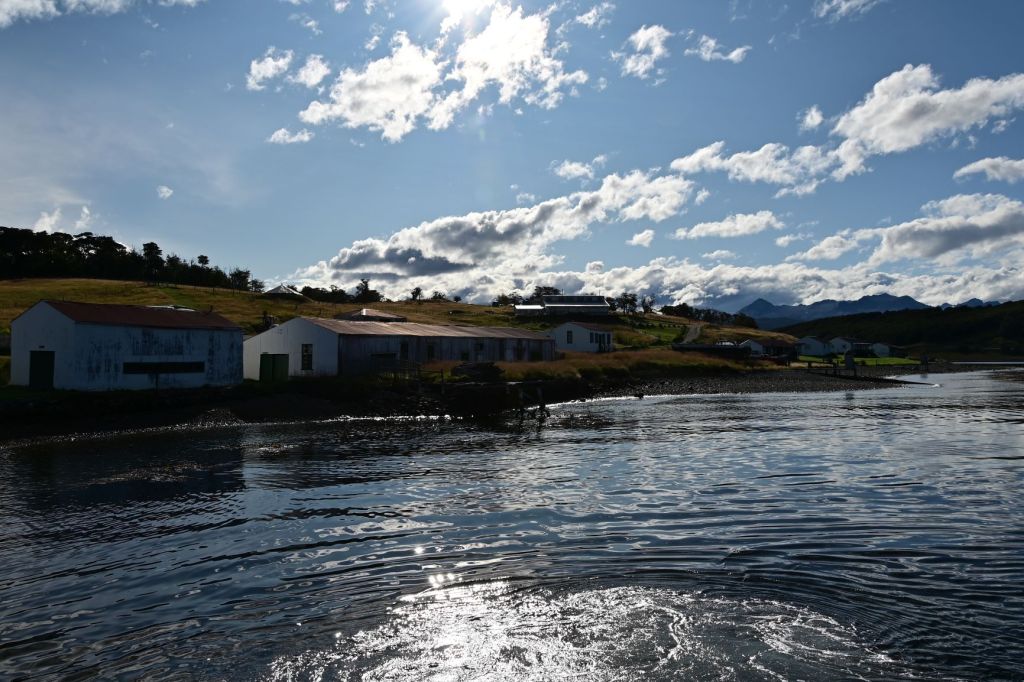
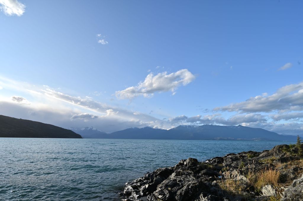
March 15 – The Beagle Channel and Harberton Penguin Reserve
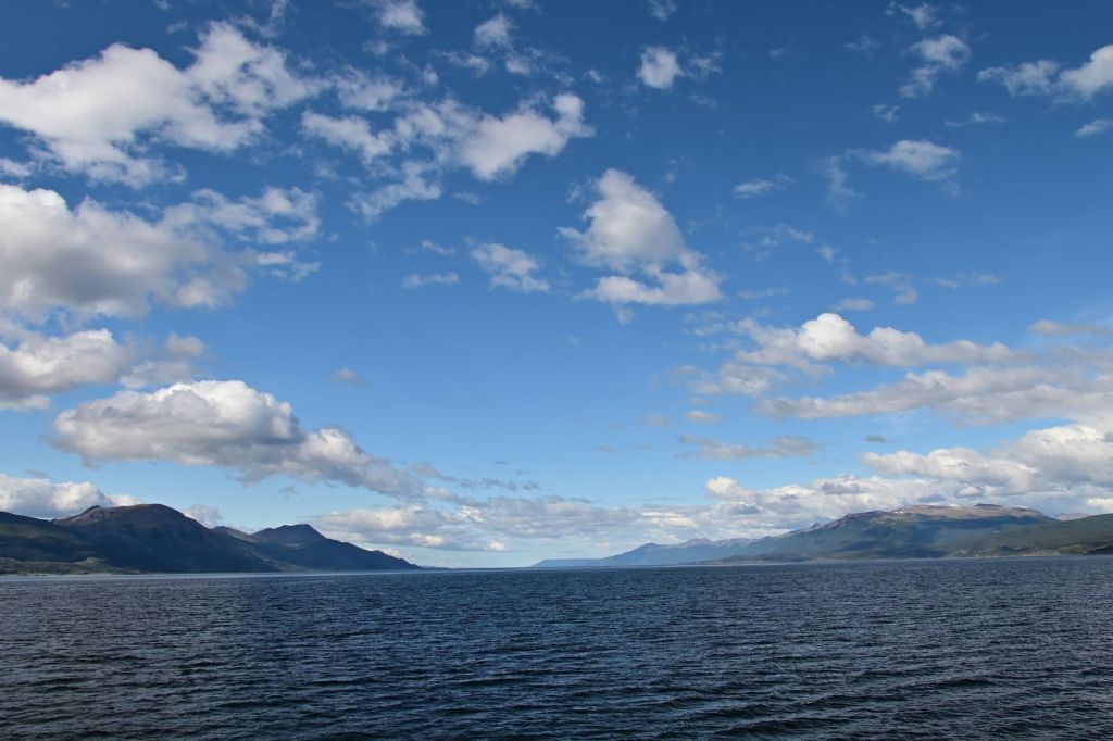
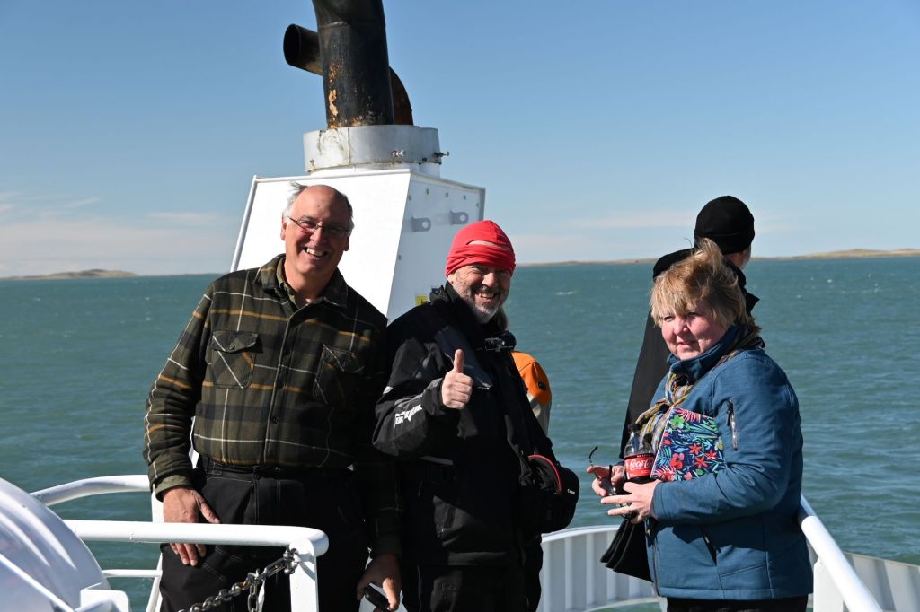
On Sunday, March 15, Kevin, Jane and I booked a boat ride out to the Harberton Penguin Reserve, which is east out of Ushuaia down the Beagle Channel towards the open Atlantic. The Beagle Channel is one of two interior passageways that allow ships to avoid the extreme weather and waves in the Drake Passage between Antarctica and Cape Horn on South America. Technically the water on the north side of the Channel is the Atlantic and the south the Pacific, and in the section we travelled, Argentina is on the north and Chile the south.
We were again very fortunate that it was a clear, sunny day with almost no winds…another great day for photos.
As we were pulling out of port, there were three or four ships getting ready to depart for Antarctica. One of which is the three masted sailboat below. The crew of our boat said it was a Danish boat with about 100 people attempting to recreate one of Ernest Shakelton’s expeditions to Antarctica.
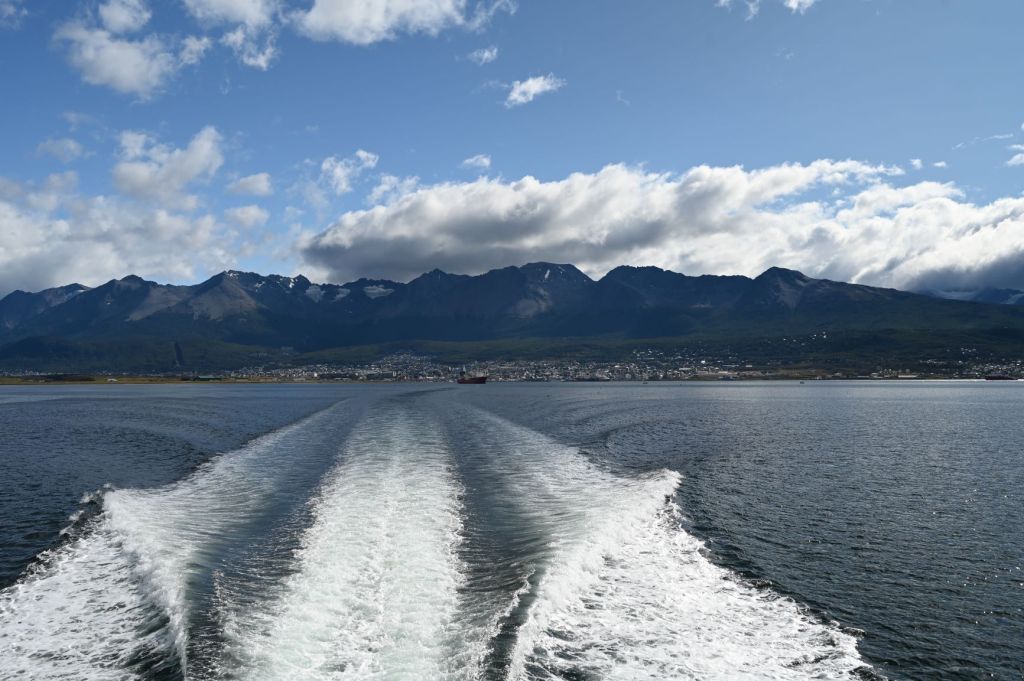
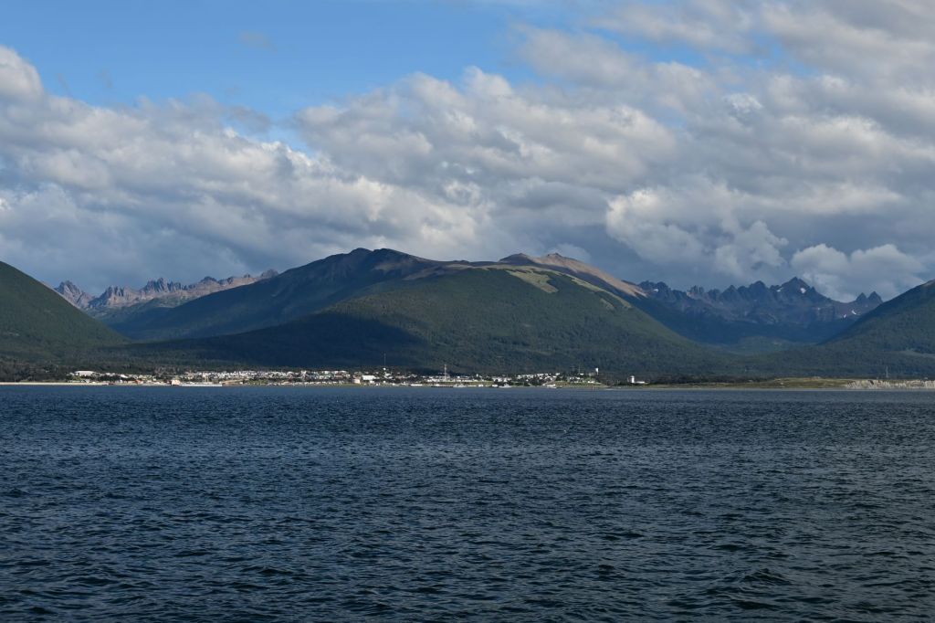
Below is a view of Ushuaia as we were leaving port.
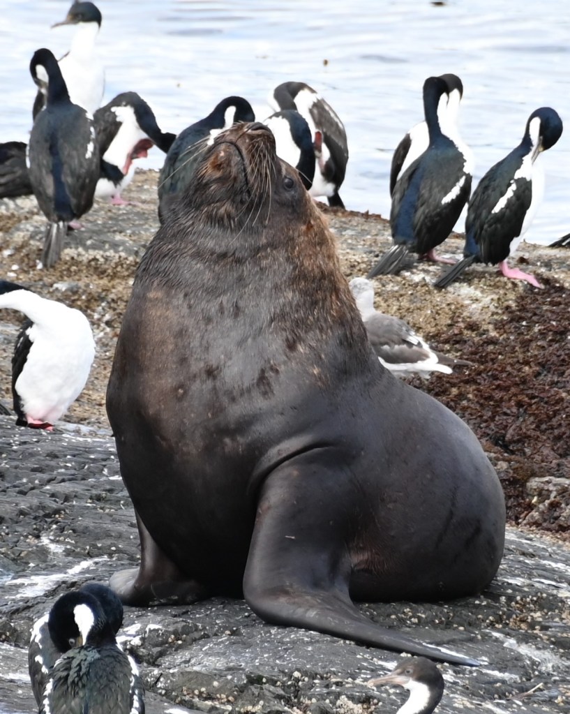
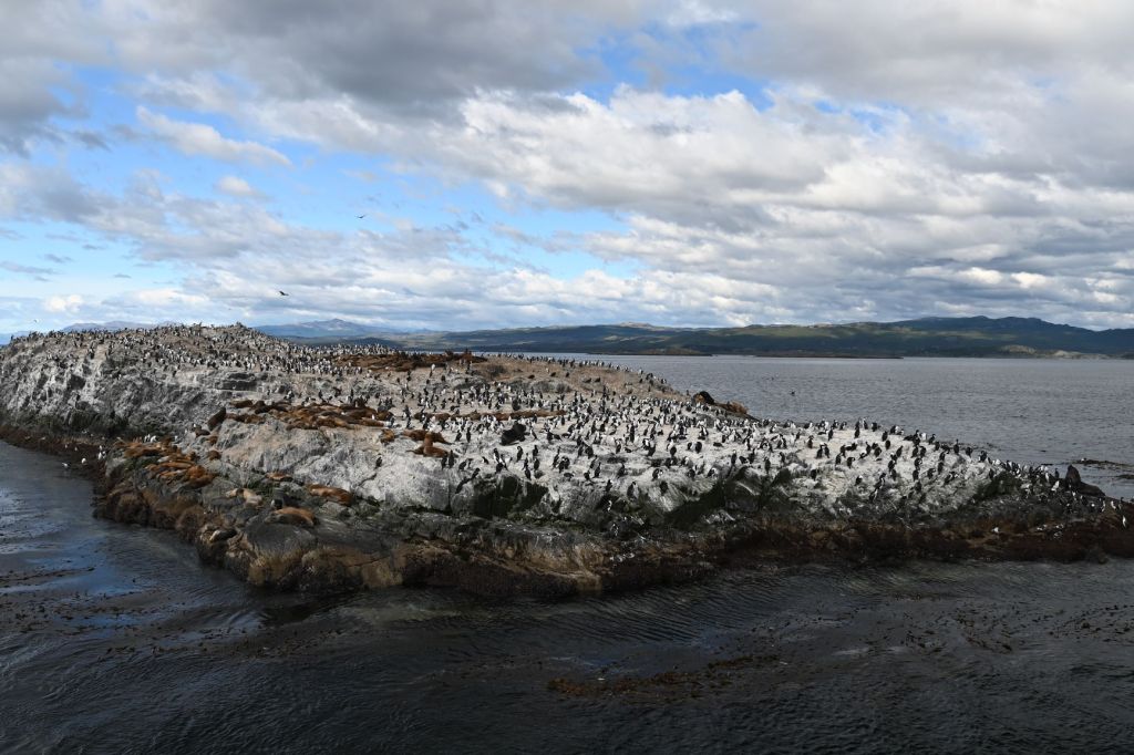
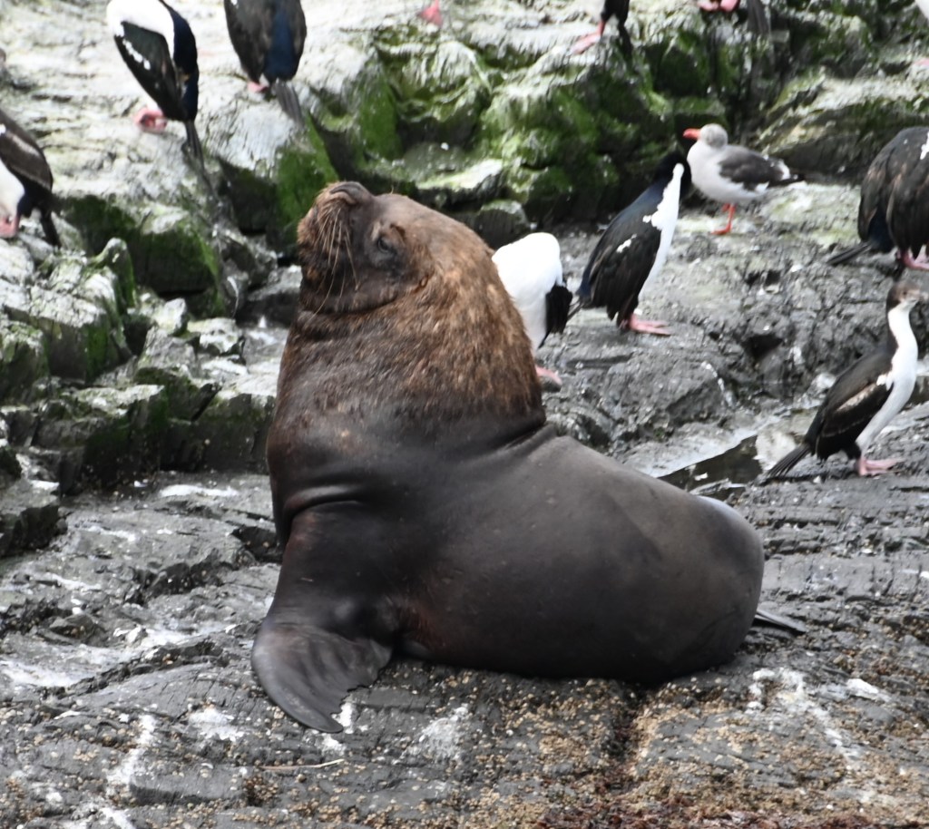
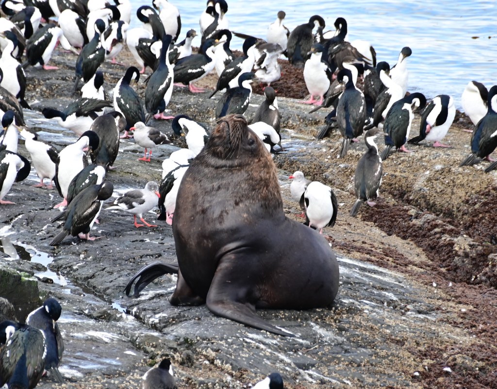
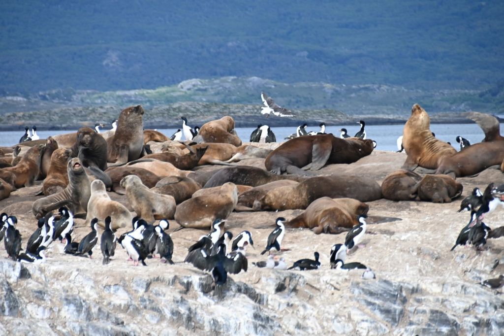
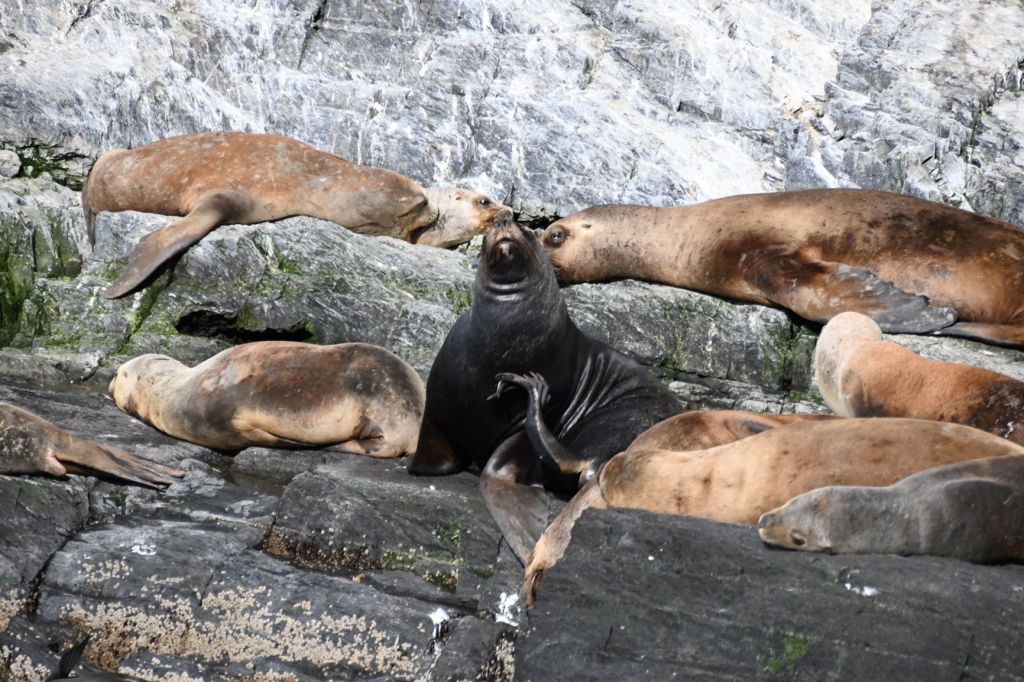
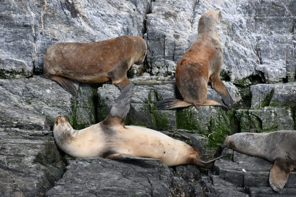
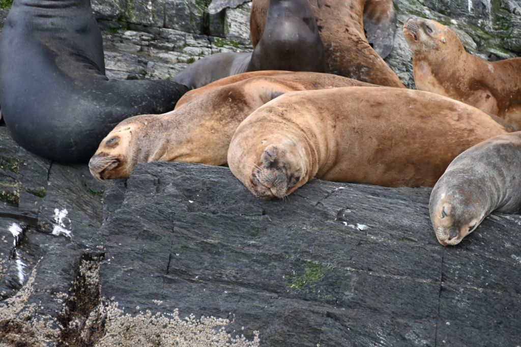
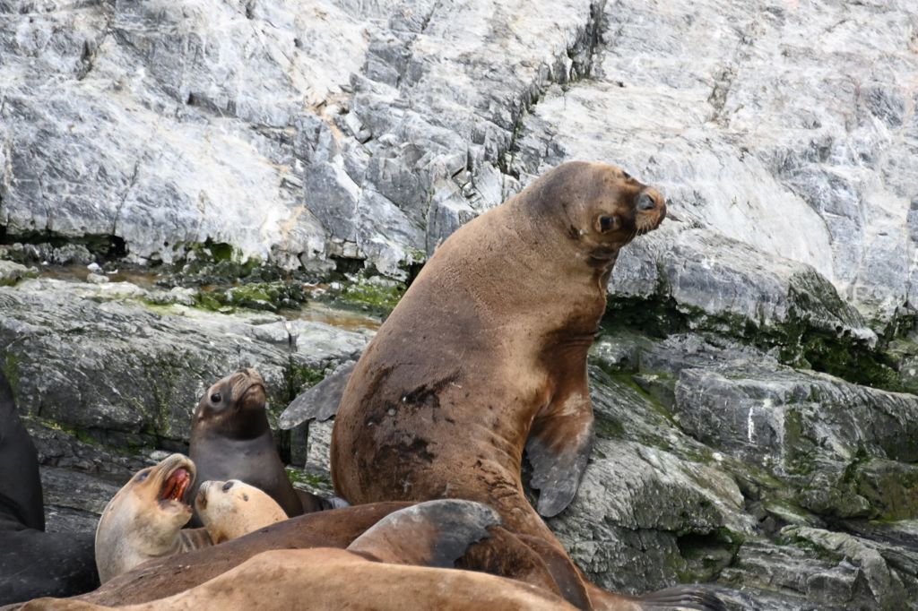
Our first stop was a rock in the middle of the channel populated by sea lions, cormorants and a few penguins.
Below are a series of pics of the occupants of the island. My favorite was the male lion on the far left of the above photo. Below are a couple close ups and several additional photos. He held this pose for the 30 minutes or so we were in the boat viewing the island.
Next stop was a beautiful, rustic light house.
Below are an eastward and westward view of the Channel.
Along the way, we passed Puerto Williams, which is in Chile and only accessible via boat. Supposedly, there is great remote camping and climbing just outside the village in the mountains behind it.
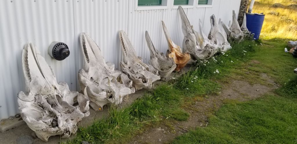
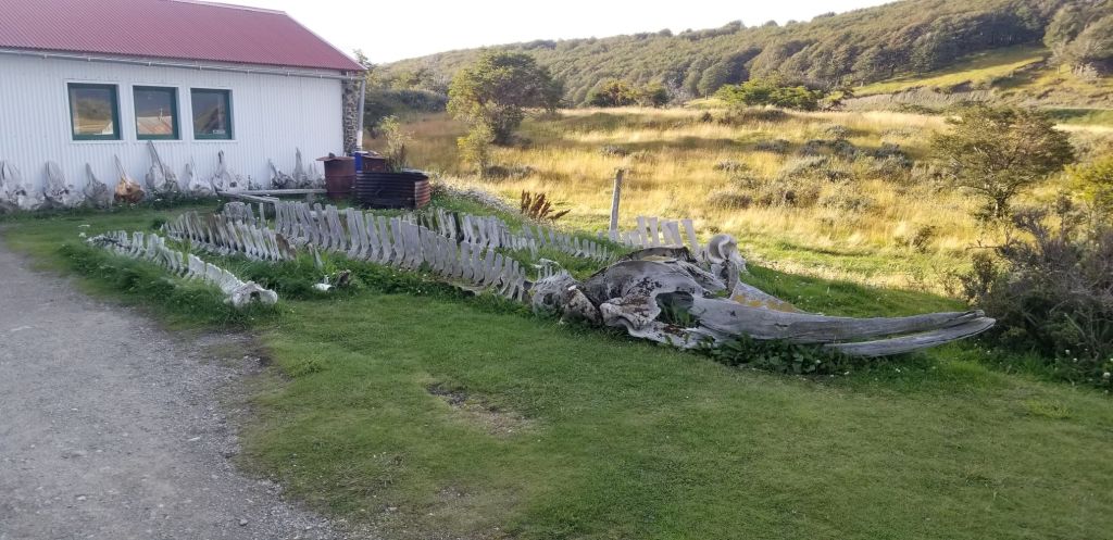
Last stop was the Harberton Estancia, which is the red marker on the map above. The Estancia was established in 1886, has been run by one family since then and today is a nature preserve and a museum with its principal purpose being tourism.
An American biologist, Rae Natalie Prosser de Goodall married one of the family members and created a museum on the grounds to preserve the many marine carcasses that wash up on the shores of Tierra del Fuego. It contains the worlds largest collection of marine skeletons with many species that are not found anywhere else in the world. Further, through the efforts of Goodall, they have identified numerous previously unknown species that have never been observed except for when their carcasses are found.
Above is a map of this region of the world, which explains why the carcasses collect on Tierra del Fuego. The ocean currents circulate clockwise around Antarctica. Tierra del Fuego and the surrounding archipelago happen to jut into the current stream. As a result, it is the only solid land masses that the carcasses can land upon.
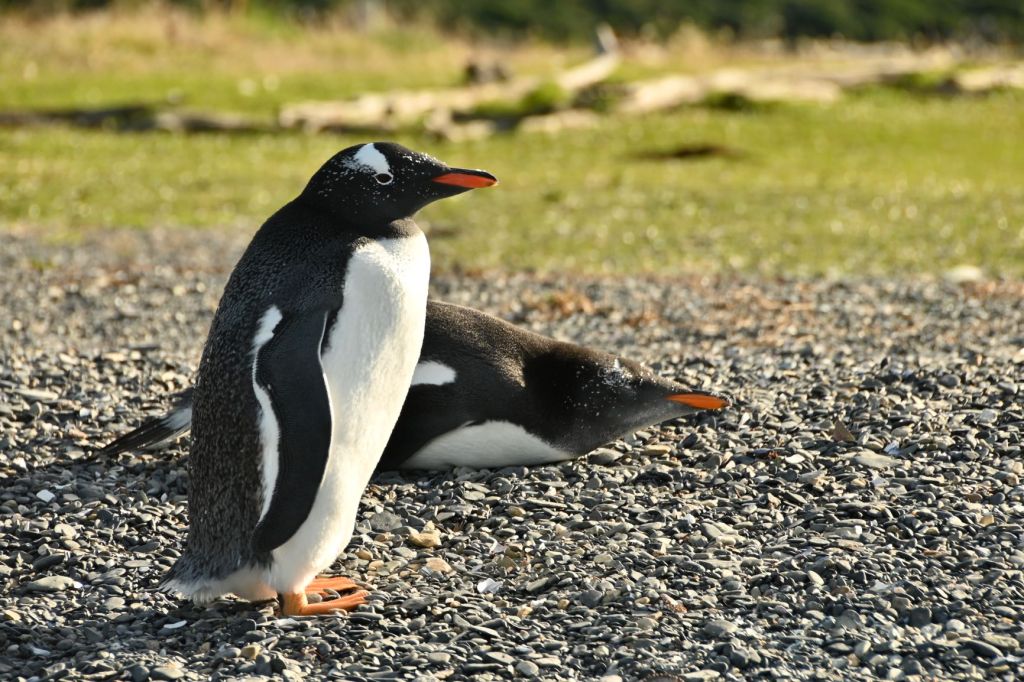
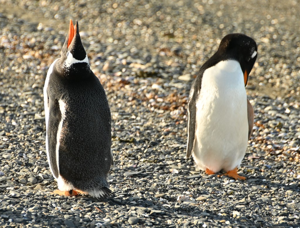
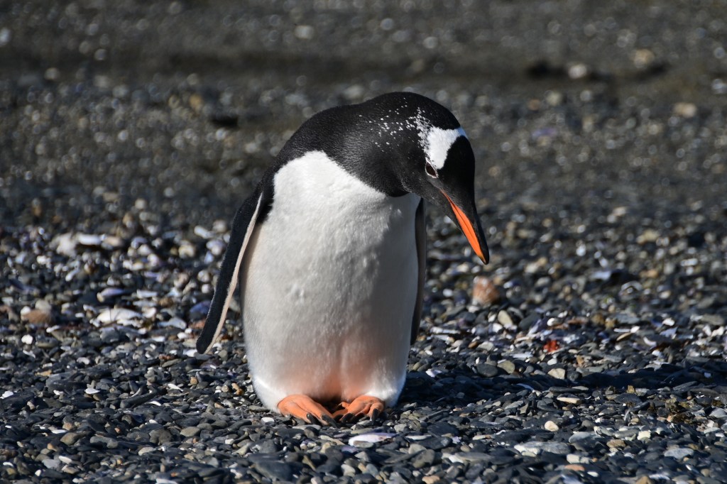
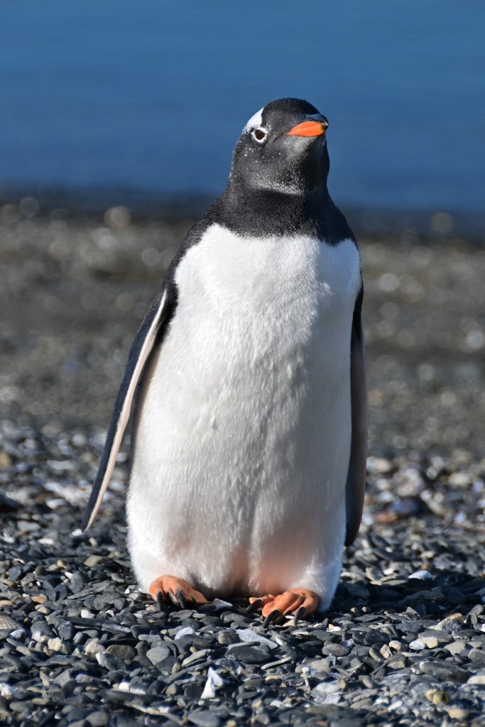
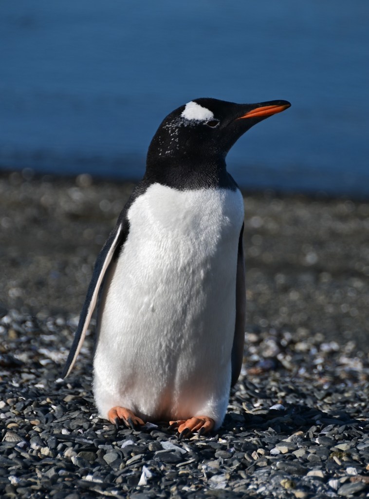
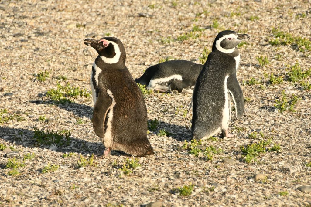
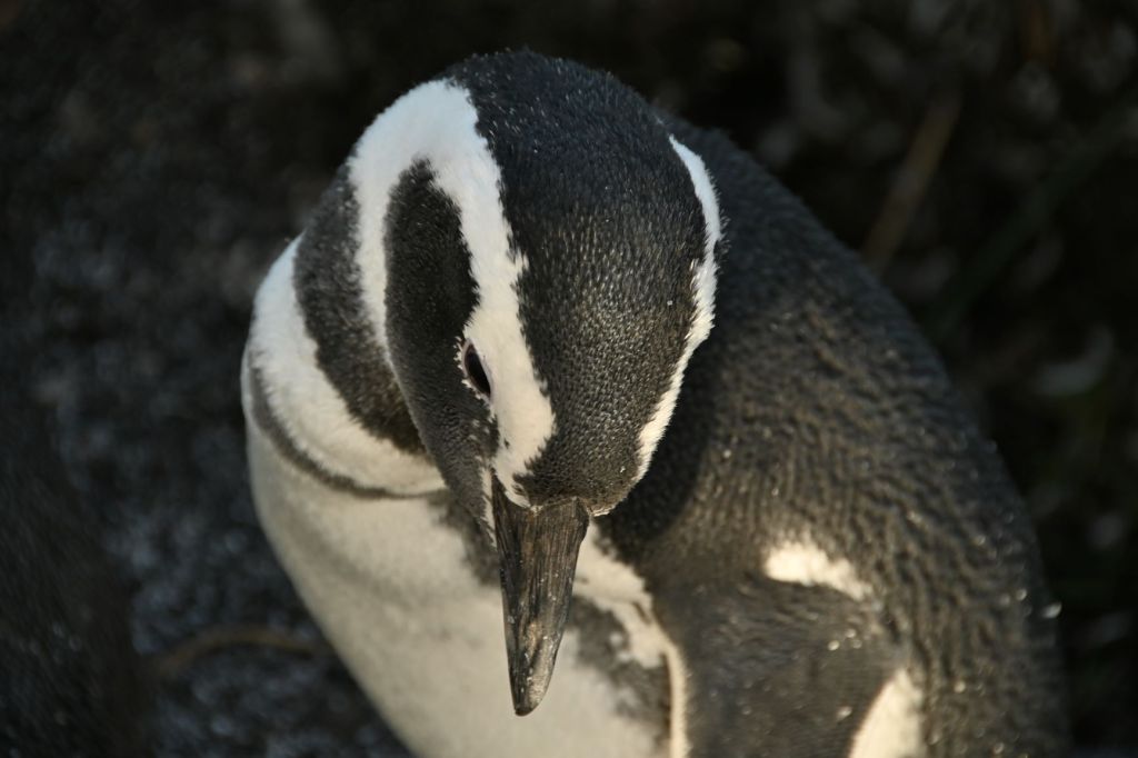
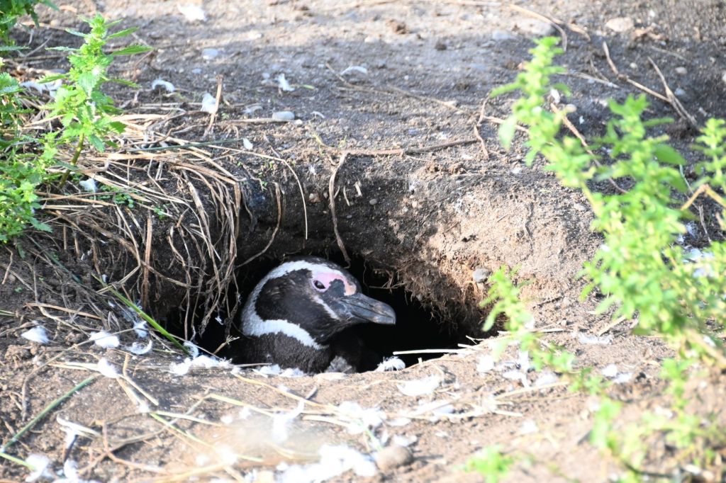
Finally, we headed out in an inflatable boat to the penguin reserve, which sits isolated on a nearby island. We were allowed to exit the boat and walk among the penguins. We spent an hour with the penguins observing and photographing them.
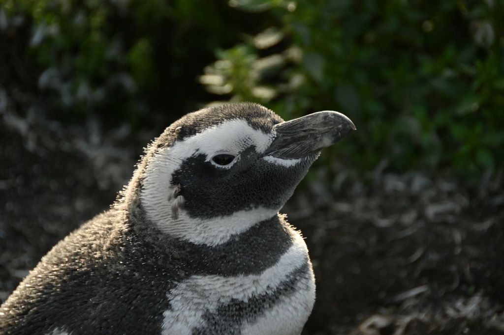
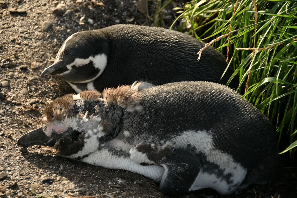
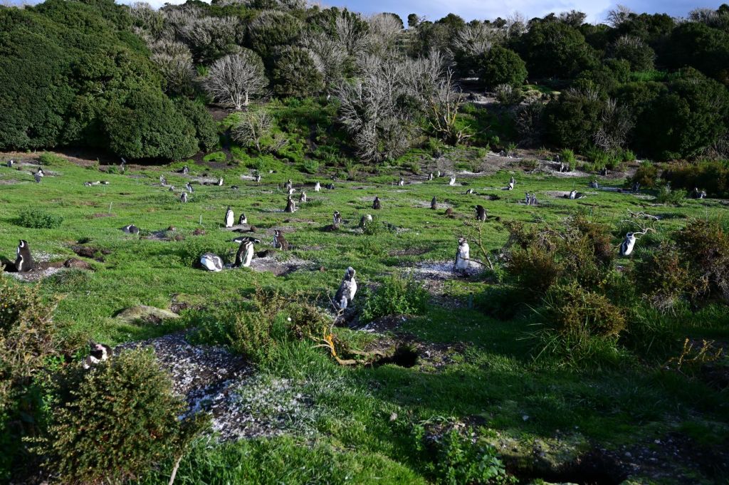
There are two types of penguins on the reserve: the larger gentoo penguins with the orange beaks and feet and the smaller Magellanic penguins. All in, there are 10,000-15,000 penguins on the island. They arrive on the island early in October to start their annual breeding season, raise their chicks and molt their feathers. Around late March, the penguins leave to begin their usual migration northward, and will feed at sea for more than 6 months, until the winter is over and spring calls them again to breed on land.
The Magellanic penguins dig holes in the earth and hatch their chicks there.
The Magellanic penguins are much more numerous than the gentoo penguins and their nests extend up and into the hills pictured in the distance.
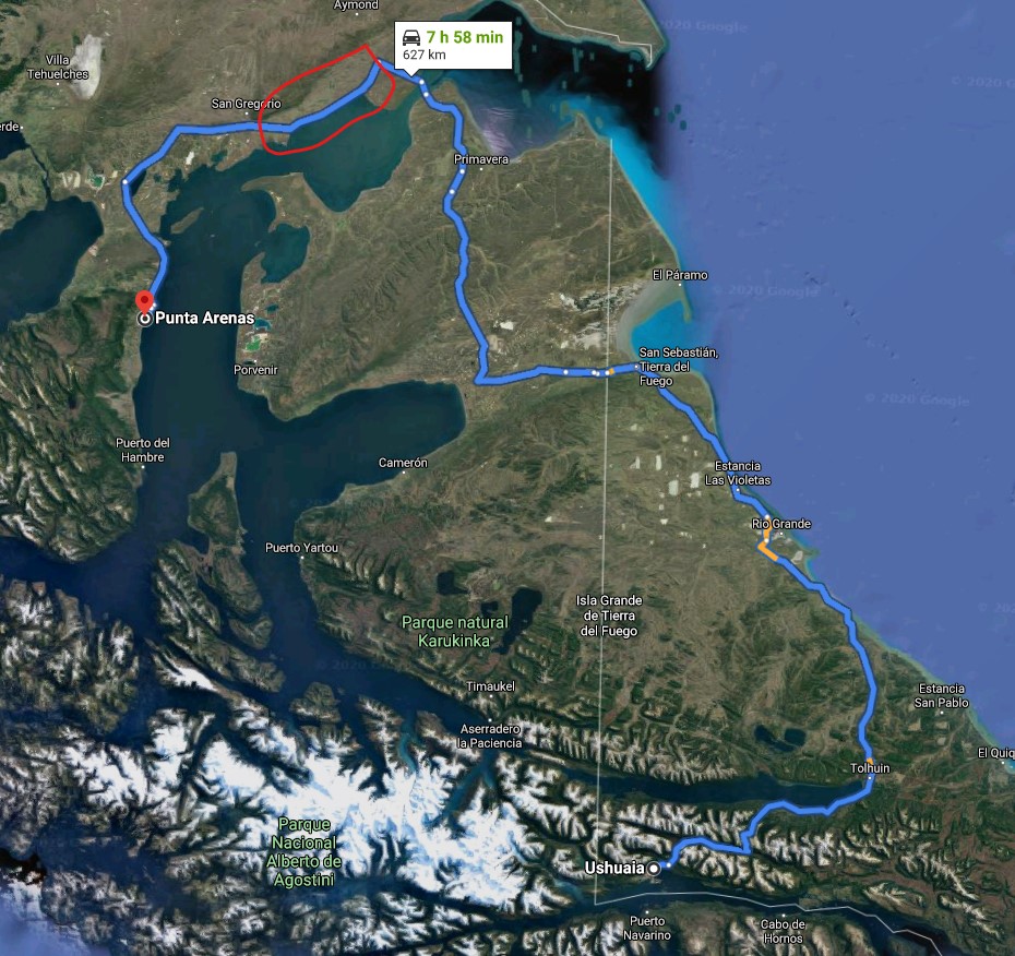
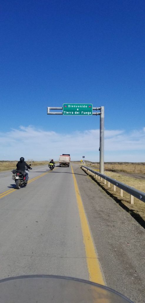
March 16 – Running for the Argentina Chile Boarder on Tierra del Fuego and Dropping the Motorcycle off in Punta Arenas
We had received reports on 3/15 that Argentina, and maybe Chile, were going to close their borders on 3/16. As a result, JD and I got out early to ensure we got across the border before a potential issue arose. Further, we needed the extra time to make the long drive to Punta Arenas. We made it to the boarder and the folks in the office said they were waiting for the call to close operations down, so it could be anytime. We made it and that is all that matters.
Today is the first day we encountered the winds of Patagonia. Our estimate is that they were blowing at greater than 50 mph. When we were on the ferry across the Strait of Magellan, the ferry took four tries to get to the ramp on the other side of the Strait and had to do a 360 in the process.
JD and I then headed out and made a left turn, which is circled in the map. The winds were at 90 degrees to the road. As soon as I made the turn, I was blown from the right side of the right lane to the left side of the left lane (the oncoming traffic lane). It was all I could do to hang onto the bike and not go spinning off into the gravel on the opposite side of the road. Because the winds were so strong, I literally had all my weight on the right side peg and handle and I couldn’t turn it to the right. This was the scariest moment of the trip. Luckily, there wasn’t any oncoming traffic for about five minutes. I eventually was able to get my foot and hand on the left gear shift and clutch, downshift from sixth to third, increase the rpms on the engine thereby increasing the centrifugal force generated by the engine, bring the bike to a cant into the wind, gain control and move over to the right lane. JD had explained this maneuver to me after we went through the Death Zone a few days ago. He saved my butt today as a result of doing so.
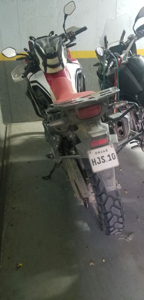
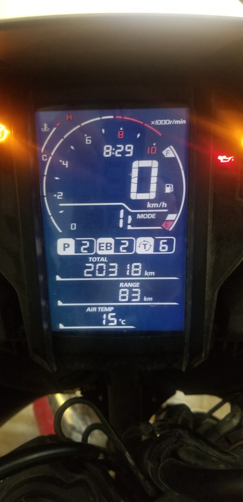
I dropped the bike off and it had 20,318 kilometers on it versus what I started out with on 3/1 of 15,850, so 4,468 kilometers or 2,775 miles. Adding that to the 3,956 miles I put on the BMW, I rode about 6,700 miles on the journey, which is about 2.5x the distance from NYC to LA…that is a lot of traveling!
I’ll be back tomorrow with the final installment in the blog…getting back to Chicago!
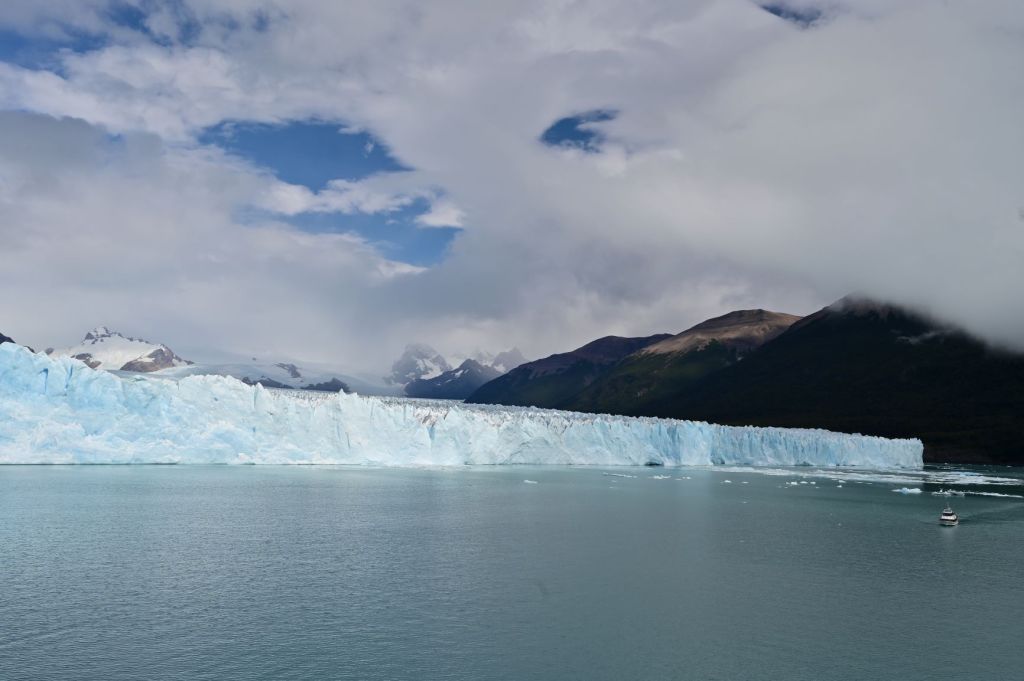
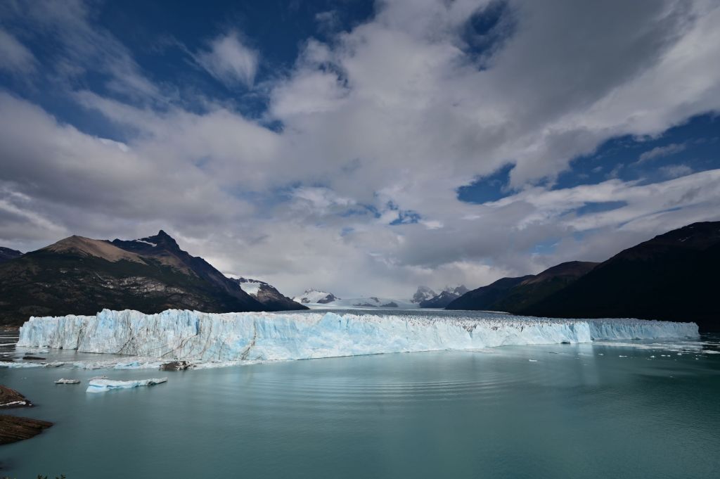
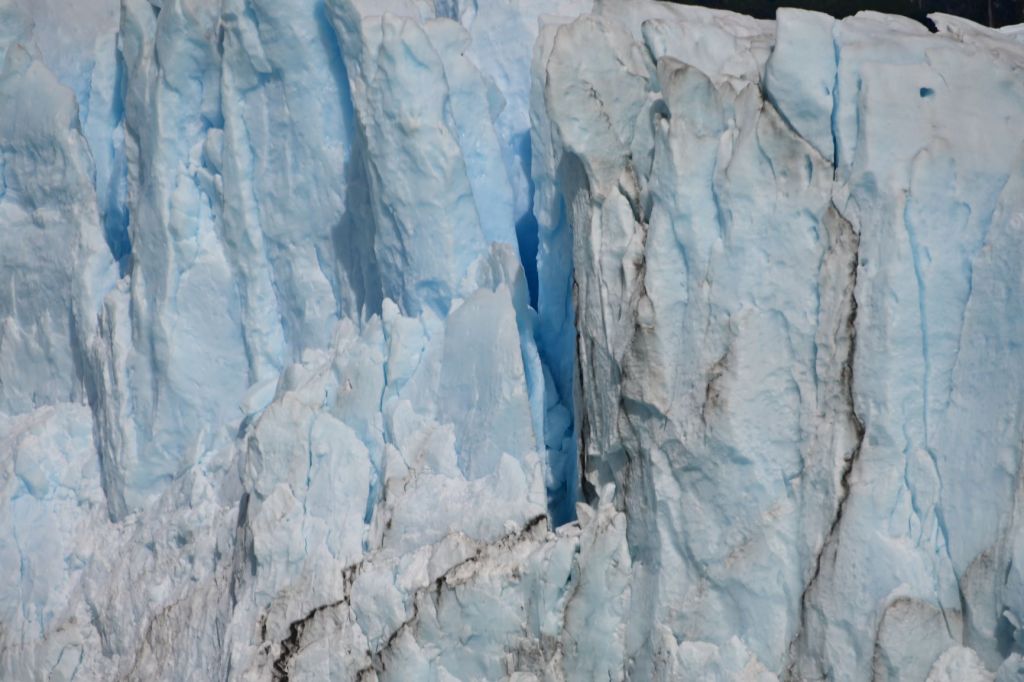
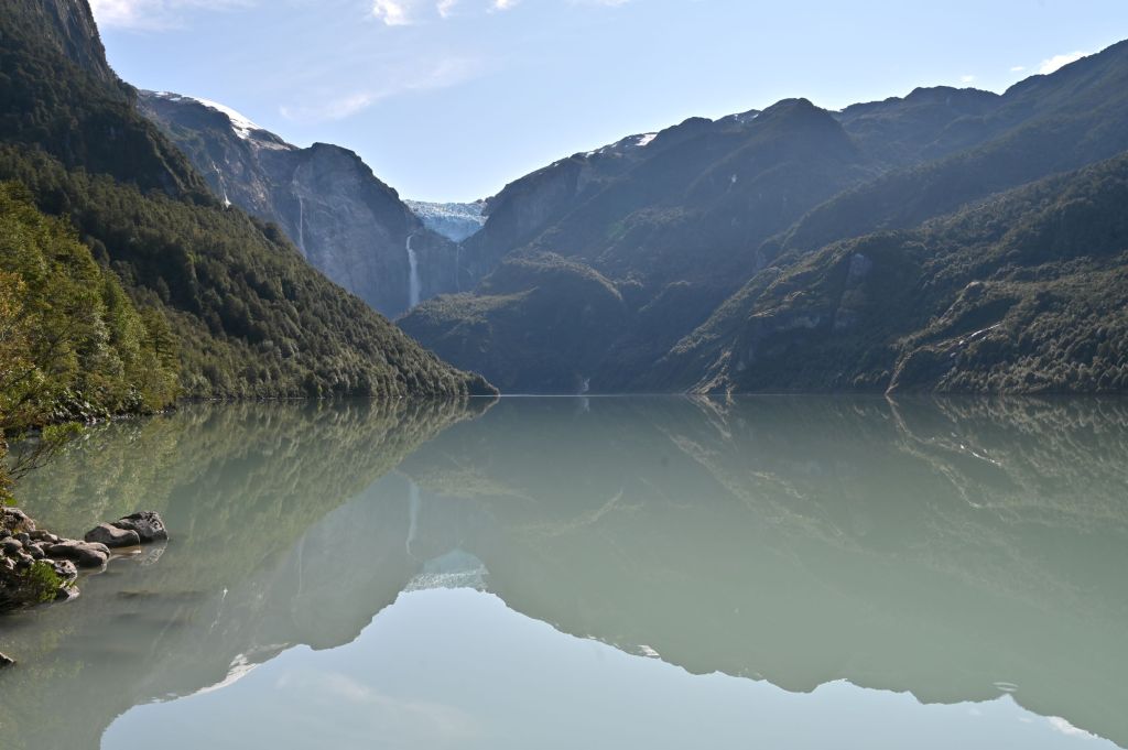
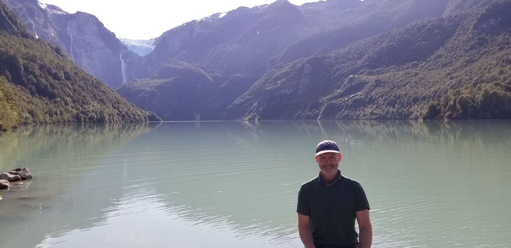
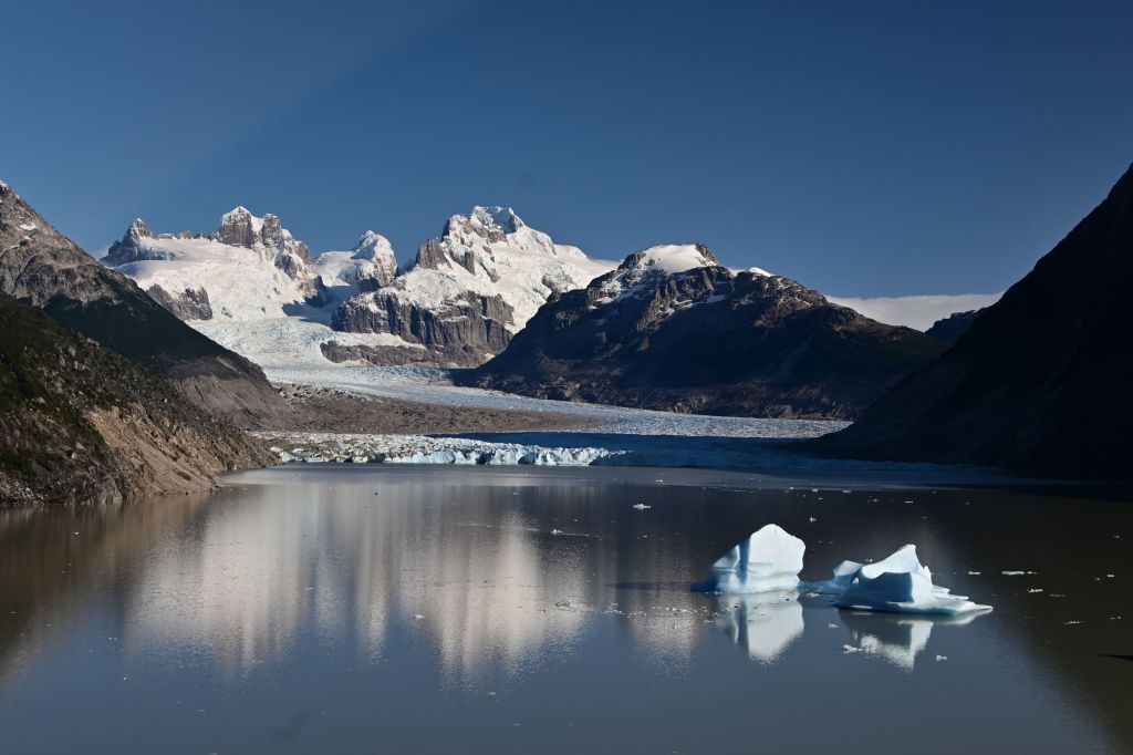
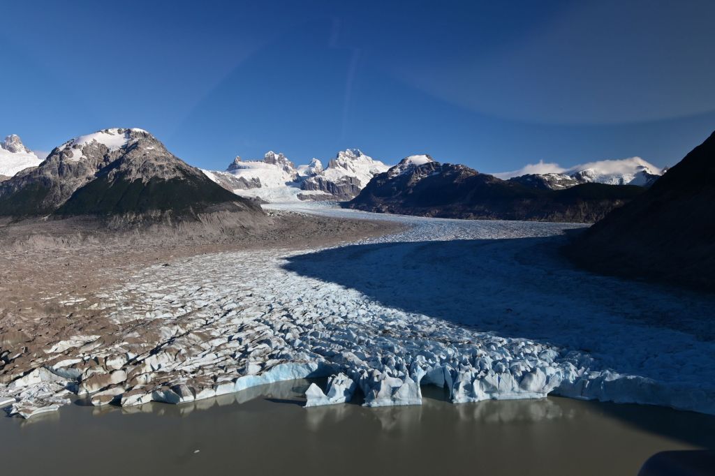
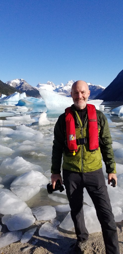
The Perito Moreno Glacier. The height of the face of the glacier (from the water to the ridge) is about 70 meters, which is the height of a 20 story building!!!
March 9 – Los Antiguos, Argentina to Gobernador Gregores, Argentina
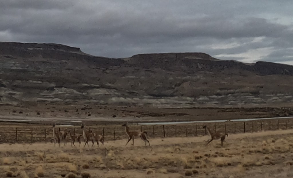
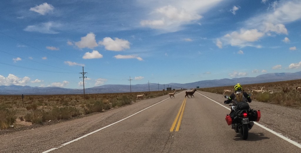
I had to leave the group early so that I could arrive in Gobernador Gregores for a six-hour phone call. I was on the road at 7:00 am, about an hour ahead of the group. The first 60k was due east and I was leaving at sunrise. It was about 45 degrees out and the sun was directly in front of me or just right or left. As a result, I was very cold and working with only 30%-50% visibility…very dangerous conditions. Further, I was entering guanacos territory. Guanacos are camelids, cousins of llamas and vicunas, that stand about five feet tall and are 200-300 pounds.
DCIM\100GOPRO\GOPR0816.JPG
There were hundreds of guanacos along the road and in the surrounding countryside. Guanacos are dumber than a bag of hammers (attribution to Gary)…they have a habit of standing right off the side of the road and then suddenly darting out into the road when one is approaching. As a result, one must be very careful around them because the direction they choose to run could very well be in the path of the motorcycle, which I did see happen several times. To add an additional element of surprise, they are very well camouflaged, so they blend in extremely well with the environment. Suddenly, you can be on top of them and have to react. All of this can be a challenge when going 100k-150k per hour with limited visibility. I had a few close encounters, but nothing too frightening…I made it through my first day of riding in guanaco territory.
The environment I was riding in this day changed very dramatically from yesterday. Today the route took me through the wide-open plains of Argentina, or the pampas. One can see for miles when riding through the relatively flat scrub land…none to very few trees, some rolling hills and a few river valleys, but otherwise flat and wide open with the major colors being beige, brown and sand. It reminds me of the savannas of Africa. Also, it can become very, very windy, as in 50+ mph winds, due to the unique weather and geography of the area. Luckily today, the winds were non-existent to minimal.
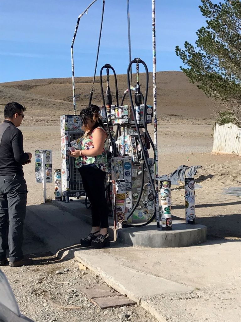
I had to stop for fuel in a very small hamlet of maybe 25 buildings called Bajo Caracoles. Bajo is definitely one of those strange little towns that crop up for some reason and becomes populated by loners, renegades and recluses. It sits literally in the middle of nowhere in an inhospitable environment…wind-blown, isolated and who knows why it is where it is. There is a doctor, lawyer, mechanic shop and a bodega with two gas pumps. It is a key location for motorcyclists because there isn’t fuel for many kilometers in any direction and one can’t make it on this section of Ruta 40 without gas from here or carrying external gas tanks. I have a two-gallon gas bag with me, filled up, but I still stopped to fill up my gas tank just in case. Below is a picture of the gas pumps with all the stickers from motorcyclists around the world that have passed through.
I went into the small bodega to buy gas and there were two women, one in her 20’s and another in her 40’s behind the counter. In my broken espanol, I asked for gas and the older woman turned to look at me, never said a word, just pointed to the door and started walking out. When she came from behind the counter, she was dressed in platform sandals, black stretch pants and a styling top and she had a very snobbish attitude. All I could think of at that moment was how incongruous she was to the surroundings. I kept looking around for an underground nightclub or some other reason she would be plopped down in this crazy, weird little place. Plus, the 20-something behind the counter rolled her eyes at her colleague as she walked out the door and gave me a smile…who knows what weirdness goes on in this place.
Around dinner that evening, we all decided that the above woman was dressed to attract someone’s/anyone’s attention and ask her to leave Bajo Caracales with him. She probably has a bag packed and stored under the counter, so she can walk out at anytime…
Anyways, I filled up and headed out of town, but I noticed a travelers motorcycle that was packed up and seemed ready to go in the small enclosed courtyard of the doctor’s office right near the gas pumps, which struck me as odd.
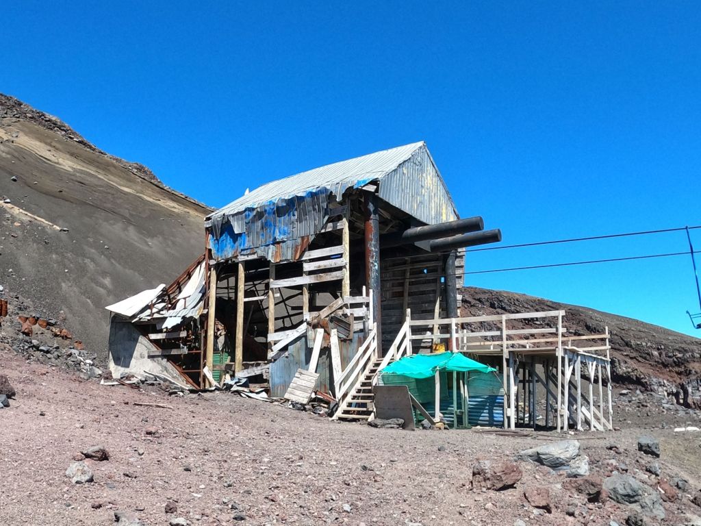
I headed out south and made it into Gobernador by noon, checked into the Hosteria Lago Cardiel and had a strange lunch with the local crowd. Surprisingly, the hotel had good internet and cell coverage and I was able to make my call. However, the hotel didn’t have much of anything else to offer and was a run down, seedy little place in this backwater town. I felt like I was back in one of the mining towns in northern Chile.
I had a break in my call so I went outside to see if I could grab a snack somewhere nearby and several members of the group, JD, Eric, Kevin and Craig were outside the front of the hotel working on the bike I had seen in Bajo. When the group got to Bajo behind me, somehow JD ran into the owner of the bike, Alexander, a 30-year old from France who has been traveling for two years. Alexander explained his situation to JD. He had bought his bike in Argentina dirt cheap (a Royal Enfield) and had been driving it when it broke down in Bajo. He had been stuck there for two days and staying with the doctor I mentioned above. Alexander didn’t know how he was going to get out of there. Luckily for Alexander, he had just run into probably the greatest concentration of motorcycle knowledge and expertise in Argentina at that moment in time. JD used to participate in enduro races which requires racing for up to six-days straight and requires the rider to fix his own bike, if there are any problems. Eric is a very experienced rider and mechanic and has an extensive network throughout Argentina related to all things motorcycles. Lastly, behind the truck that Eric drives is a trailer with three slots for motorcycles, all of which were empty.
After JD heard Alexander’s story, he convinced Eric to load Alexander’s motorcycle on the trailer and take Alexander with the group to Gobernador, which has a motorcycle repair shop that Eric knows of. So, JD and Eric had Alexander’s bike broken down and diagnosing the problem(s) when I walked out. As it turns out, the bike needed extensive repairs and parts, which would take about 10-days to arrive and be installed. So, JD got Alexander a hotel room (which JD paid for) and bought him dinner and made sure he was situated and ready to deal with his issues. Alexander decided to take the next 10-days and hitch hike to Torres del Paine. JD and Eric got him out of Bajo and on his way. One last detail….when he was in Bajo and staying with the doctor, Alexander said that all the doctor did for the entire time he was there was sit in front of his TV and watch old western movies….more strangeness coming out of Bajo!!!
March 10 – Gobernador Gregores, Argentina to El Calafate, Argentina
We got going at about 8:00 am after Alexander came out to say thanks and goodbye to everyone.
Alexander saying goodbye to his guardian angel!!!
We had to stop for gas immediately because the station was out of gas the night before and there is only one gas station in the town and for many kilometers around. Unbelievable, that they can’t better manage their supply issues here. There must be some issue related to government control or regulation of the gas supply because it is not well organized.
In the morning as we were getting ready to go, Eric, as he does every day, gave us an overview of the day’s ride. Today’s ride included about 70k of hard packed gravel with marble sized rocks on top and in some places the rocks pile up between the tracks and create a very unstable and dangerous surface (kilometer long piles of marble sized rocks 2 inches to six inches deep) requiring one to ride the track and stay out of the piles. Eric warned us about this section and said to take it easy. What he failed to tell us was that he calls this the Death Zone (we found this out over dinner). Typically, this is where there are serious injuries, if someone is going to get hurt due to the degree of risk in riding this surface. For once, I headed Eric’s advice and took this section at my own pace to ensure I was in control and didn’t encounter a disaster. Even with that, this was a tough ride. When we were having lunch, everyone commented on how hard it was riding through these conditions. I had one scare where I lost control of the bike and started into a series of about three foot arcs back and forth in the deep gravel. Surprisingly, I was able to gain control and keep the bike upright.
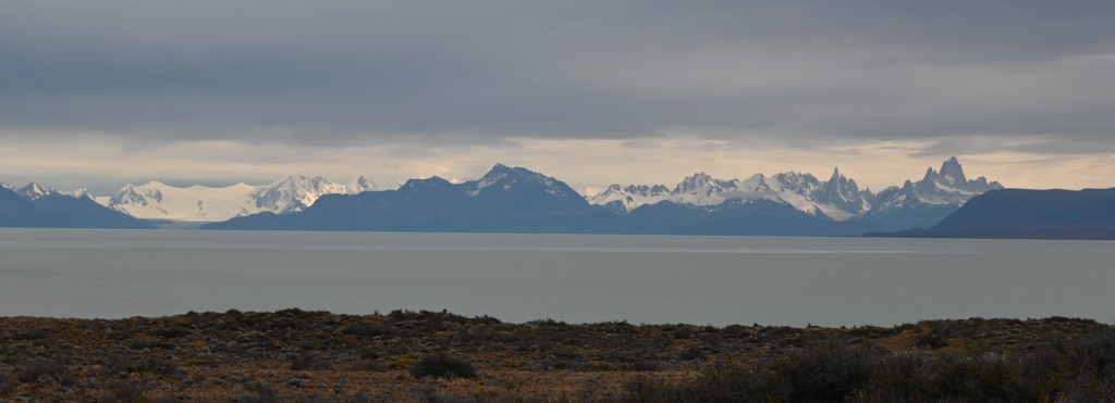
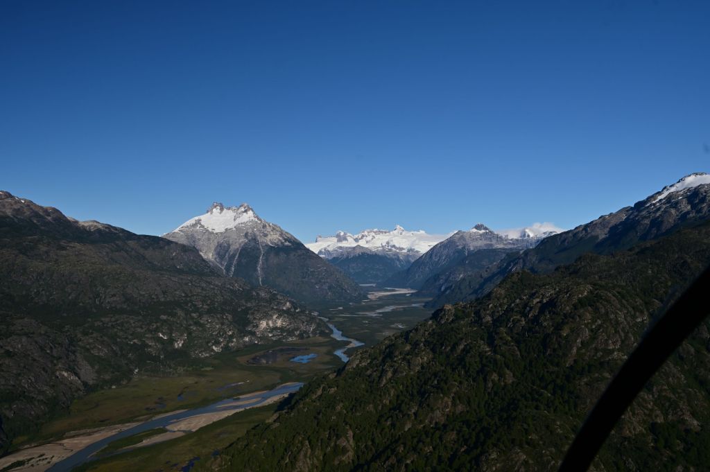
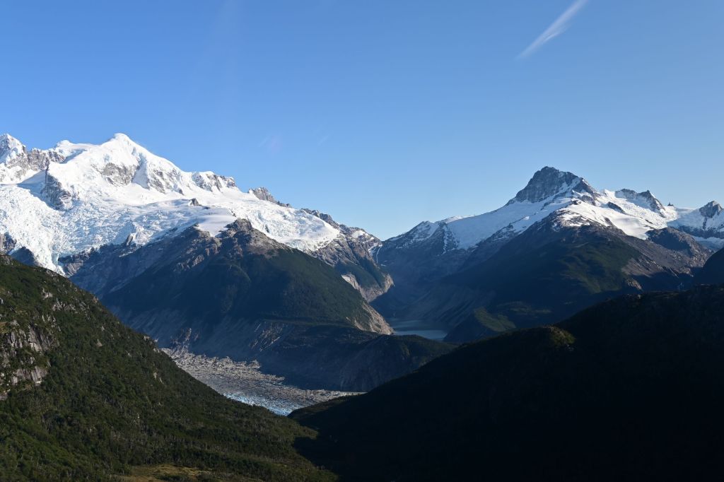
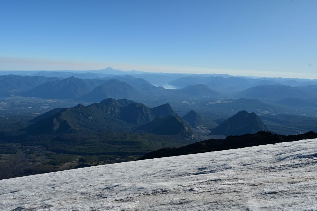
Our goal this day was El Calafayte, which is a tourist town about 60k away from the Perito Moreno Glacier. Further, we will be heading back west towards the Andes and the mountains begin to appear in the distance as we approach. Below is a pic of the Mount Fitzroy massif we could see in the distance.
Next time back, I plan on spending time around Fitzroy to camp and climb.
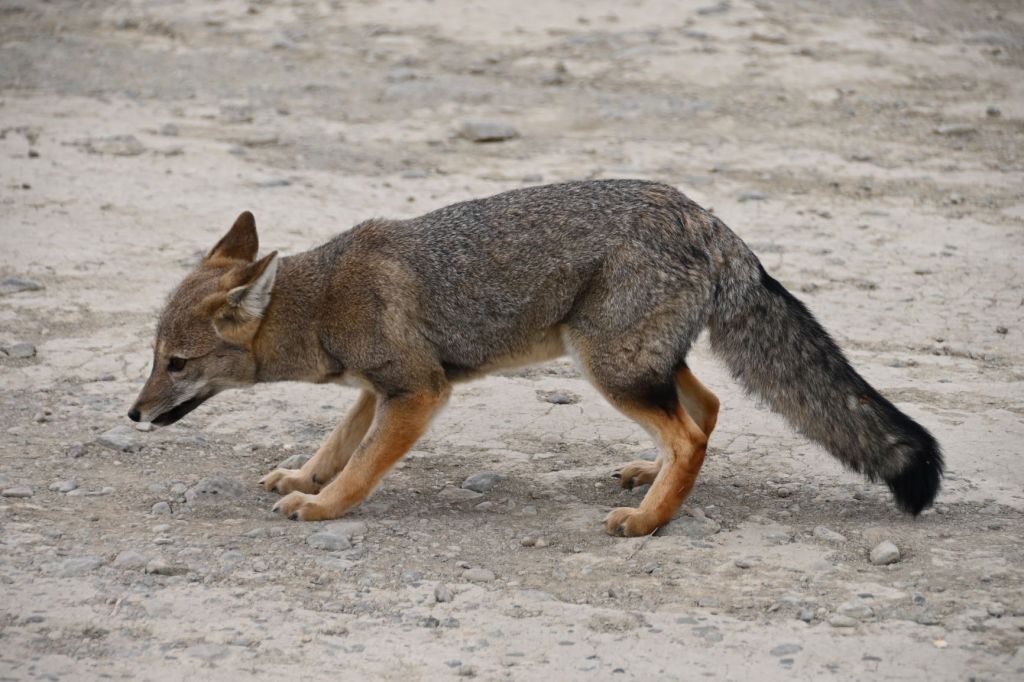
When I stopped to take the above picture, the fox below came creeping onto the miranda and was begging for food from everyone who stopped.
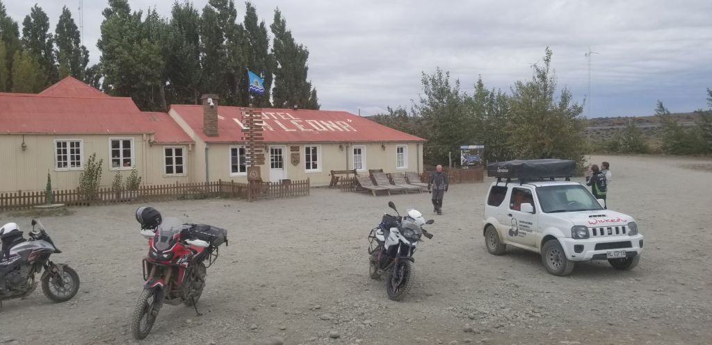
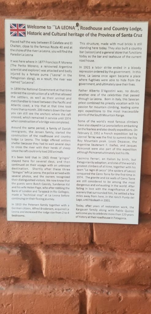
We stopped at a historic place for lunch called La Leona. Butch Cassidy and the Sundance Kid frequented this place when they were on the lam from Pinkerton’s. I didn’t realize until now that they had run this far south. I was informed this day that they were caught and killed in Boliva.
The restaurant is an old building set on a river running out of the glacier runoff from the Fitroy massif and was running very strong and high. Great empanadas for lunch.
Interestingly, at least to me, the car in the picture below is a Suzuki Jimny, which is what we drove from London to Mongolia in 2011. Seeing it brought back great memories of the Mongol Rally and my time with Bobby Carey and Bob Picchietti.
El Calafate was as advertised a tourist town with many backpackers and all the expected tourist shops, craft brewers, chocolate stores and expedition outlets.
March 11 – Rest Day in El Calafate
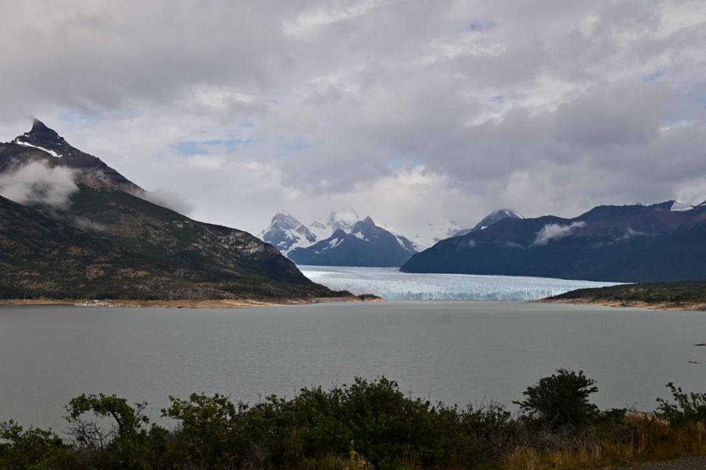
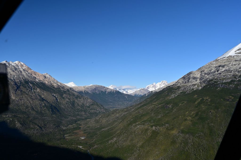
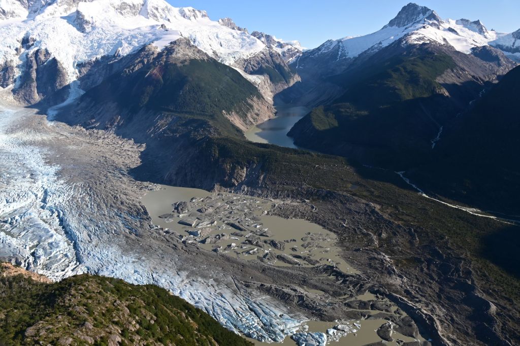
As luck would have it, rain was in the forecast, so a good day to be off the road. The bad news is we needed to travel about 80k to get to one of the great attractions in South America, the Perito Moreno Glacier. We looked at the weather and it was supposed to break around 10:00 so we took the opportunity to hang out and rest. The weather did start to break and JD, Craig, Mike and I headed out. Great ride west into the Andes.
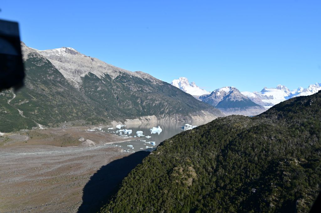
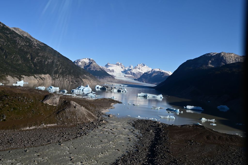
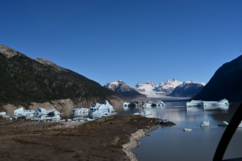
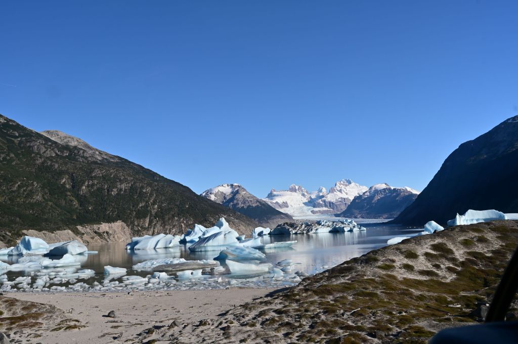
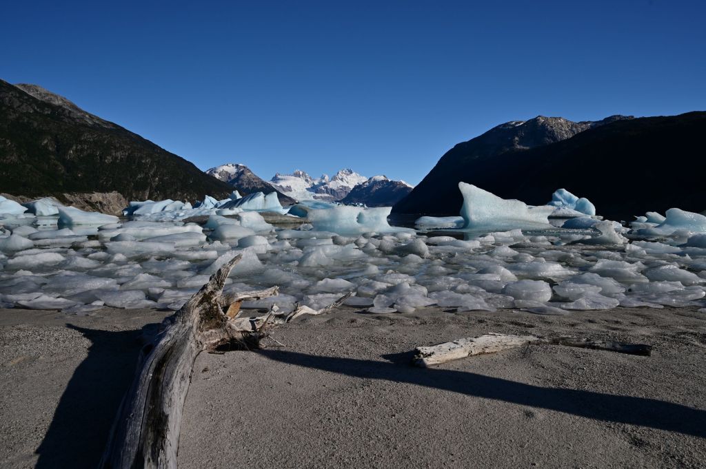
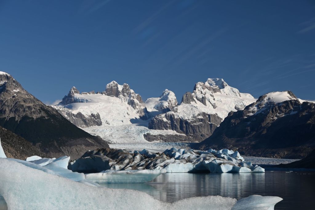
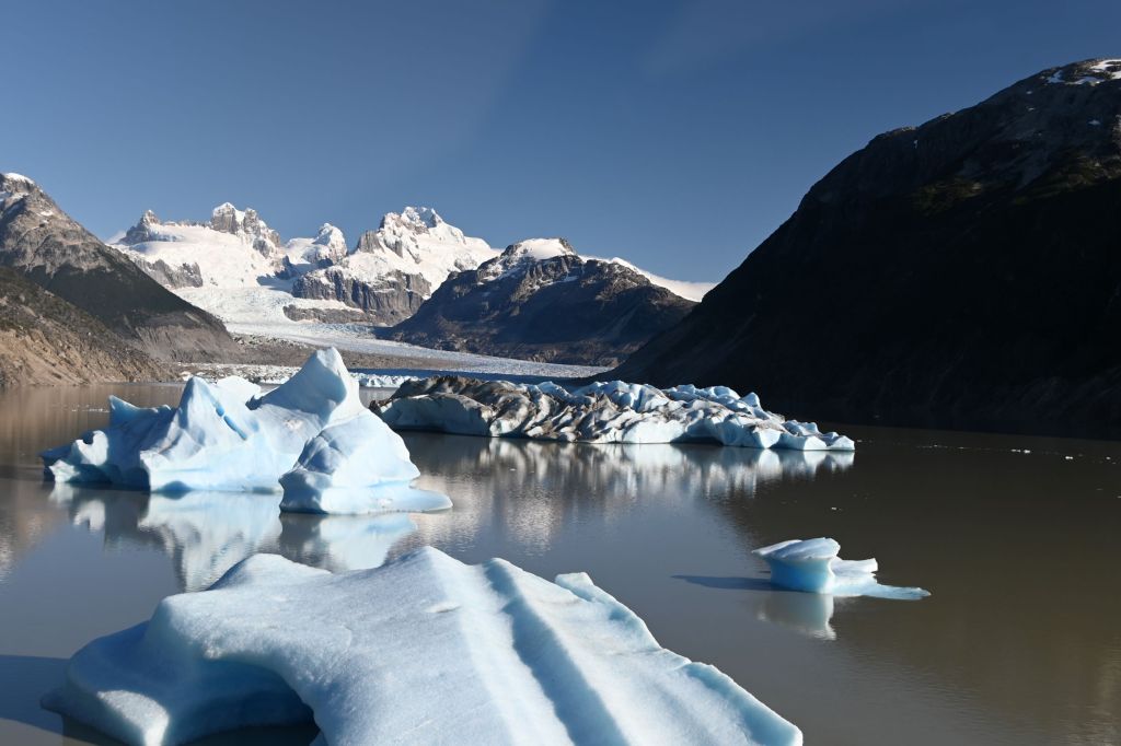
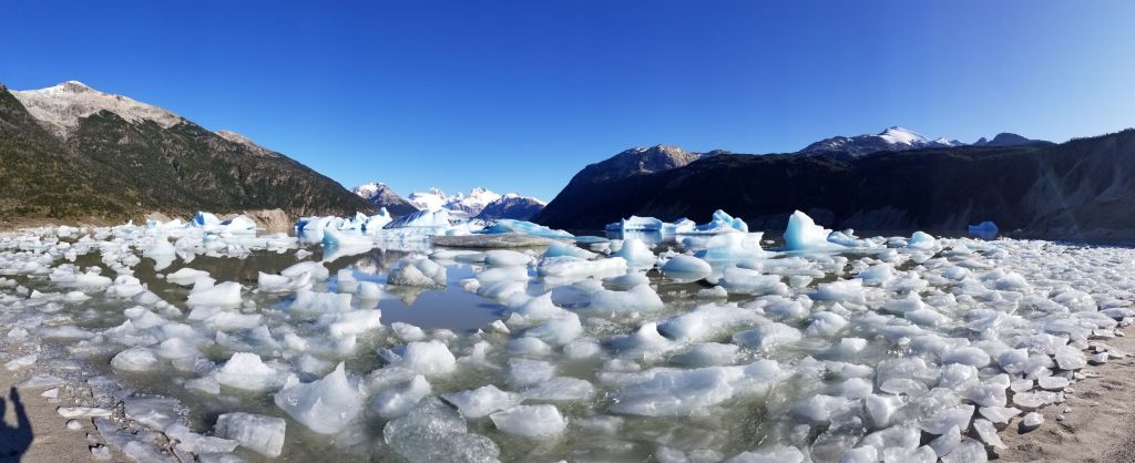
The Perito Moreno Glacier is a spectacular sight with a park surrounding it. The glacier comes within about 400-500 yards of a large hill around which walkways and viewing areas have been built facing the glacier. The glacier advances upward about 70 meters from the water for a a horizontal distance of about one kilometer. When we got there the sun came out and the glacier started calving with all the associated cracking sounds and huge blocks of glacier falling off the wall into the surrounding lake…an awe-inspiring site. We probably spent about an hour just listening and watching this massive display of the forces of nature.
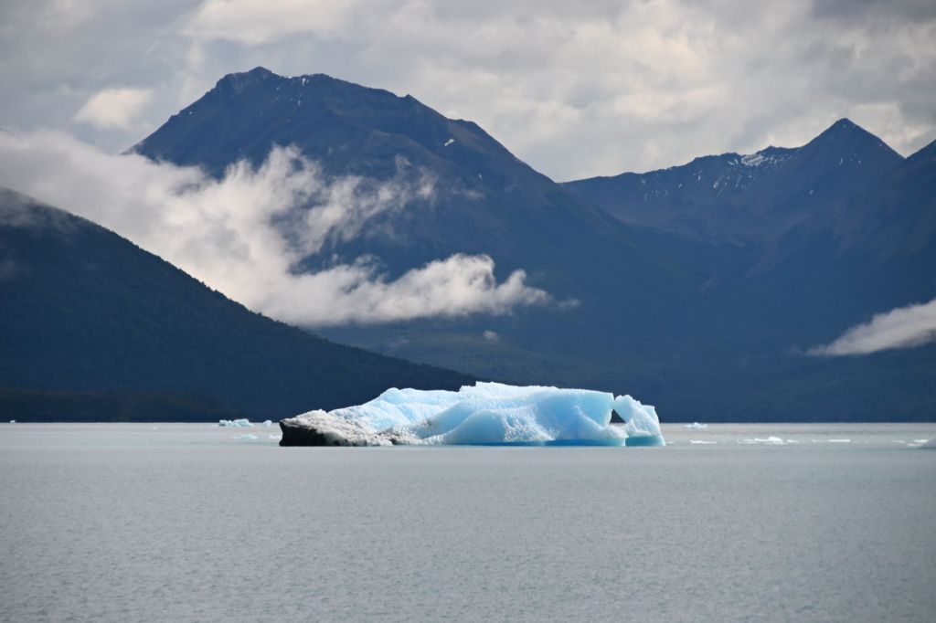
I’ve included the below photo to provide some perspective on the size of the glacier. The ship on the lower right hand corner carries about 100 people and is dwarfed by the glacier.
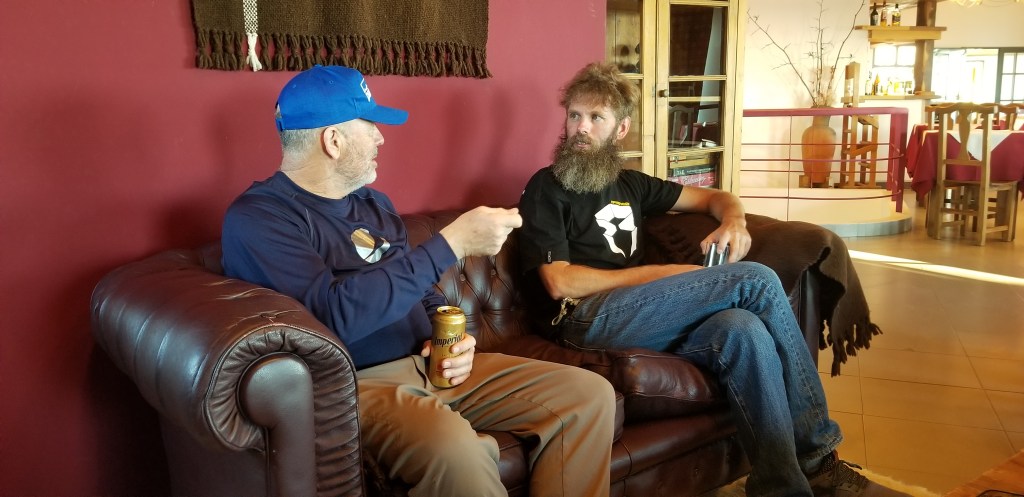
Below is a great pic of Mike. I made a critical error in my last posting. Mike was in the Marines…not the Army!!!
Had my best dinner on the trip this evening with Eric at La Tableu.
March 12 – El Calafate, Argentina to Torres del Paine, Chile
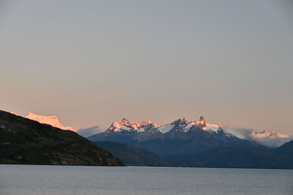
We left El Calafate at sunrise, which painted the sky and clouds an intense pink and yellow. Today, our ride ends in Torres del Paine Parque Nacional, one of South America’s leading attractions. The ride took us east back into the pampas across the border into Chile.
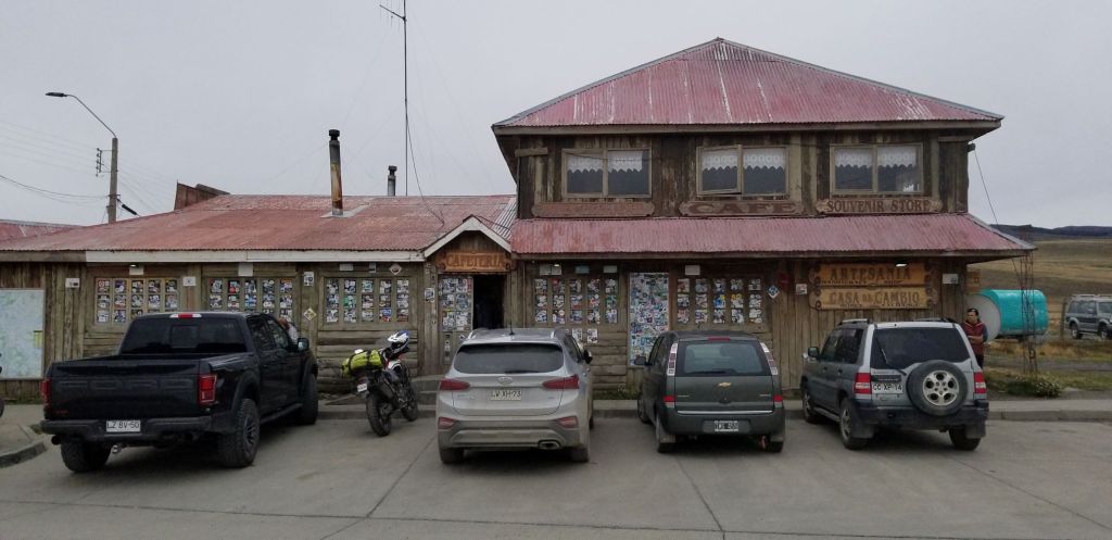
Hard on the border crossing on the Chilean side, we stopped for lunch. There is a restaurant/gift shop/cambio called El Ovejero run by a real character, whose name I didn’t catch. A picture of the place is below. It is covered in travelers’ stickers from all over the world due to it being a choke point going into the Parque from Argentina.
The owner was sitting at the door in a Hawaiian shirt and a Patagonian beret. He had command of the entire place as the cashier, cambio and maître de. Further, the Ford Raptor sitting in front of the place above is his. No one drives this type of vehicle in this area of the world! All the locals and tour guides had to “kiss the ring” of the owner. According to Eric, he also owns the local hotel and an estancia close by…so he pretty much owns everything in the area. It was amusing to watch the whole scene unfold as we had lunch. Again, one of those times I wished my espanol was sufficient to engage in a conversation and learn more about this interesting character.
Below is a photo of Craig who was photobombed by Eric.
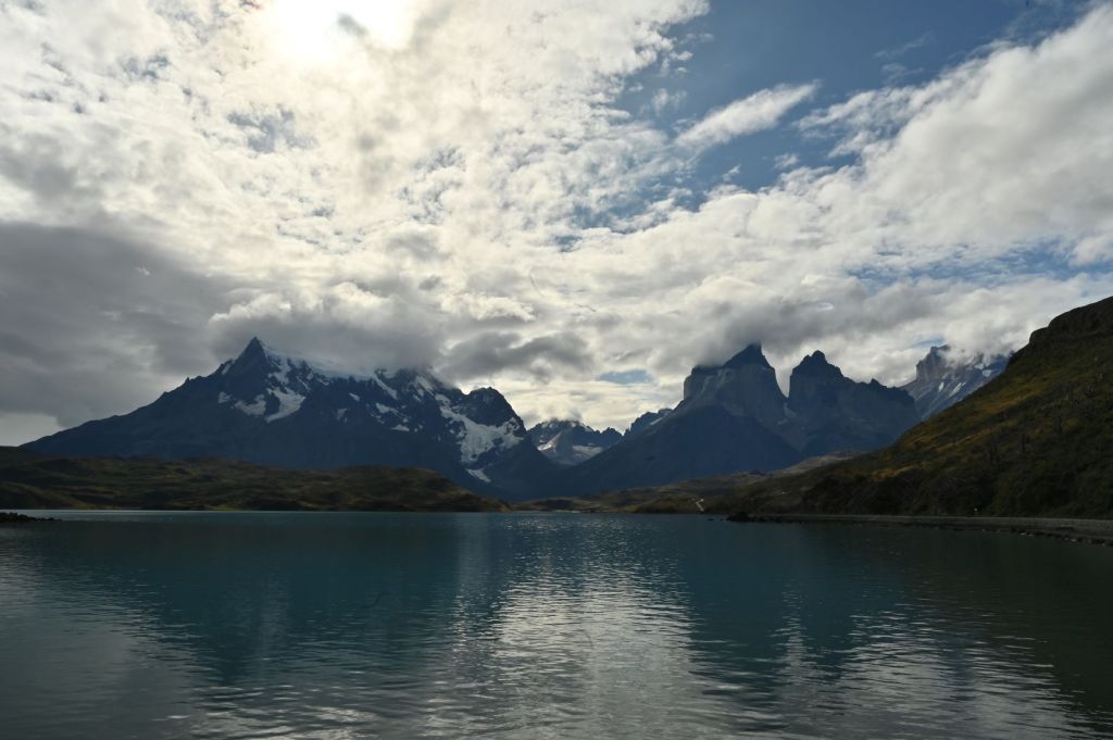
Torres del Paine is truly spectacular. I would put it the same category as Grand Teton, Yellowstone or Yosemite National Parks. A huge high alpine massif with highly unusual features and world class hiking, camping, fishing and climbing. The difference is that is populated by about 2% of the people one would typically see in the above U.S. based national parks.
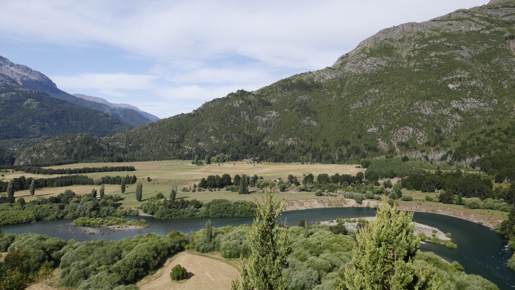
We stayed at a nice lodge, Hotel del Paine, hard on the Rio Serrano, which I got a great shot of the next morning, which is below on March 13.
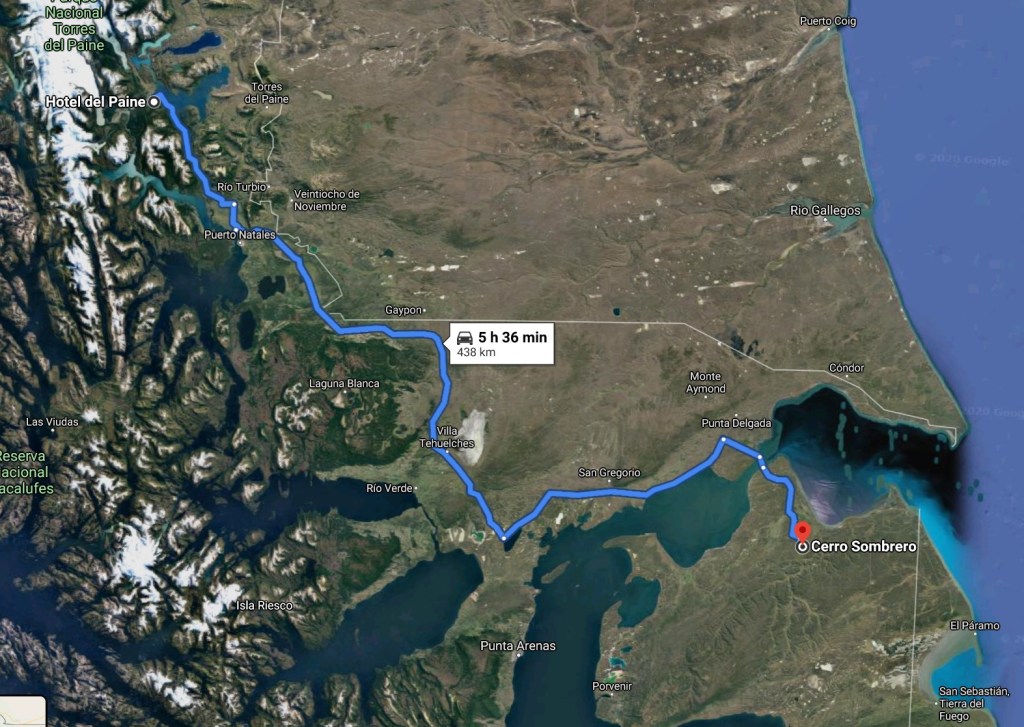
March 13 – Torres del Paine, Chile to Cerro Sombrero, Chile
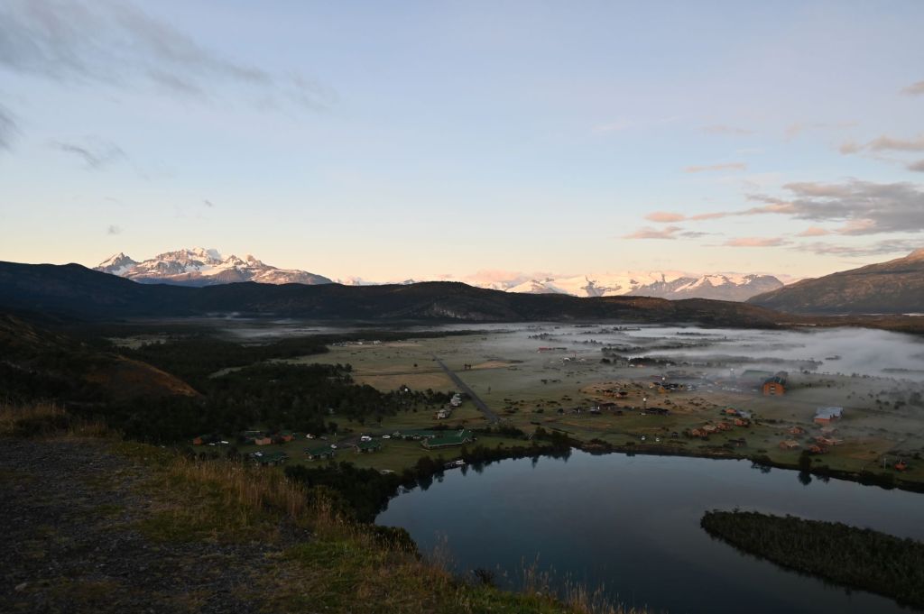
I was able to get up early, before sunrise, and ride to an overlook of the Serrano Valley and the Torres del Paine massif. I was extremely lucky that the sky had cleared and it was a crystal clear morning great for photographs.
Our lodge is the one in the lower mid/left section of the photo below right on the Rio Serrano.
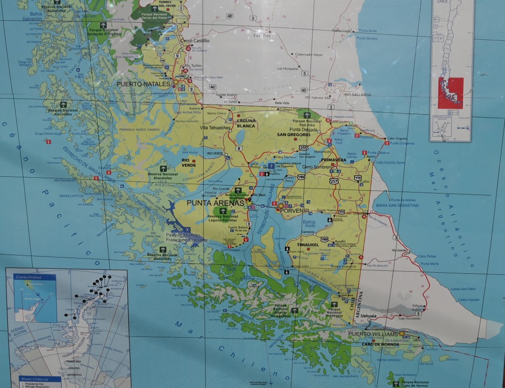
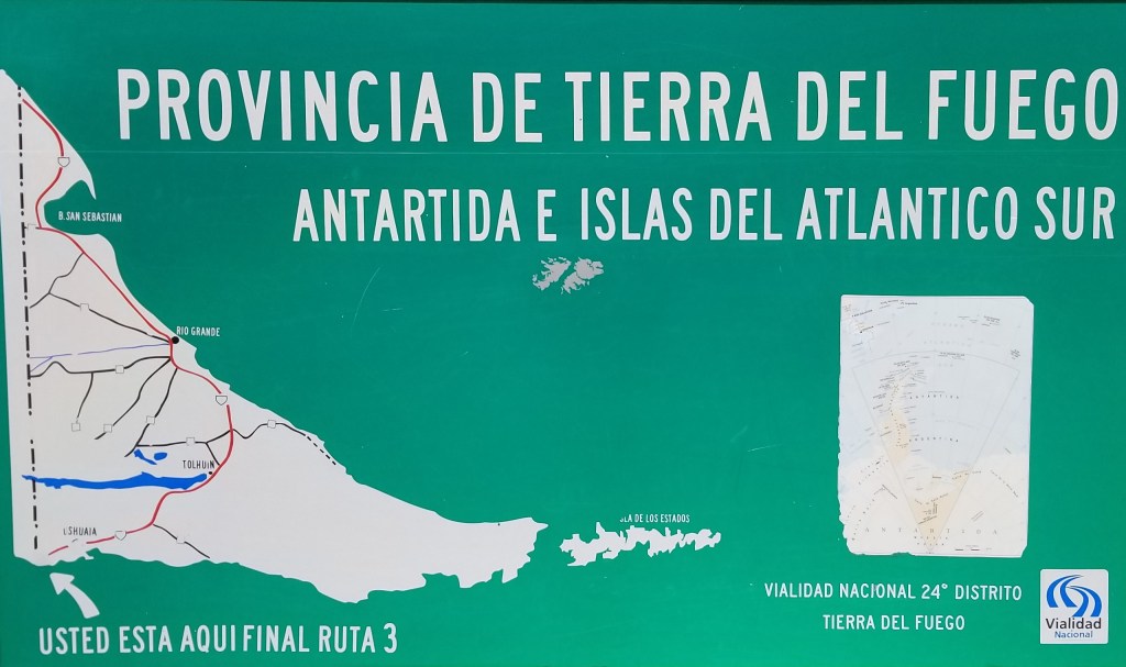
We then headed back to the open plains of Chile and south onto the island of Tierra del Fuego by crossing the Strait of Magellan by ferry. Below is a good map of the area which shows the Strait of Magellan. The Strait is an important passage between the Pacific and Atlantic. Ferdinand Magellan’s original name for the strait was Estrecho de Todos los Santos (“Strait of All Saints”). Charles V, the financier of the Magellan exploration, changed the name to Strait of Magellan to honor him. The route is difficult to navigate due to frequent narrows and unpredictable winds and currents. The strait is shorter and more sheltered than the Drake Passage, the often stormy open sea route around Cape Horn, which is beset by frequent gale-force winds and icebergs. Along with the Beagle Channel, the strait was one of the few sea routes between the Atlantic and Pacific before the construction of the Panama Canal.
Below is a photo of the Bahia Blanco, the port on the Strait that we disembarked upon when entering Tierra del Fuego…not much to see but an important departure point to the southernmost landmass in the world. You can see in the map above that Tierra del Fuego is bordered on the west by the Strait, the south by the Beagle Channel and the East by the Atlantic.
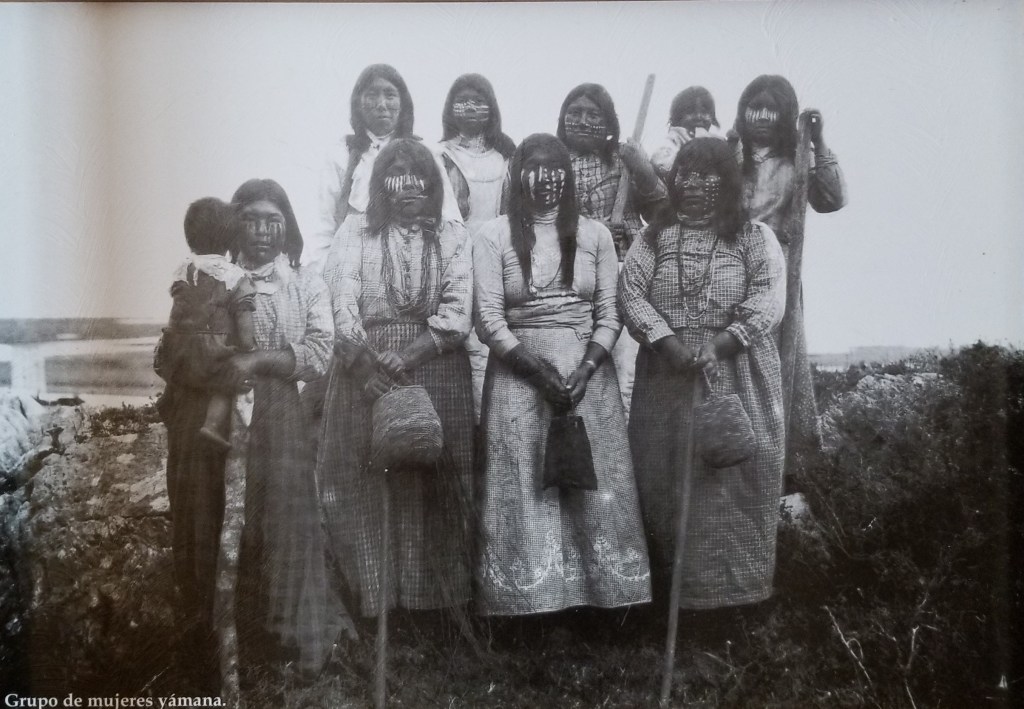
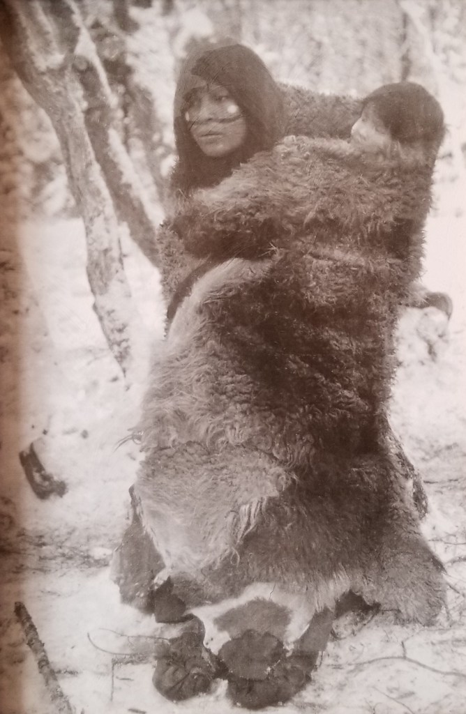
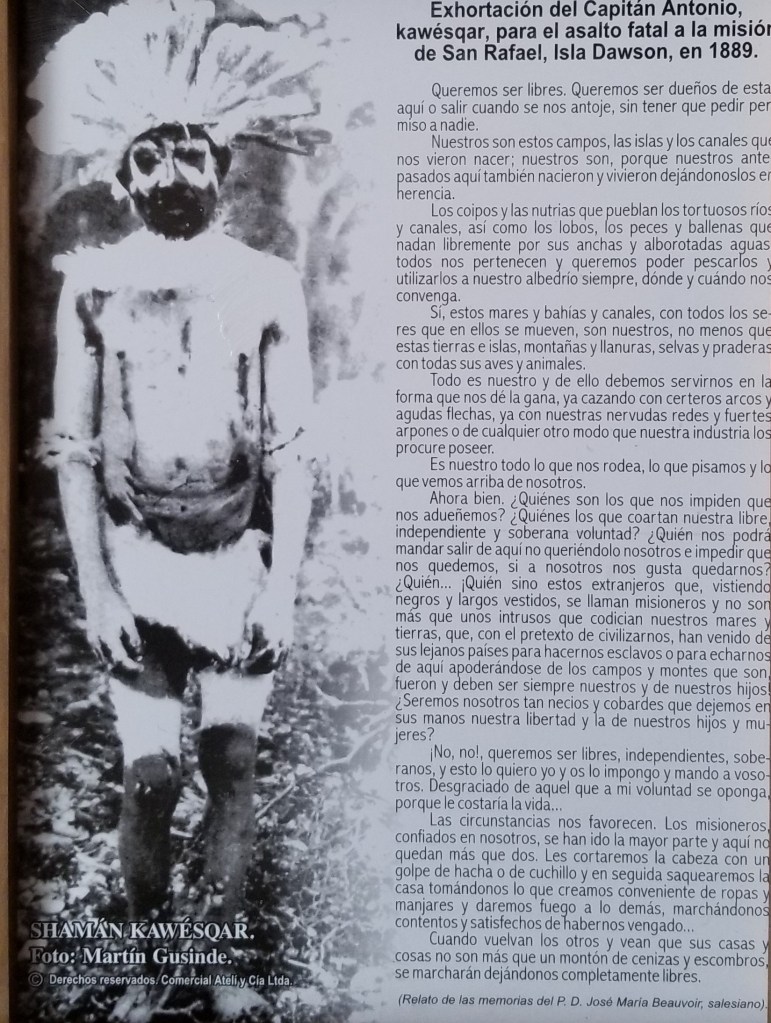
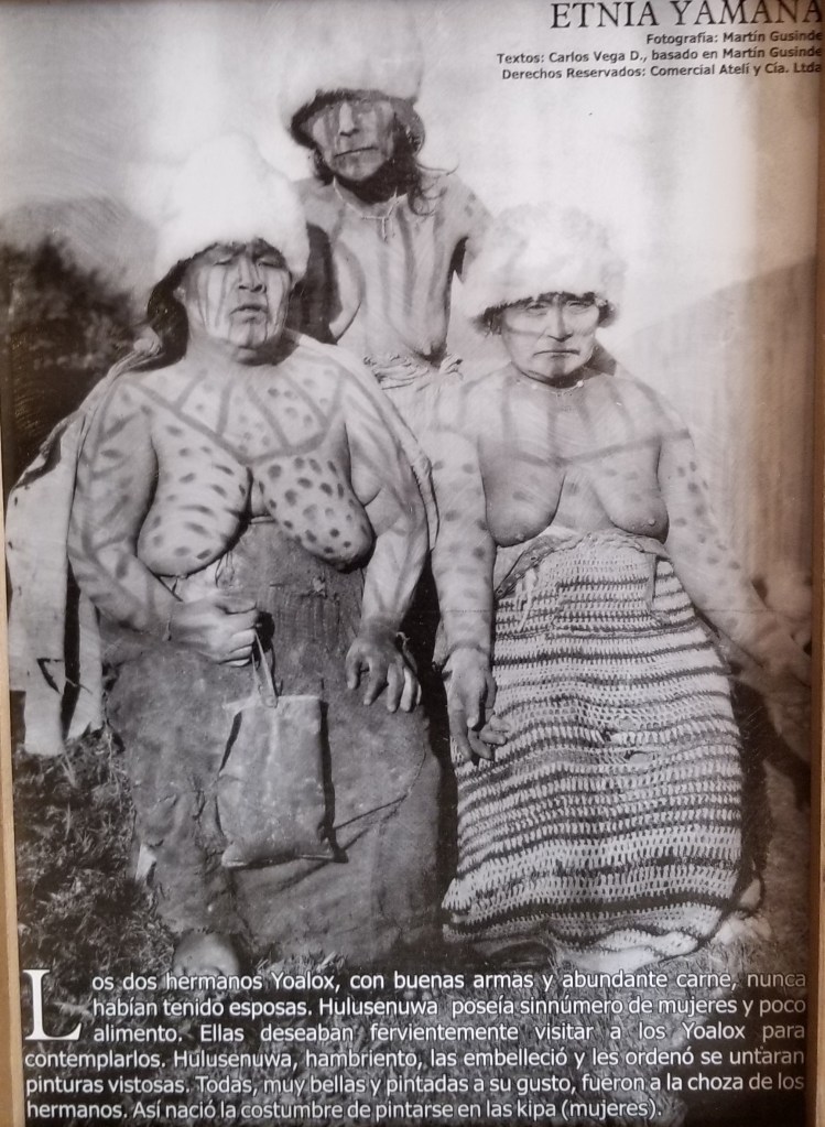
Cerro Sombrero is one of the end of the road type towns, which I love to explore. Our hotel is below and is a place that is typically populated by oil and gas workers. It’s very basic, but in the entryway were a series of photos from many years ago of the native Indians that were the original inhabitants of Tierra del Fuego. I’ve reproduced them for you here. I found them fascinating.
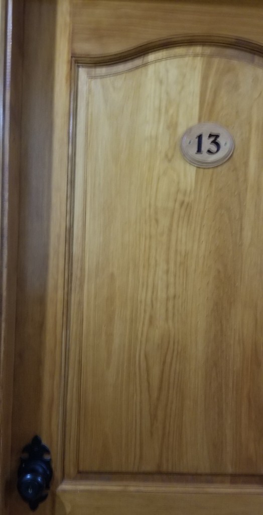
As luck would have it, I was assigned room 13 on Friday the 13th. I was hoping this was not an indication that my luck on this trip (which has been extensive) had run out.
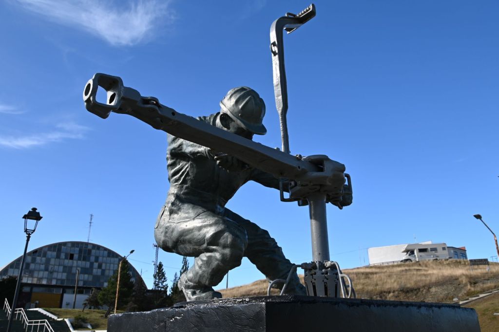
I took a couple hours and walked around the small village. Below are some pics that attempt to capture it…a wind-blown frontier town with not much going on. However, the sculpture in the town square, reminded me of the Soviet style of sculpture we saw a lot of on the Mongol Rally.
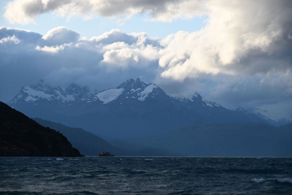
March 14 – Cerro Sombrero, Chile to Ushuaia, Argentina
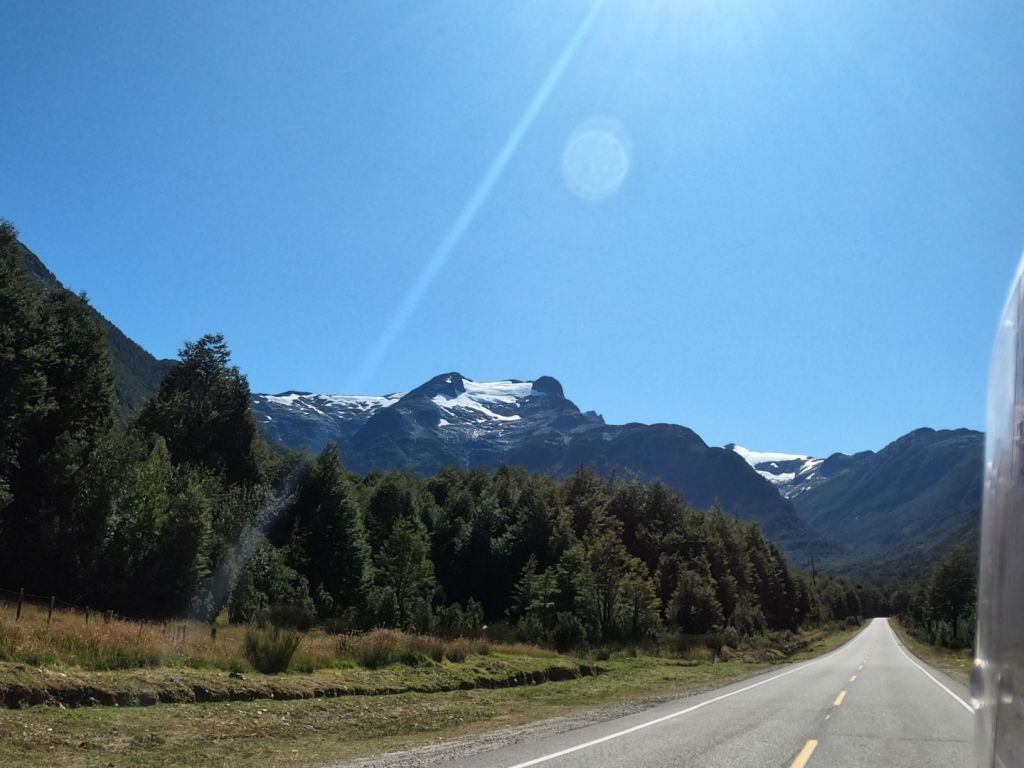
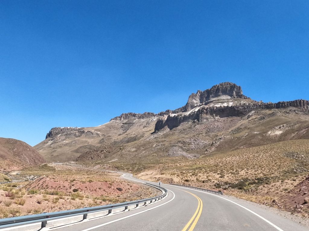
This leg of the journey was a surprise to most of us. I had expected that the terrain would be flatish and not that interesting, but it turned out to be very different that this. Ushuaia and the area surrounding it is the only part of Argentina that is located on the western side of the Andes, so to get to Ushuaia we had to go back up and over the Andes. The Andes decline in height from North to South, so the mountains were more in the 2,000 meter zone in contrast to the north, where they are as high as almost 7,000 meters.
The story of how the border came into being here is an interesting one. In the 1980’s the boarder in this area, as well as much of Patagonia, was still in dispute. The countries of Argentina and Chile were attempting to negotiate a peaceful settlement of the boarder and they ran into issues that were not reconcilable by the teams. As a result, the two very Catholic countries turned to the Vatican to mediate the dispute and Pope John Paul II defined the boarders between the two countries leading to a triangular piece of Argentina being isolated from the rest of the country and only accessible by crossing the Strait.
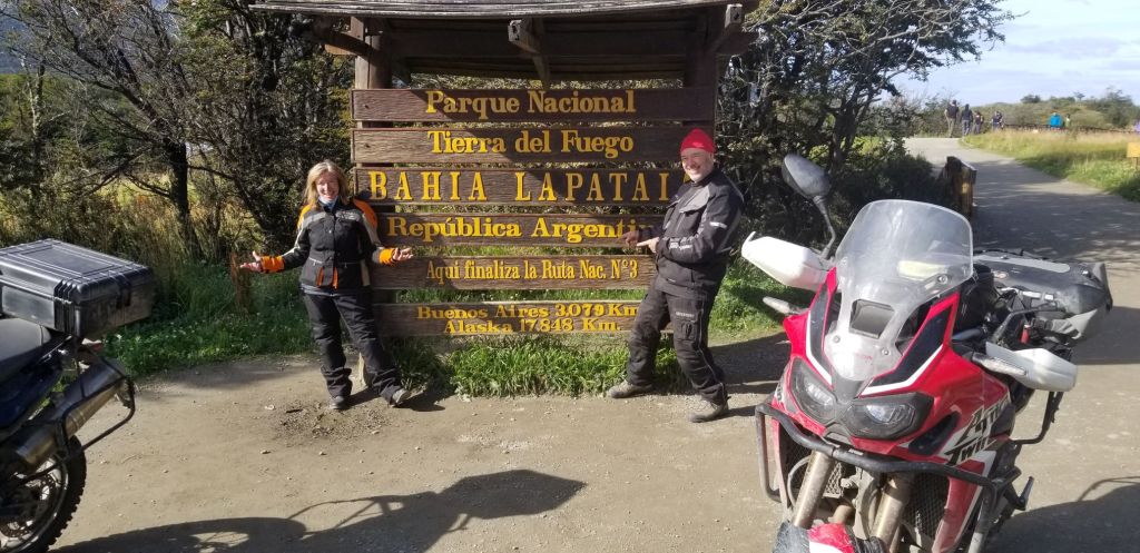
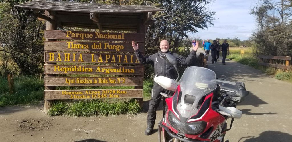
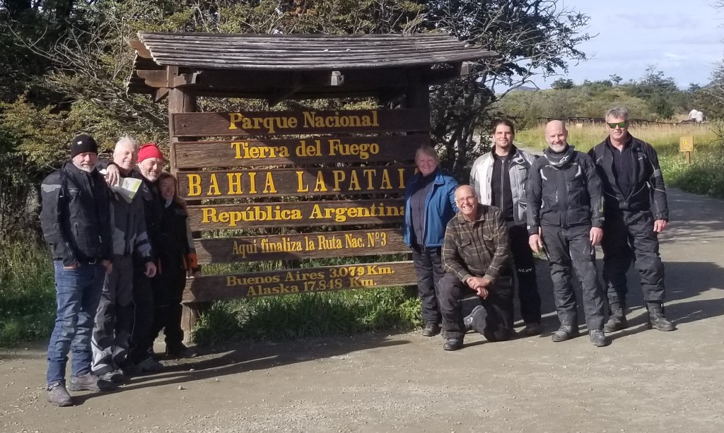
Ushuaia is also considered to be the Fin del Mundo and southernmost part of the world that can be reached via a road. There is a famous sign here that travelers go to and capture a picture documenting reaching the journey’s end.
Of course, we did the same.
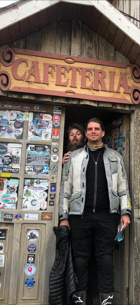
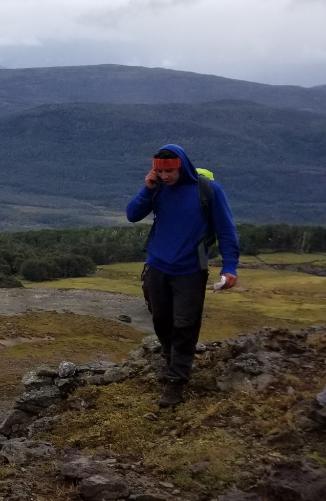
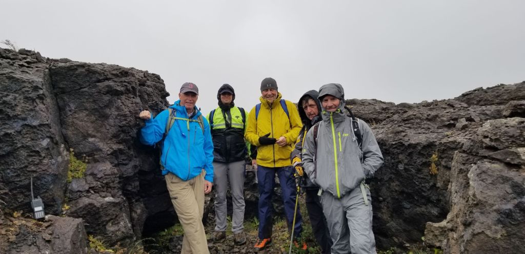
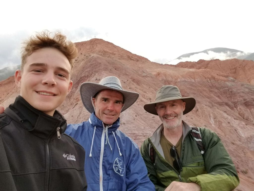
Above is the group whom I’ve greatly enjoyed riding from Pucon to Ushuaia: Phil, Mike, Gary, Illiana, Jane, Kevin, Craig and JD. Missing are Eric, John and Randy.
I’ll provide another couple posts as a wrap on the trip in the next couple days.
“The Heart of Patagonia is the Wind, and Its Soul is the Mountains” EricThomsen, our guide.
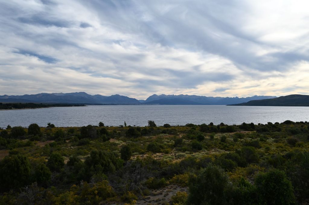
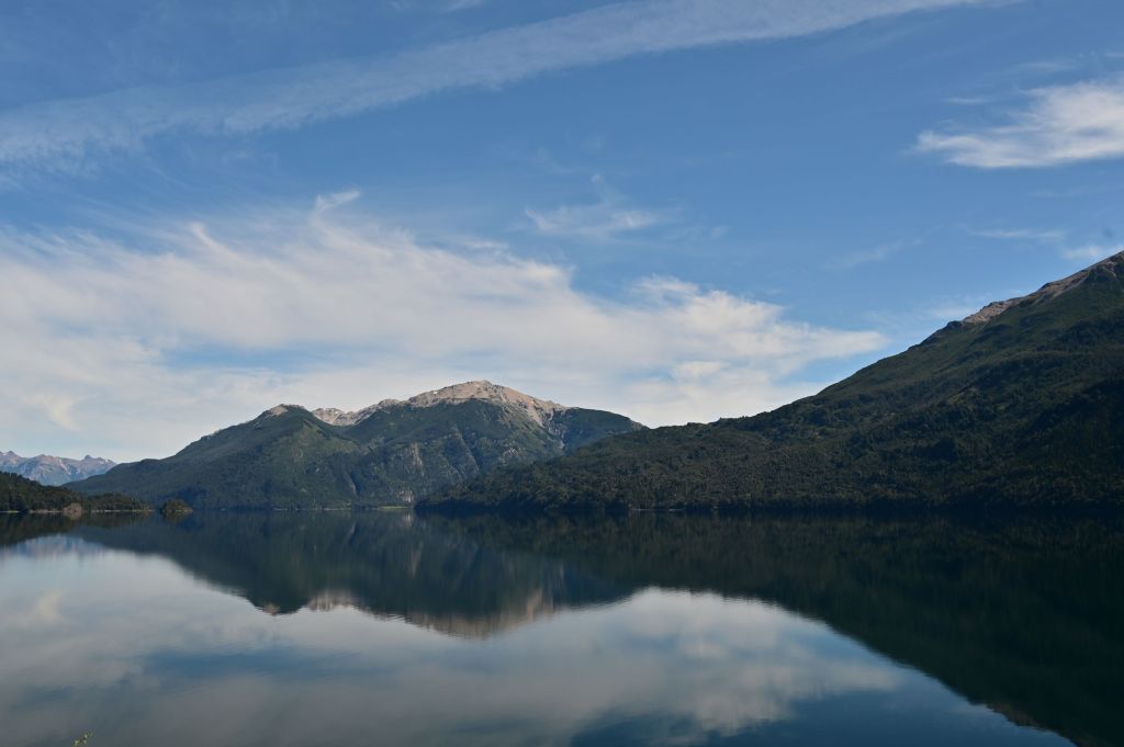
On this leg of the trip, we have experienced in full the soul of Patagonia. Many great rides in, and exposure to, the mountains, lakes, glaciers, volcanos, flora and fauna of Patagonia. Several of the members of our group have given up taking pictures due to a belief that the beauty of Patagonia can’t be captured in a video or photograph. Rather, one has to come and experience the diversity and grandeur of Patagonia first hand. I can’t disagree, but I didn’t give up trying. Below, you will see A LOT of photos I have taken and a few videos, which attempt to provide my take on this very special place…one I plan on being back to many times in the future. I hope you enjoy!
As we move south and into the open plains of Southern Argentina and the archipelago region of Chile, the heart of Patagonia, the wind, most likely will play a much larger role in our journey.
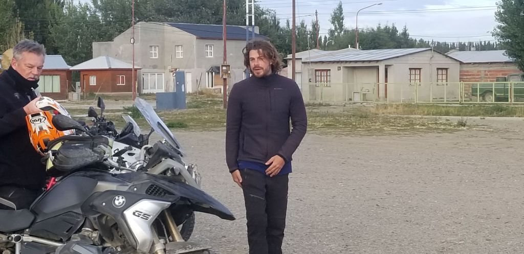
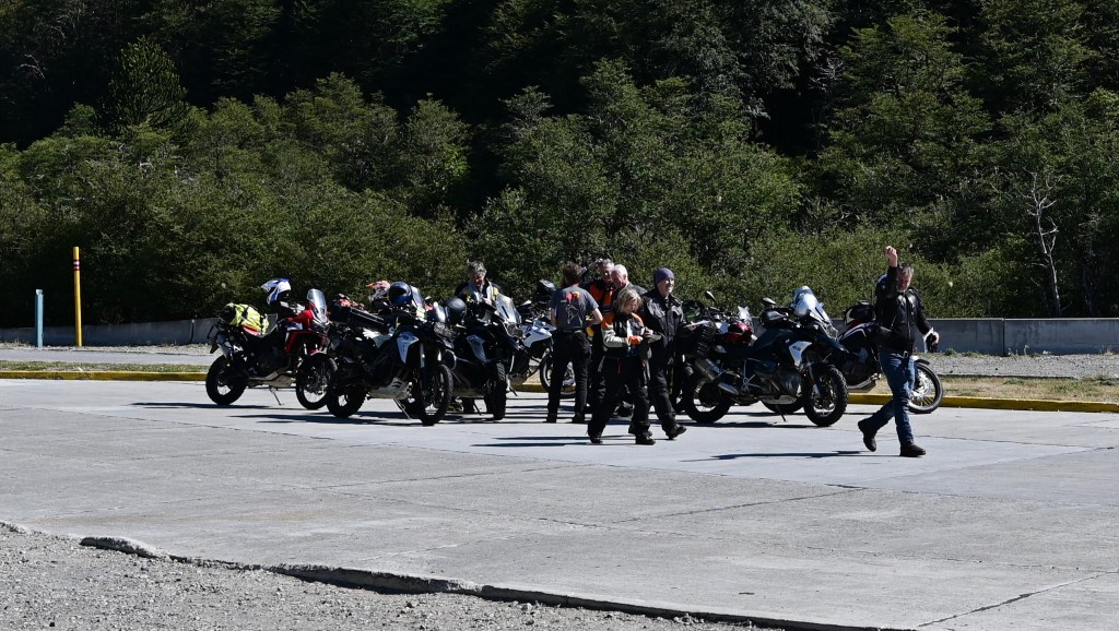
March 1 – Meeting the Ride Adventures Group in Pucon
Met the group I’ll be riding with over dinner. The group consists of Eric, our mechanic and sort-of-guide, Kevin and Jane from Virginia, Gary and Illiana from Toronto (but, Gary is really from the UK and Illiana is really from Greece), John and Randy from Whistler, Craig from New York, Mike from Tampa, Phil from Las Vegas and JD from Oklahoma.
Before, I met Eric at dinner, I spotted him on the street in Pucon and immediately thought that he looked the part of someone from Pucon. Great person with extensive motocross experience. He drives the truck behind us so as to help anyone who crashes, has a flat or needs assistance. Eric is from Cordoba, Argentina and in his 40’s with a couple kids and a wife. He has led an interesting life. He is the only person I know who has spent time in Greenland, in fact, he went to school there for a year. Eric has been a fantastic presence on the trip with entertaining stories and a trove of wonderful info about the areas we are traveling and experiencing. Eric is pictured on the right below with Gary at the end of one of our days.
Kevin was in the Navy and then an air traffic controller. He is now retired, but drives a grammar school bus, as does his wife, Jane as a means of giving back to their community. Gary grew up in Southampton and then eventually moved to the Toronto area. Gary was on dialysis for seven years before receiving a kidney transplant from his mother. He is a heavy equipment operator. John and Randy are both retired executives who live full time in Whistler and ski as well as ride off-road extensively. Craig was an investment banker, then into private equity and recently left to start his own entity. Mike is retired from the Army as a colonel and served in Iraq, Afghanistan, Pakistan and several other middle eastern countries. Before the military Mike obtained a Ph.D. in philosophy and ethics from Stanford and a masters, I believe, in philosophy at Harvard. Mike grew up in Boston. Phil is a manager of a two players clubs in Vegas. JD is a retired equipment leasing company owner. JD is also one of the most accomplished off-road, enduro racers in America and spent five years on the world-wide racing circuit. He owns a considerable amount of property in Oklahoma and built a 14-mile dirt track on his property…serious rider!
Should be a good group of people with which to people to spend the next couple weeks.
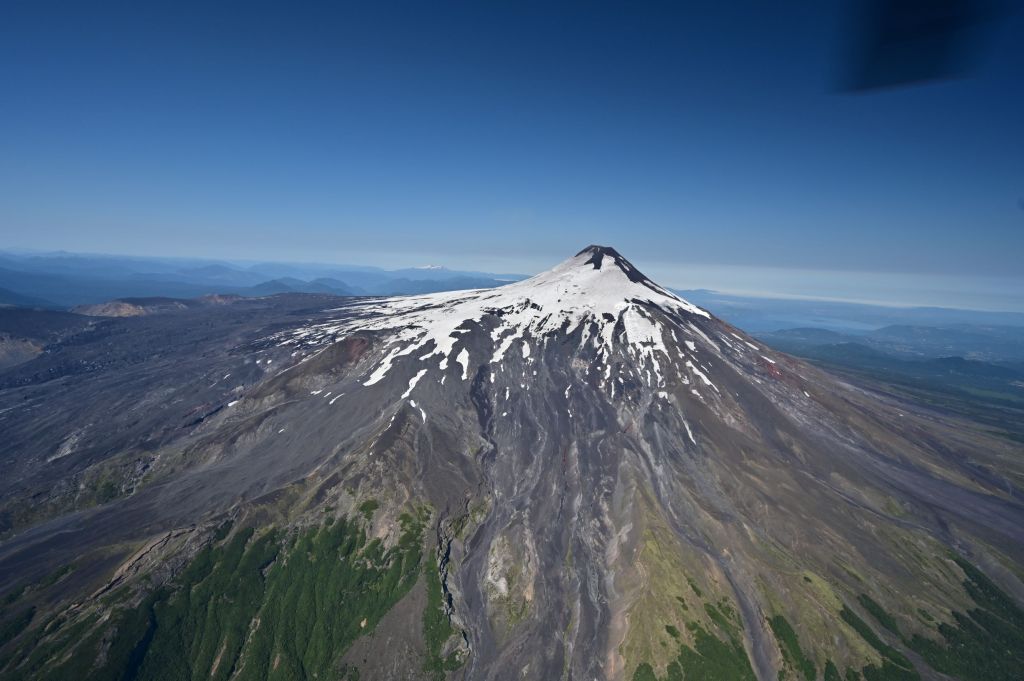
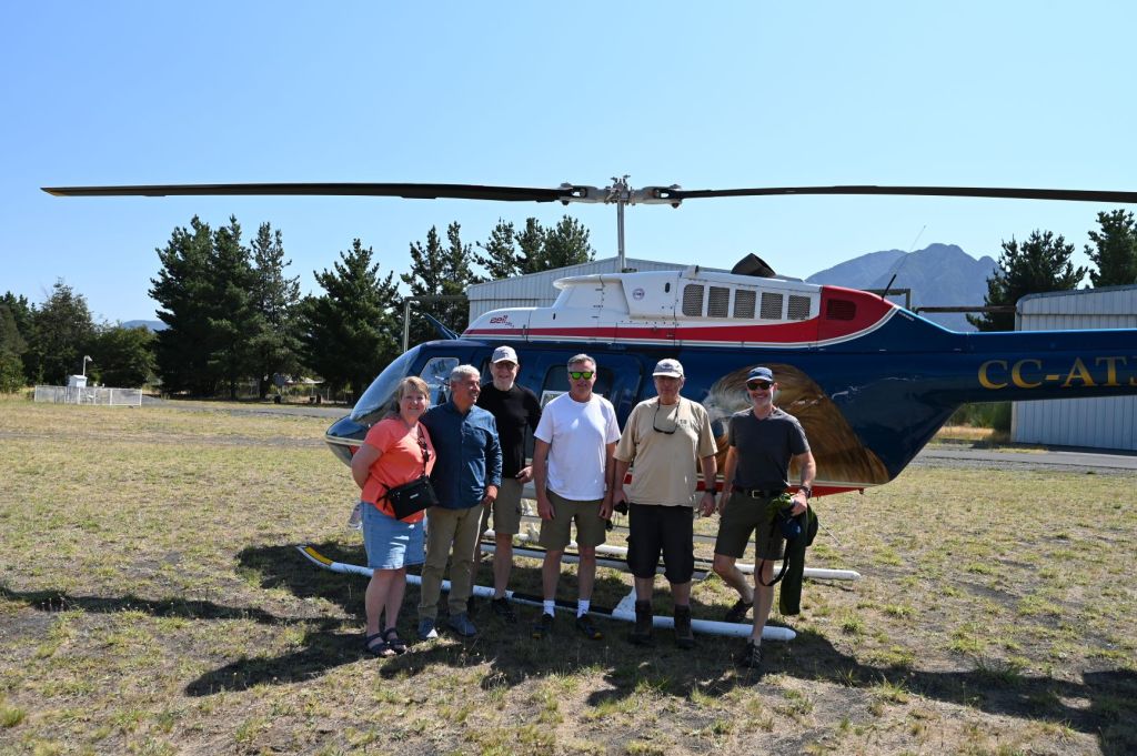
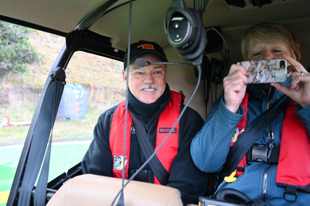
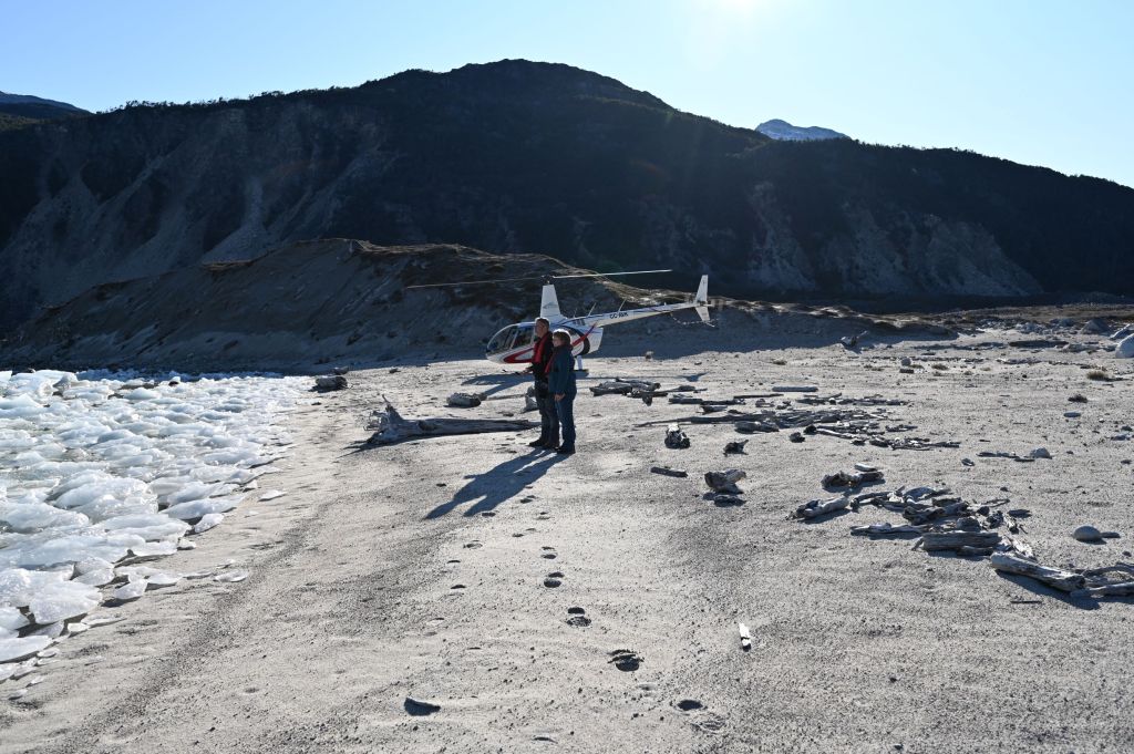
Earlier in the day, Jane, Randy, John, JD and I decided to take one of the available tours in Pucon with a local who owns a helicopter, Francisco. Francisco flew us over Villarrica volcano and Lanin volcano.
Below is a an interesting area around the volcanoes.
Lanin in the background over another volcanic peak, the name of which I didn’t catch.
Below is an interesting alluvial zone.
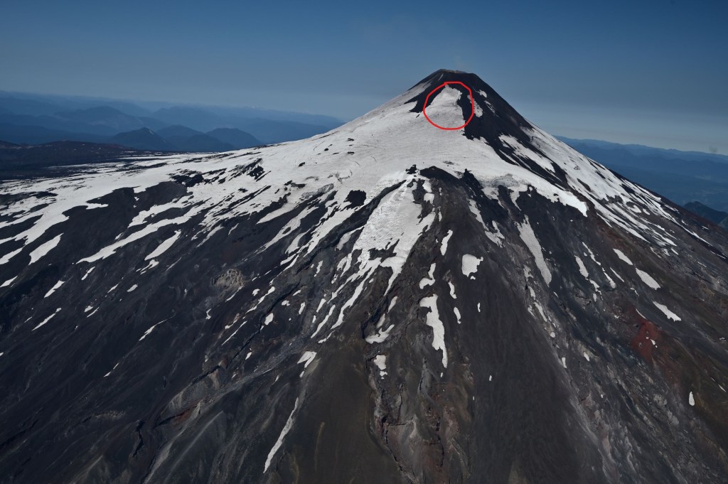
Below are several pictures of Villarrrica. In the second one, I have circled the zone which we slide down. You can make out the chute created by our decent. If you look very closely, it is a vertical bright white line on the right side of the circle.
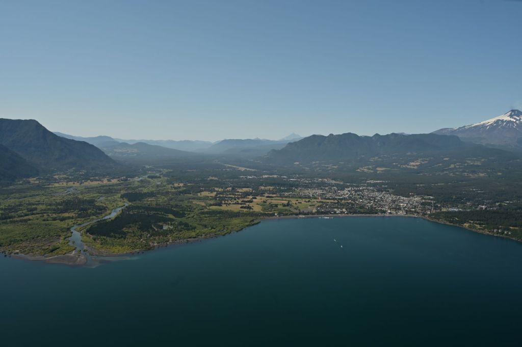
The town of Pucon is pictured below with Villarrica on the far left.
Jane, Francisco (the pilot), John, JD, Randy and yours truly.
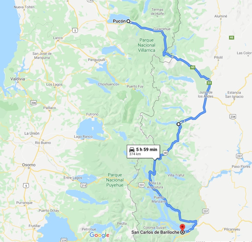
March 2 – Pucon, Chile to Bariloche, Argentina
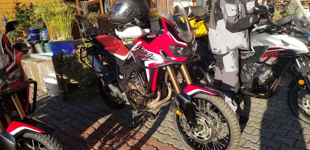
We all assembled in the Hotel Rangi and then were transported in a van to a location outside of Pucon to pick up our motorcycles at Uli’s place. Uli, from Germany, owns all the bikes and stores them in his garage on his property outside of Pucon.
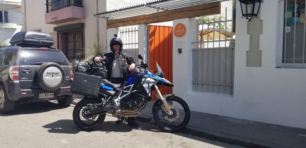
I’m driving a Honda Africa Twin CRF1000L. Very nice motorcycle with all the bells and whistles included on it. I’m starting out with 15,850 kilometers on the odometer.
Below, the gang heading for a boarder crossing into Argentina.
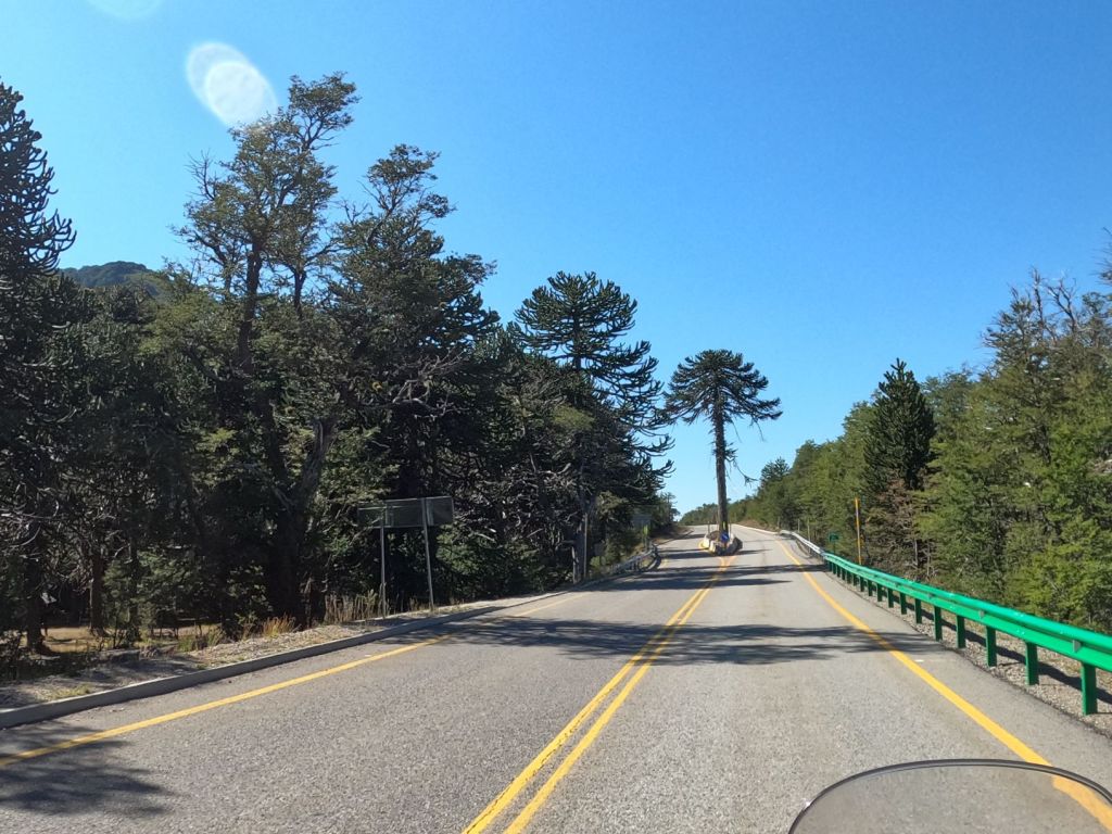
Right after the boarder crossing there was this forest of trees, Araucaria, which were very unusual.
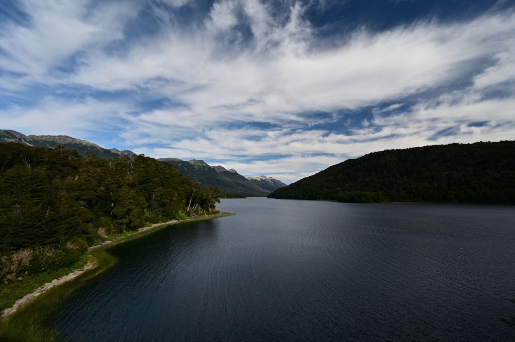
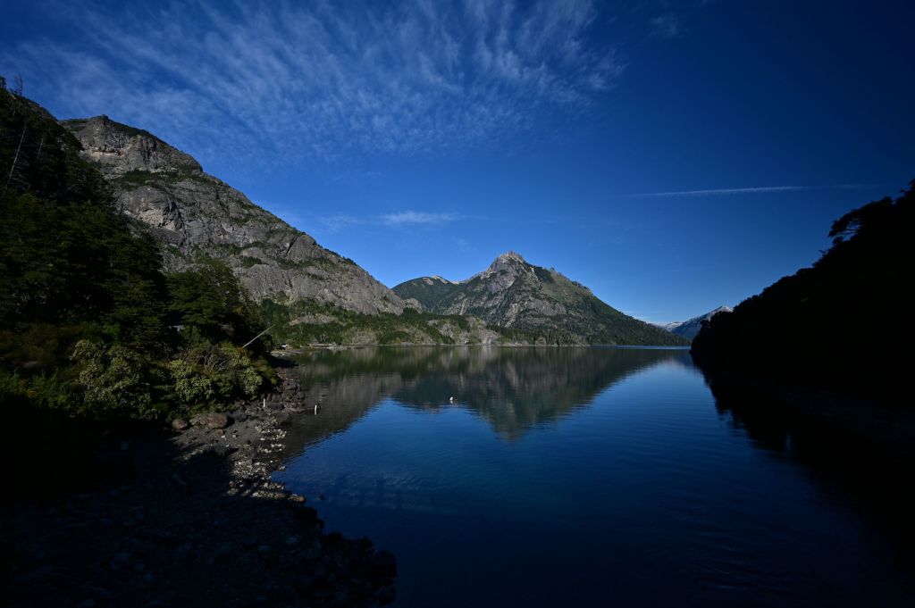
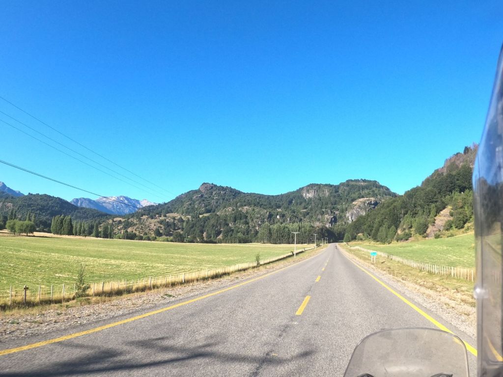
Once into Argentina, we entered the Seven Lakes Route on Ruta 40, a spectacular region of lakes, mountains, valleys and rivers. Below are a few photos of the area.
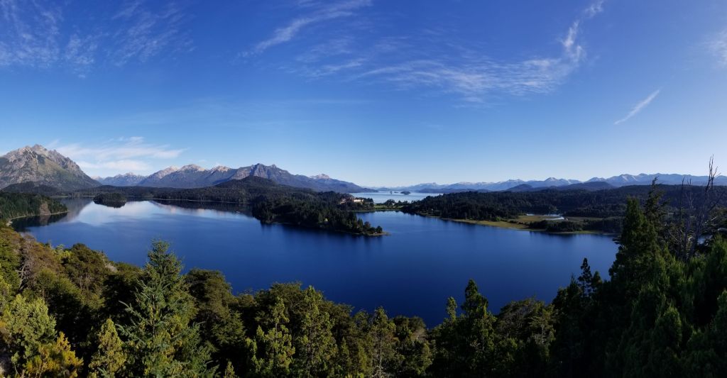
We pulled into Bariloche late in the evening. Bariloche is a tourist town that is a skiing center in the winter. As a result, it looked very Swiss or German with high quality housing/hotel stock. There is one hotel, Llao Llao Hotel, which is pictured in the distance in the photo below that has been seen in many movies…very impressive.
March 3 – Bariloche, Argentina to Trevelin, Argentina
We headed out on Tuesday to view the Llao Llao Loop which winds around the southern end of Lago Nahuel Huapi. The Llao Llao Hotel is pictured on the peninsula in the middle of the photo.
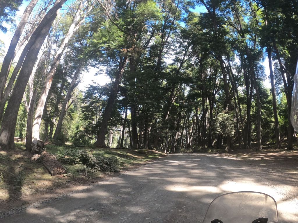
Aftewards, we took a less traveled route through Parque Nacional Los Alerces, which is famous for its Fitzroy trees, which are a cousin to the Redwoods. Below is a photo in a grove of the trees.
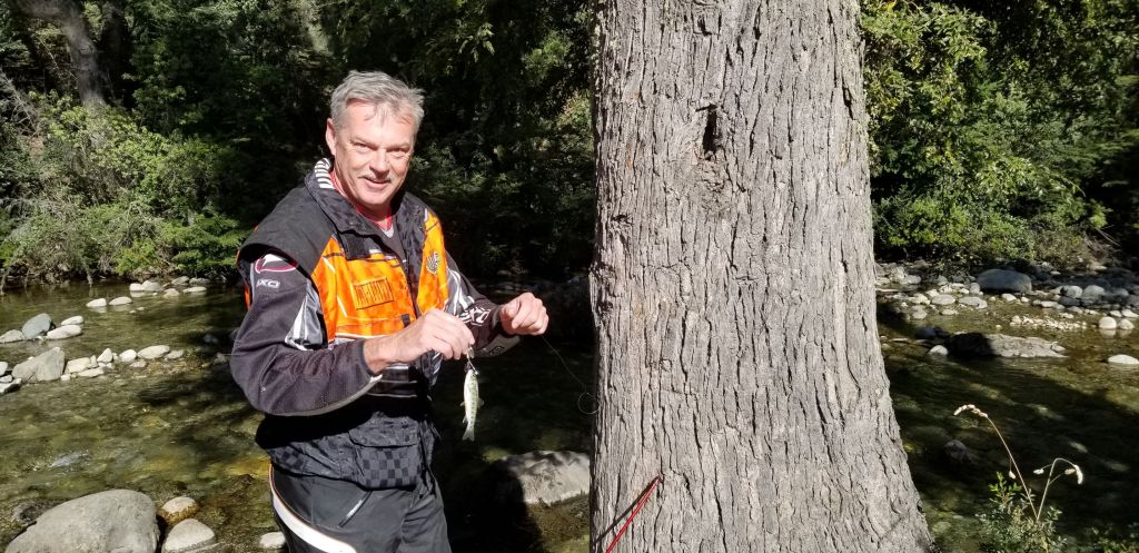
JD has a practice of finding interesting fishing spots, pulling out his small portable pole and then making 10 casts…and only 10 casts to see if he can catch anything. Below, is the only fish that I have seen him catch…or is that his bait…I’m not sure!
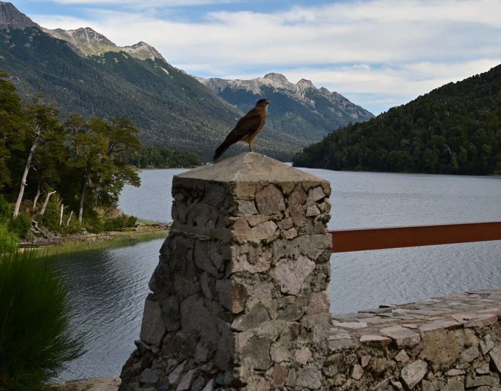
Later on the ride, we came to a mirador (Espanol for viewing point) and this bird allowed me to essentially walk right up to and catch this photo. Looks like a peregrine to me.
The ride through Los Alerces was on dirt roads and was hot. We wound our way through a series of lakes and rivers and all I could think about was taking a swim…so I did. Below is a lake that I stopped at and spent about 30 minutes in the water. Simply beautiful place with refreshing water. I believe it was Lago Futalaufquen. As far as I could see there were maybe 5-10 people on this huge lake camping and enjoying the solitude. This is one of those places I plan to come back to and camp…
When I was in the water, JD showed up on the shore…he had been fishing around the corner and saw me in the water. He joined me for a swim.
We stayed this evening in a hotel called Casa de Piedra that was owned by an Italian family. Interesting place with a beautiful Ducati in the lobby!
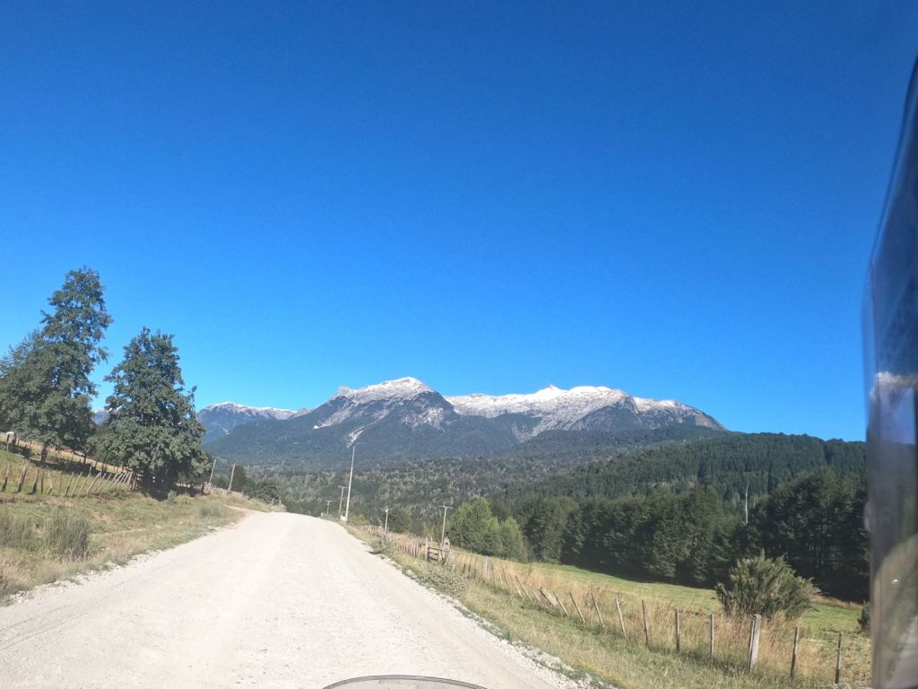
March 4 – Trevelin, Argentina to Puyuhuapi, Chile
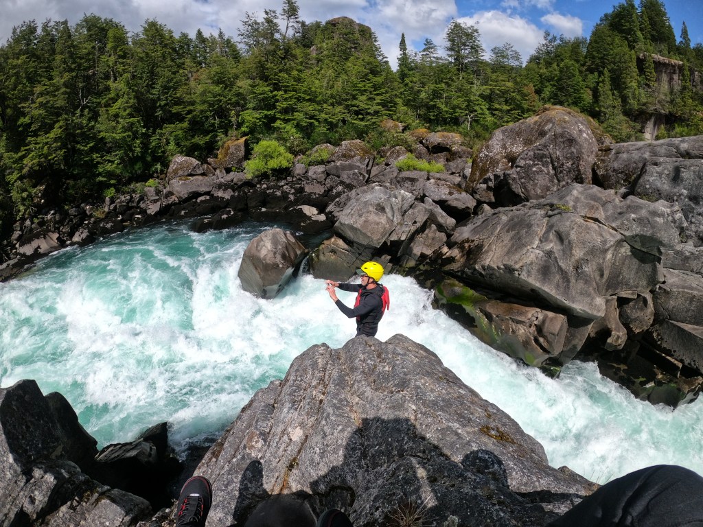
Wens. brings me back to Futaleufu! In the second picture below, high above the greenhouse on the mountain bench in the sky is the high alpine lake, Lake Obsession, I hiked up to on Feb. 7. I have great memories of this wonderful valley given the fantastic whitewater rafting I was able to engage in during February.
Below is another photo of me (in my riding gear as opposed to my rafting gear) on the Rio Futaleufu.
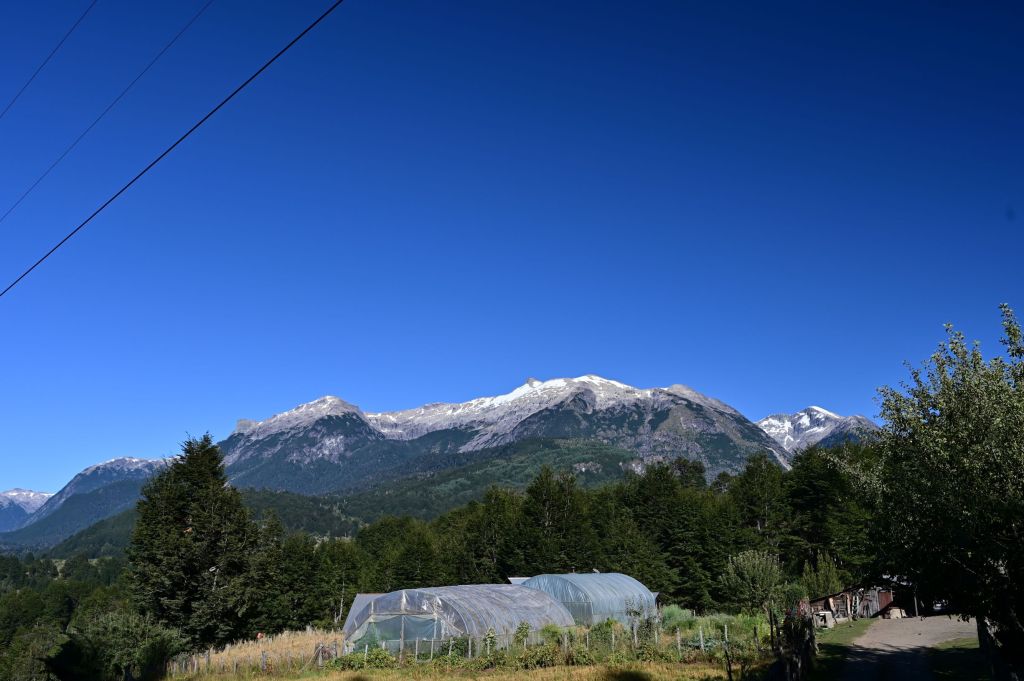
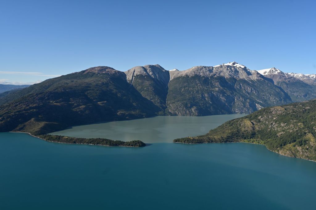
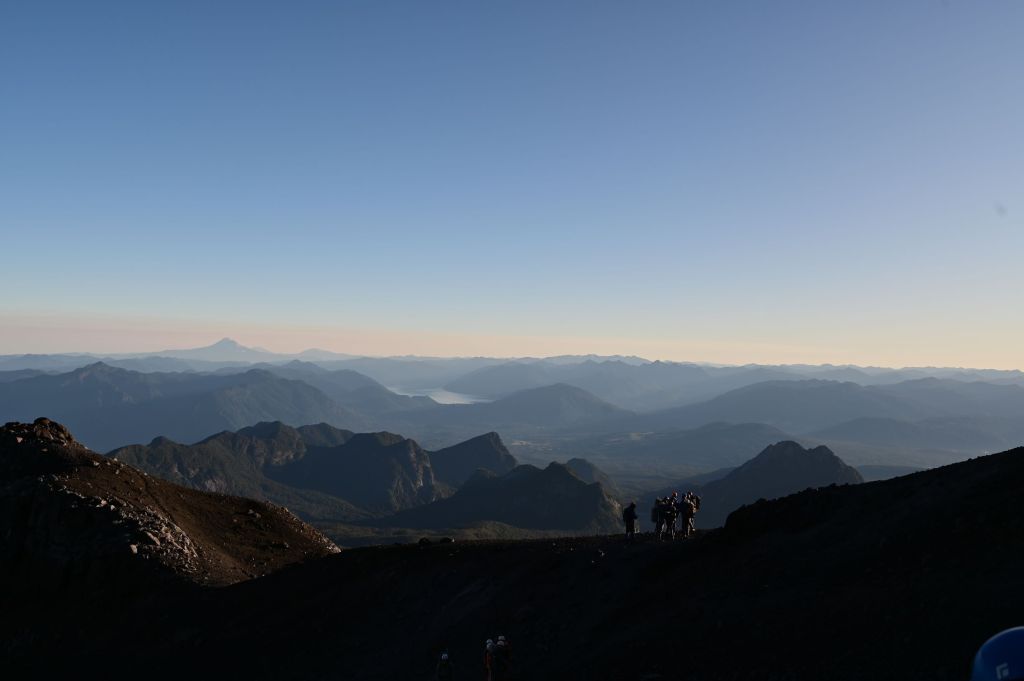
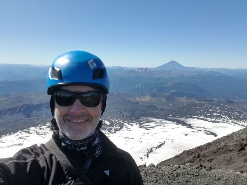
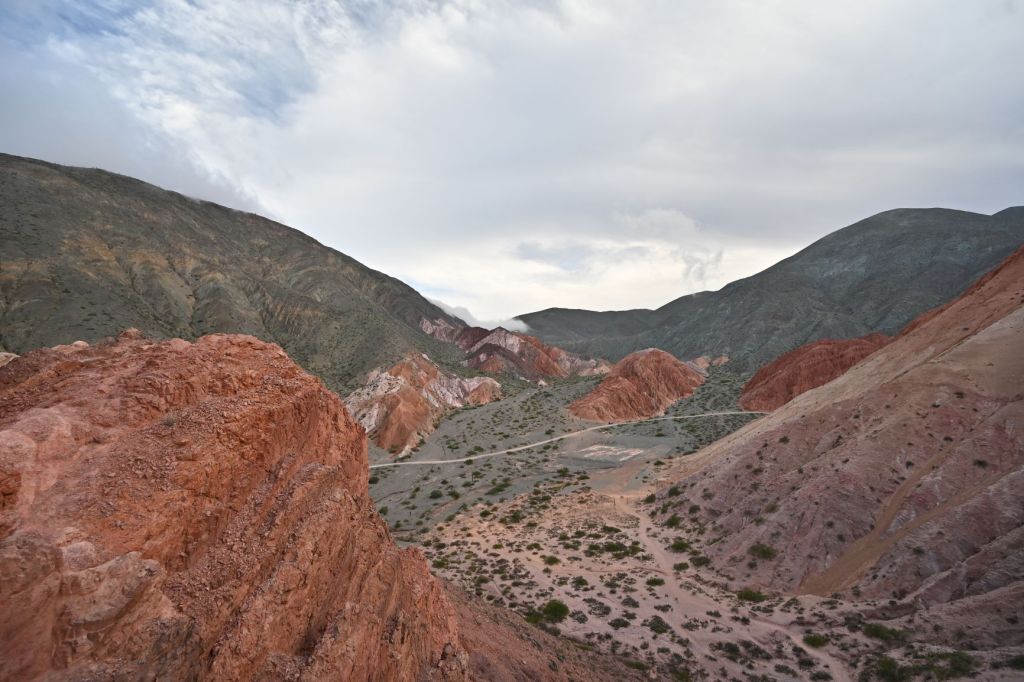
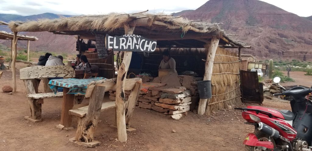
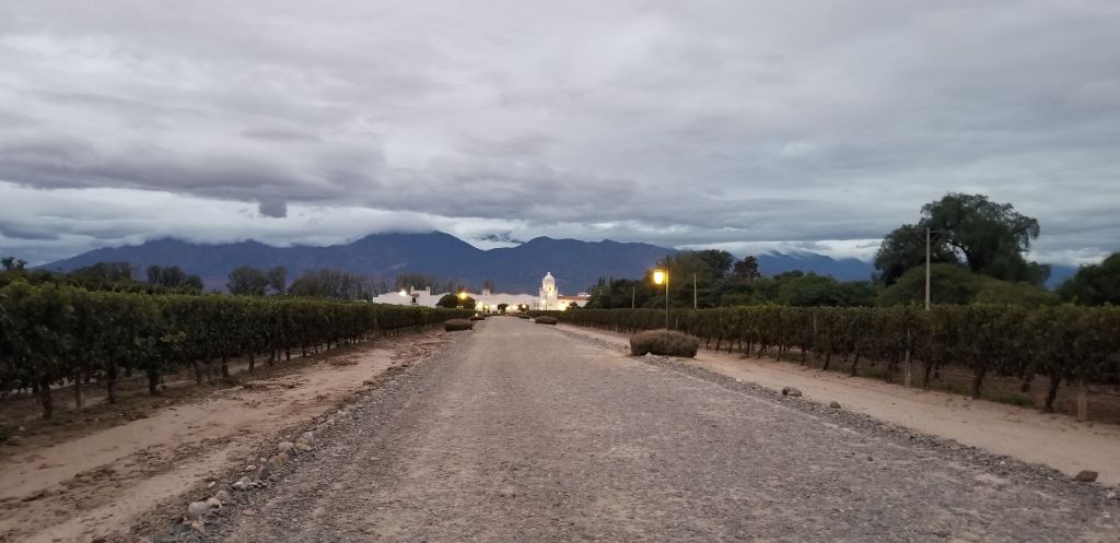
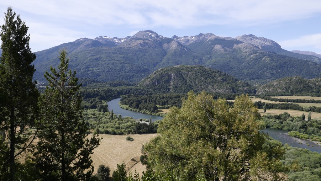
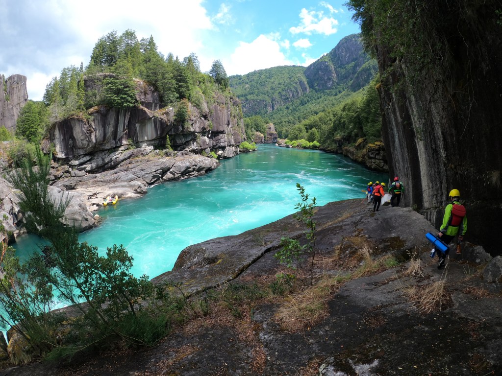
We then advanced to Ruta 7, the famous Carretera Austral, which we will be on for the next few days. At the end of the day, I took the photo at the top of this post of Gary and Illiana heading over a ridge towards Puhuhaupi…what a great visual, Gary with his hands off the bike in amazement over the scene ahead of him…totally captures the moment!!!
Below are a few additional images of the ride.
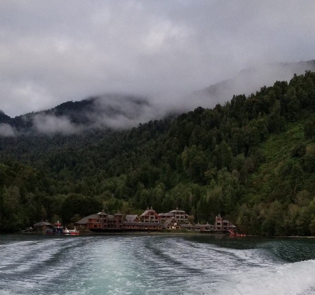
To get to our hotel, the Puyuhuapi Lodge & Spa, we had to park the bikes and get on a ferry to cross the fjord. Below is the view of the hotel from the water. While we were pulling into the hotel, two dolphins were playing in the bay in front of the hotel.
The hotel is only reachable by ferry or boat. There are no roads that connect to it. As a result, the forest and surrounding area is pristine. Below is a huge broad leafed plant on the grounds.
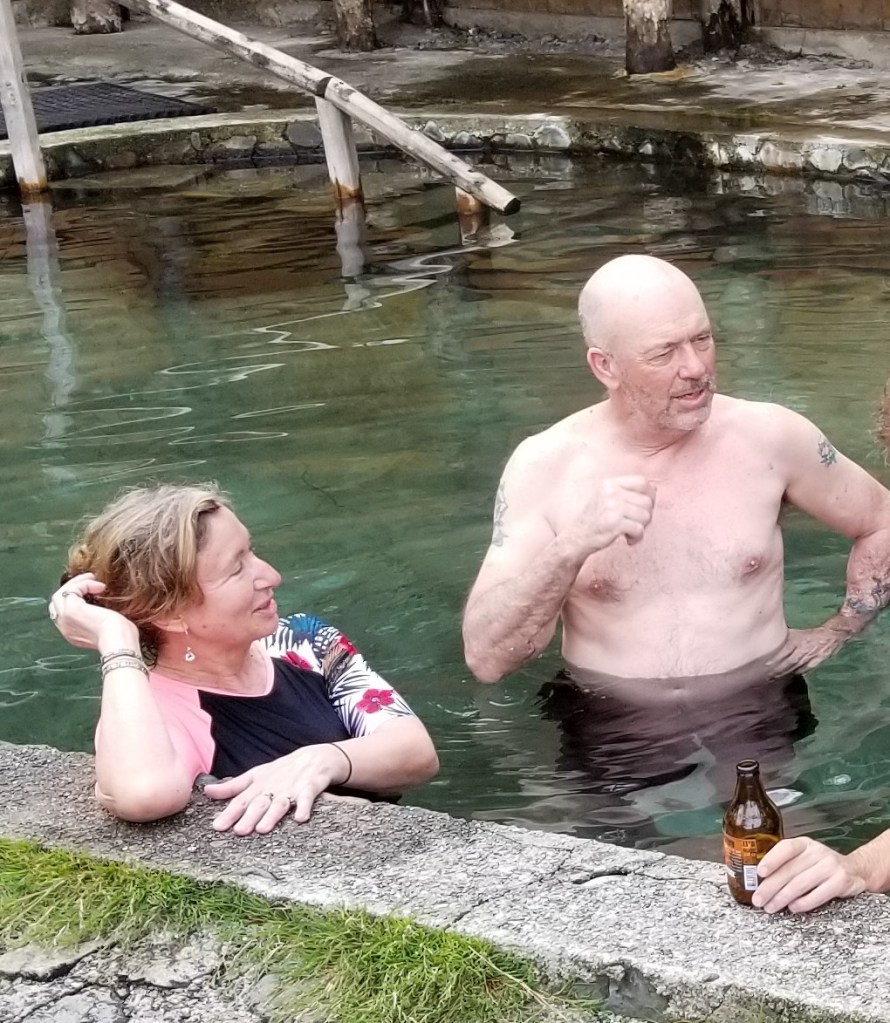
There is a hot springs on the grounds, which a few of us took advantage of that evening. Below are Gary and Illiana in the springs after a swim in the fjord.
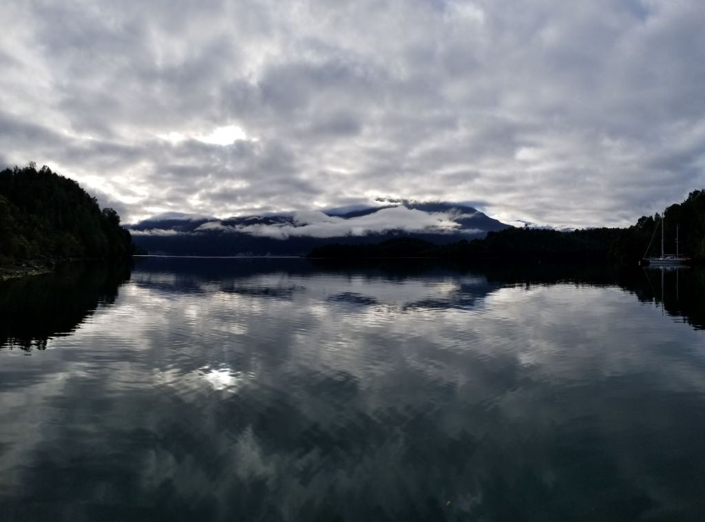
There was a spectacular scene off the deck of the hotel this evening, which I captured below.
March 5 – Puyuhuapi, Chile to Coihaique, Chile
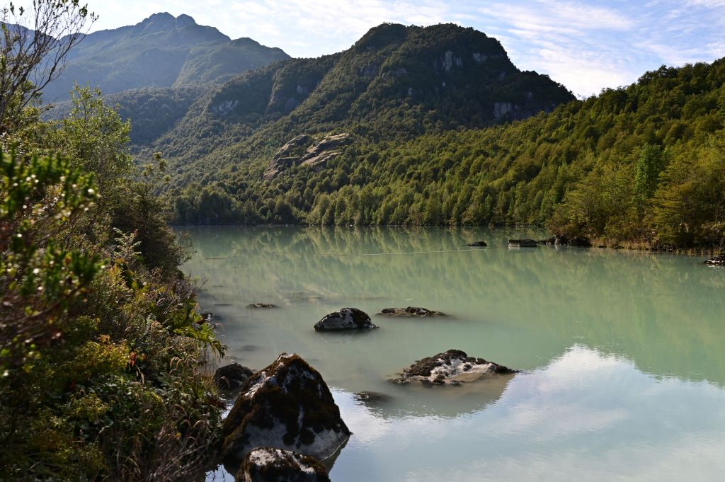
On Thurs. morning we got back on the ferry, crossed the fjord and were back on the dirt roads towards Coihaique. First stop was a stunning glacier, waterfall, glacial lake and stream called Ventisquero Colgante. The water in the lake was a pale green due to the glacial runnoff, as you can see below. We have been very fortunate to date with the weather…blue skies and no wind (as you can see in the reflective lakes in many of the photos)…a big deal in this part of the world!
Below is the river flowing out of the lake above.
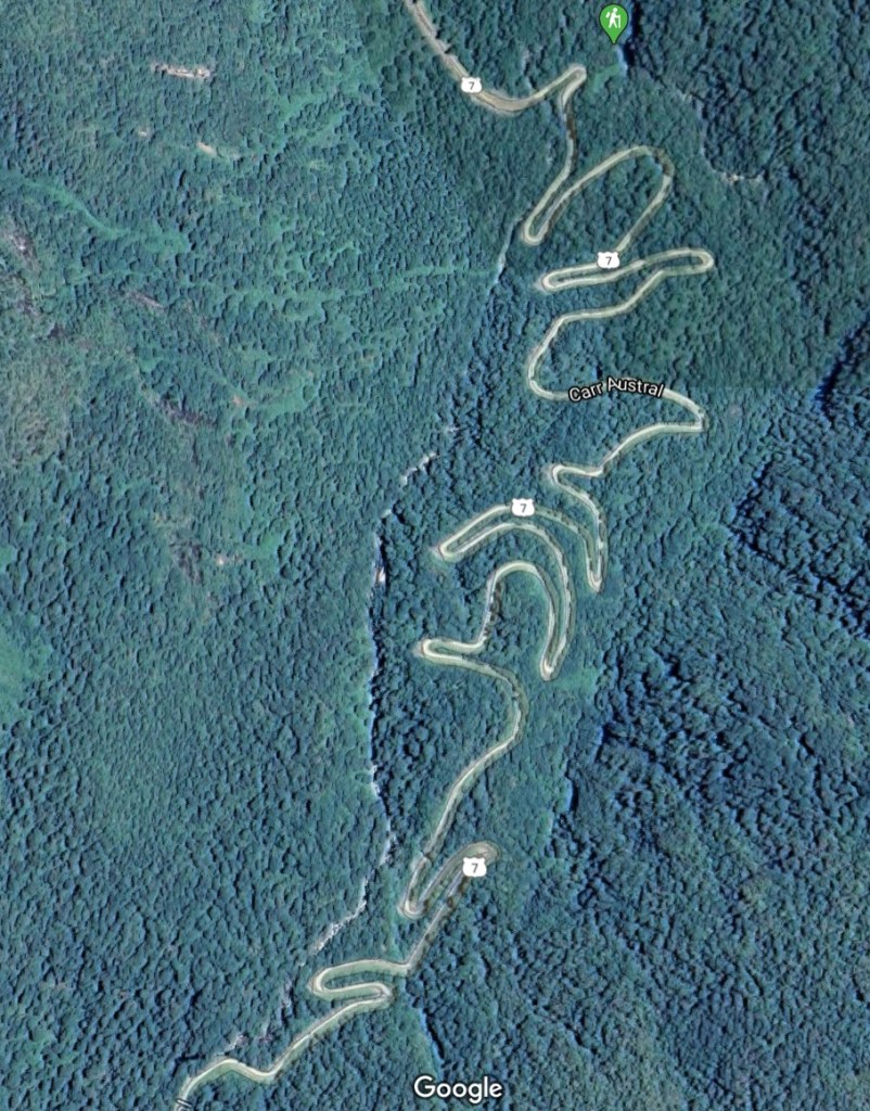
The balance of the day was a ride down the Caterrera Austral with one section that was a series of hairpin turns in the dirt up a steep mountain. This section had me sleepless the night before, because Erik warned us that there would be huge commercial trucks coming down it and taking up the whole width of the turns so they could get down. Take a look at this on the map below.
I didn’t encounter any trucks, but I was in first gear the whole way and making wide turns. Yet, I still put the bike down on one turn…damn…I thought I had the swing of this dirt riding stuff.
Below are a series of pics I took on the balance of the ride.
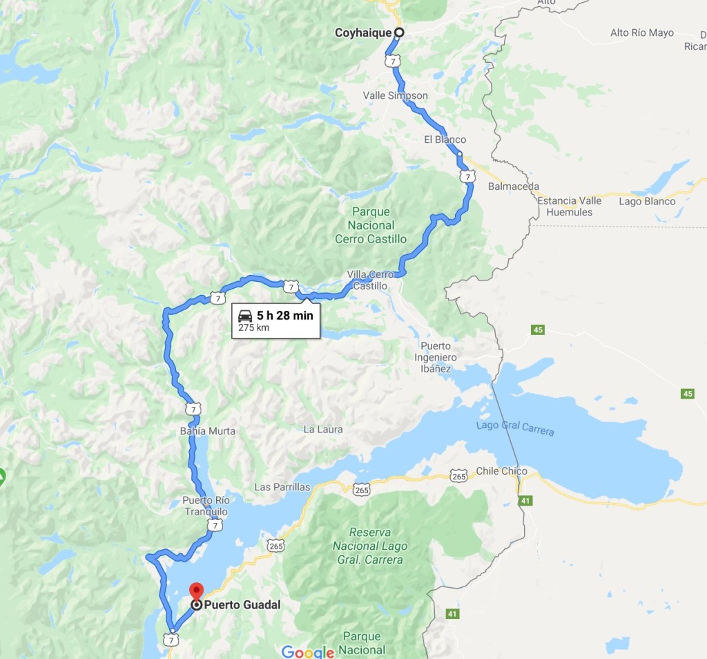
March 6 – Coihaique, Chile to Puerto Guadal, Chile
Today is a relatively short ride of 220k through the Ibanex River Valley, Cerro Castillo past Laguna Verde and through El Bosque Muerte (the Dead Forest). We are truly into Patagonia now. The rivers and lakes are bright green and blue caused by glacier run off.
We had lunch at Puerto Tranquillo a small outpost on Lago General Carrera, which is the 11th deepest lake in the world at 586 meters. This is the lake that Doug Tomkins and his fellow kayakers died on in 2015 due to sudden winds capsizing them, leading to hypothermia and failed rescue attempts. Doug Tompkins was the founder and owner of The North Face and with his first wife, Esprit. Doug Tomkins purchased and then donated over two million acres of land in Chile and Argentina to their governments and in the process created a series of parks running the length of the west coast of South America.
Below is a photo I took upon first encountering the lake. Yes, the water really is that color.
March 7 – Rest Day in Puerto Guadal, Chile
This was a perfect day to be off the bikes…raining, cold and windy. Further, I was beat and really needed a rest. The daily riding has started to wear on my body…I can feel myself start to break down somewhat.
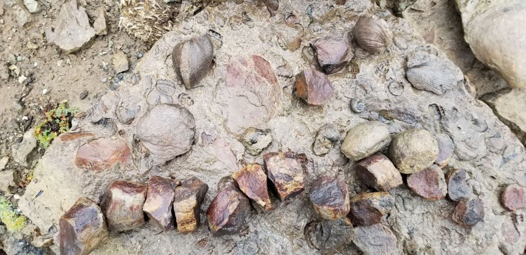
The Terra Luna is owned and run by Philippe, who is from France and moved to Chile 38 years ago. He lives on the property. In addition, Philippe owns a helicopter and pilots excursions into the mountains. Our hope was the weather would clear up and we could take the helicopter up to the glaciers and possibly do some fishing. Unfortunately, the flight was a no go due to weather. As a result, the bail out option was a hike up to a peak that has hundreds of fossils.
Randy, John, Mike, Craig and I assembled at 10:30 and piled into the van below, which was in very sorry shape, as you can see. We started out with Luca, our driver and guide, who steered the van up the hill onto the road, but before we got to the road, it stalled out and the decision was made to swap vehicles.
Luca, our guide.
We eventually got to the trail head. The hike was about 8k and up about 1k. The hike was very cold and windswept. It was a struggle getting to the top since we were bushwacking through cow pastures in the mud, stone and clay. At the top there was an outcropping of rock that had been pushed up to the surface by tectonic action and it was riddled with fossils, mostly shells and crustaceans. Photos of the peak, the fossils and the view out to Lago General Carrera are below.
We quickly headed back down after a rapid tour of the fossils and made our way back to Terra Luna. The afternoon was a napping and organization for tomorrow’s ride.
Before dinner, the light was stunning on the mountains across the lake so took the below photos.
March 8 – Puerto Guadal, Chile to Los Antiguos, Argentina
I got up early and was able to get a few more pictures of the mountains in the morning light before breakfast.
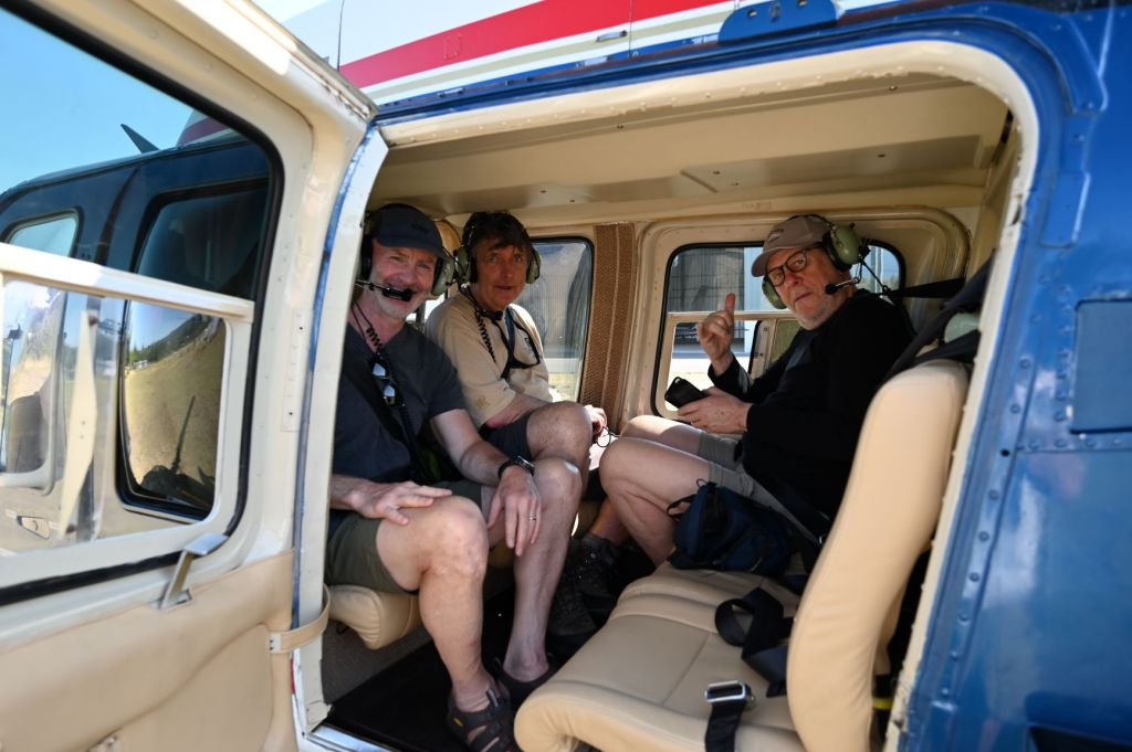
Short ride today of only about 180 kilometers today. As a result, Eric set our departure time for 10:00 AM. I was packing by bags and getting ready to go at 8:30, when JD came knocking at my door to tell me that the helicopter was available to go this morning and asked if I wanted to go. It took about three seconds to make that decision, packed my camera equipment and headed out. It was a perfect day for the helicopter trip…no wind with practically no clouds in the sky. Jane, Phil, JD and I took off at about 9:00. Philippe was our pilot.
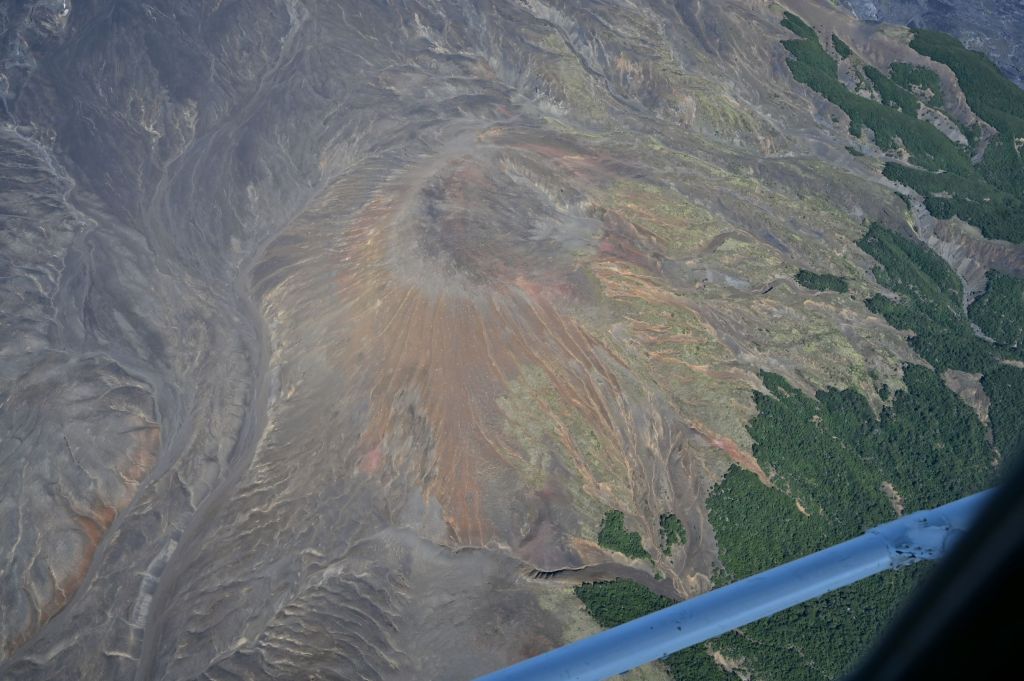
We headed out over Lago General Carrera and then up and over the mountains. Below are several pictures and some video. This flight was one of the top-10 experiences I have had in my life. The scenery was spectacular…mountains, valleys, glaciers, high alpine lakes, waterfalls… ENJOY…we sure did.
Philllipe our pilot.
I also have several videos which I will work on and add on to the next post.
After we got back, we got on our bikes and headed south along the southern border of Lago General Carrera for almost the whole trip today. We met for lunch at Chile Chico (which is the scene below) which had the feel of a windswept town at the edge of the world. We crossed the boarder into Argentina at Paso Rio Jeinemeni, at which point the lake’s name changes to Lago Buenos Aires.
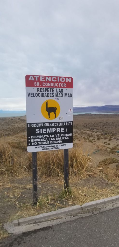
We quickly made our way to Hotel Antigua Patagonia for the night. Tomorrow brings about the big change in environment to the flats of southern Argentina and the winds that sweep off of the Atlantic and head towards to the Pacific. The winds can get up to 80 mph and are typically crosswinds. Further, there are may guanacos, which are skittish and prone to crossing the road and hitting bikes and cars. Should be an interesting day!!!
I believe I have finally hit stride on traveling alone, managing the motorcycle, planning my routes and taking advantage of the time I have to travel and think about what may be coming next in my life. The traveling alone piece has been more challenging than I thought. Managing the motorcycle has now become second nature, which shouldn’t be a surprise given the number of kilometers/miles I have driven on the trip to date. The areas I am traveling in this section of the trip are also interesting but have required advance planning as opposed to winging it. I’ve been able to get ahead of the curve in the evenings and plan out the next day as to where I want to stop and at which places I want to spend time.
As to what comes next in my life, well….I still don’t know the answer to that. However, I have some ideas and Kathy and I will sit down and discuss them when I get back…I’m starting to narrow down the list of possibilities and prioritize where my time should probably be spent.
Finding a comfort zone, finally, has resulted in a marked increase in my enjoyment level, and I have been able to see more of the humor in the situations I find myself…and there is no lack of that as you will see below.
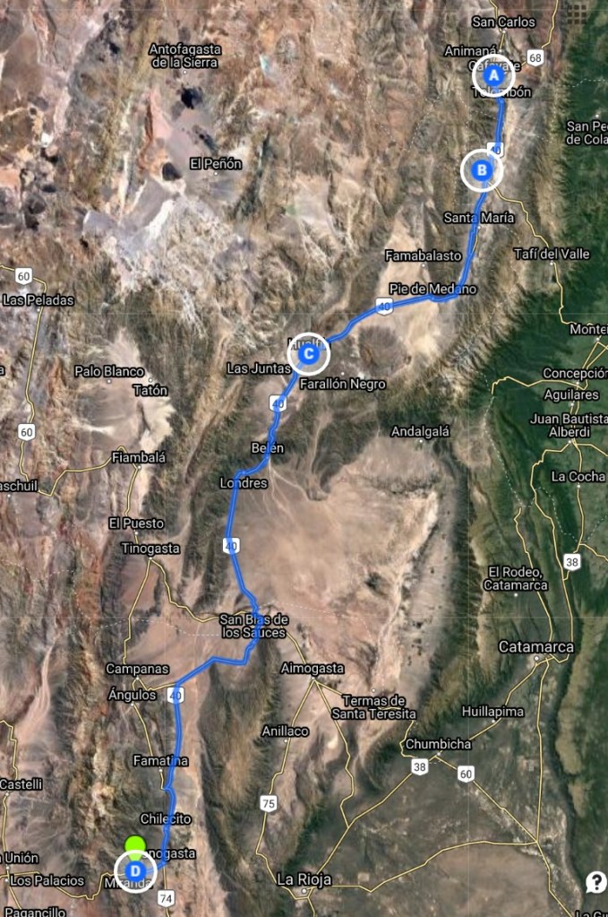
Feb. 23– Cafayate to Miranda
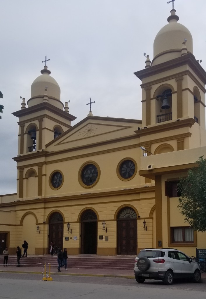
After a sleepless night due to the Serenata de Cafayate (What a misnomer that is…should have been more like the Assault of Cafayate!!! You can read more about it in the post below.) I pulled into the town square to take a picture of the church, which I thought was one of the more interesting churches I have seen on the trip…very Palladian…
….and I ran into the 8:00 AM after effects of the Serenade, which can be seen below. We’ve all been there before.
Anyways, I exited Cafayate and and entered right into the countryside of Argentina and the wine district along Ruta 40. I’m surprised by the size of Argentina’s wine industry. There have been and will be as a travel further southward vineyards along Ruta 40 for several hundred miles.
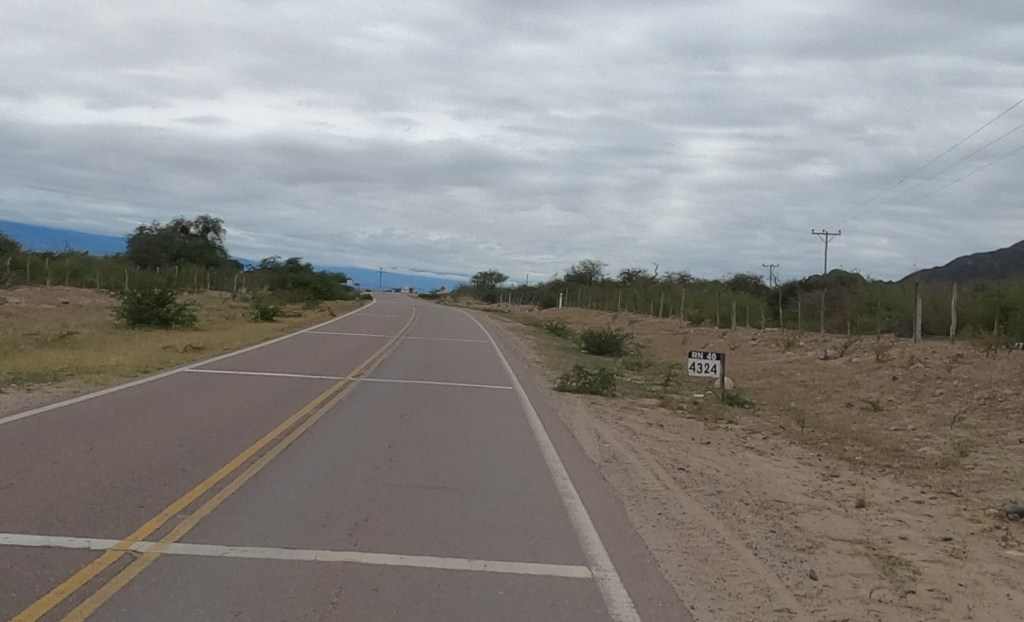
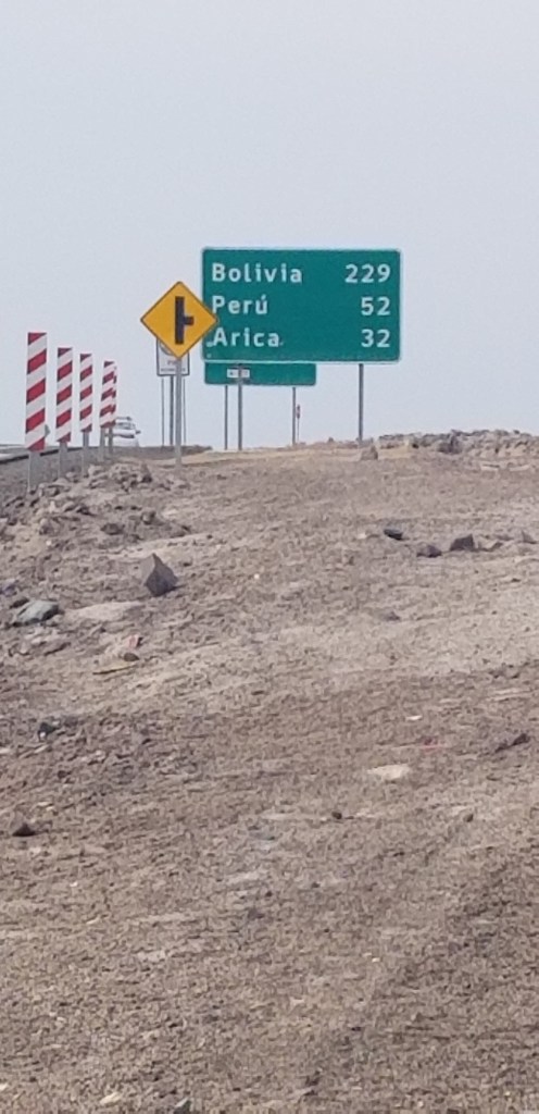
I took the photo below to highlight the length of my journey from here. The kilometer marker on Ruta 40 is 4324 and it will end in Ushuaia, I believe at zero. Onward!!!
DCIM\100GOPRO\GOPR0609.JPG
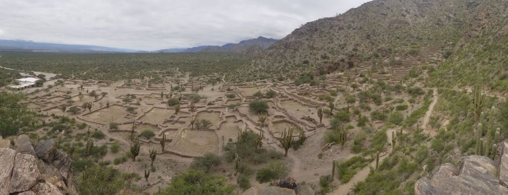
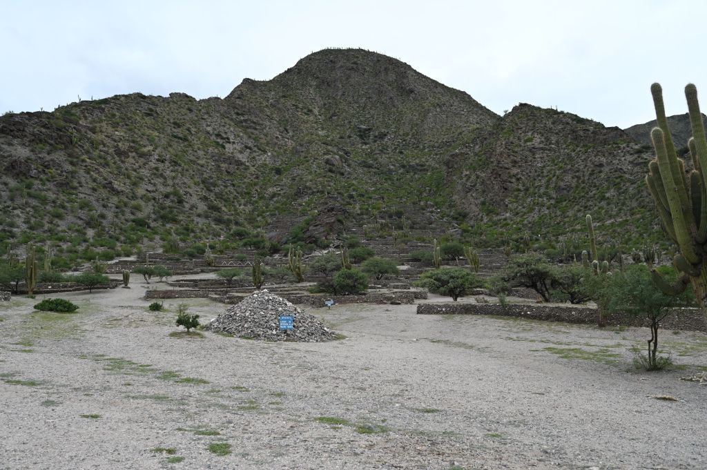
About an hour outside of Cafayate, I took a detour to see the Ruinas de Quilmes (B on the map), which is an achealogical site and largest pre-Columbian settlement in Argentina. The area dates back to ca 850 AD and was inhabited by the Quilmes people. It is believed that about 5,000 people lived here during its heights. The Quilmas people lived here through the Inca invasion in the 15th century, but were defeated by the Spanish in 1667 after 130 years of resistance. The remaining 2,000 Quilmas were then marched from here to Buenos Aires during which about another 1,000 died. Today, there remain distant relatives of these people in the area and in Buenos Aires.
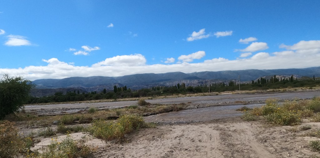
From the Ruinas de Quilmes I headed south on Ruta 40 through a great section of road that was two lanes and wove in and out of small agriculturally focused towns, many of which were involved in the wine business. I got to a small town called Santa Rosa and for some reason Google maps routed me around the town and then onto a dirt road that had the below river in the middle of it. The river was about 75 yards wide and the water was about 18 inches deep at its deepest. As I was sitting on the bank of the river making up my mind whether or not to cross it on the bike, a local man came up, rolled up his pants and started to walk across…decision made for me…time to go for it.
DCIM\100GOPRO\GOPR0611.JPG
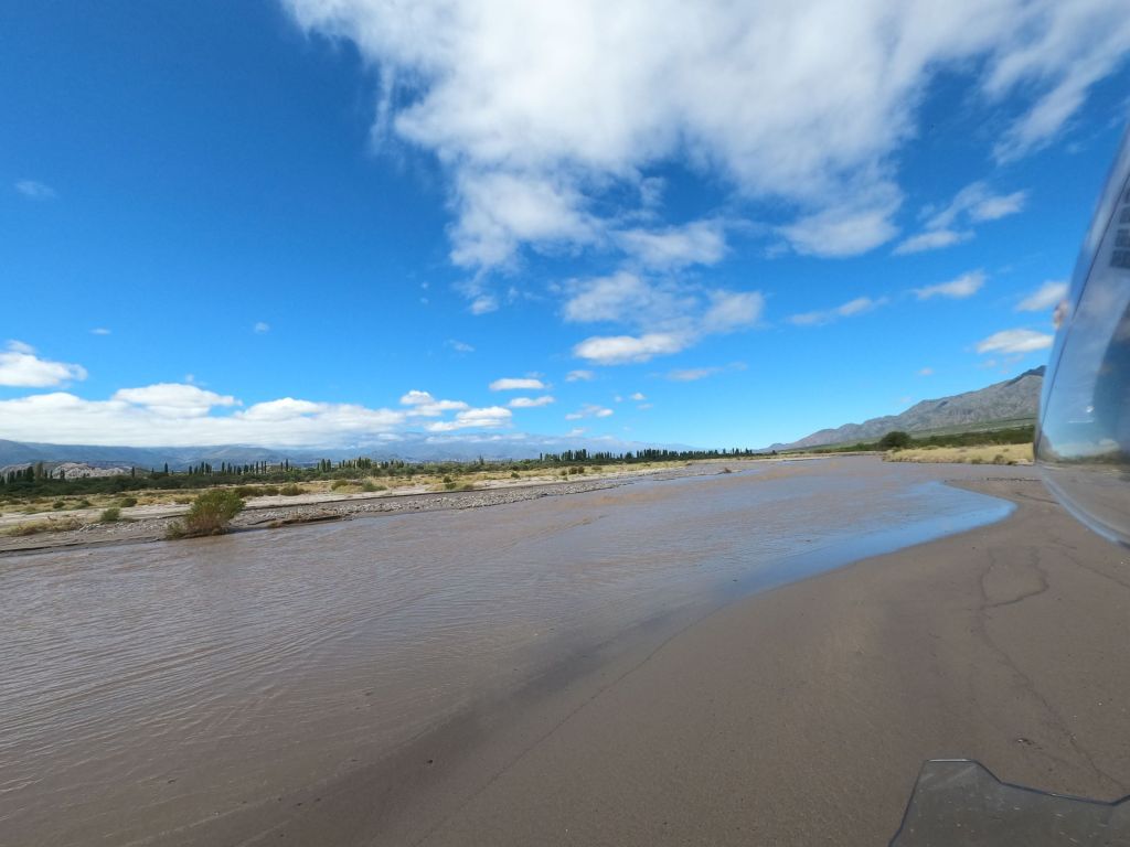
Below is a stopping point I reached about midway through the river. The local man who had been crossing in his bare feet was now stopped, watching me and giving me hand signals as to which direction to go. So I followed his directions…bad idea!
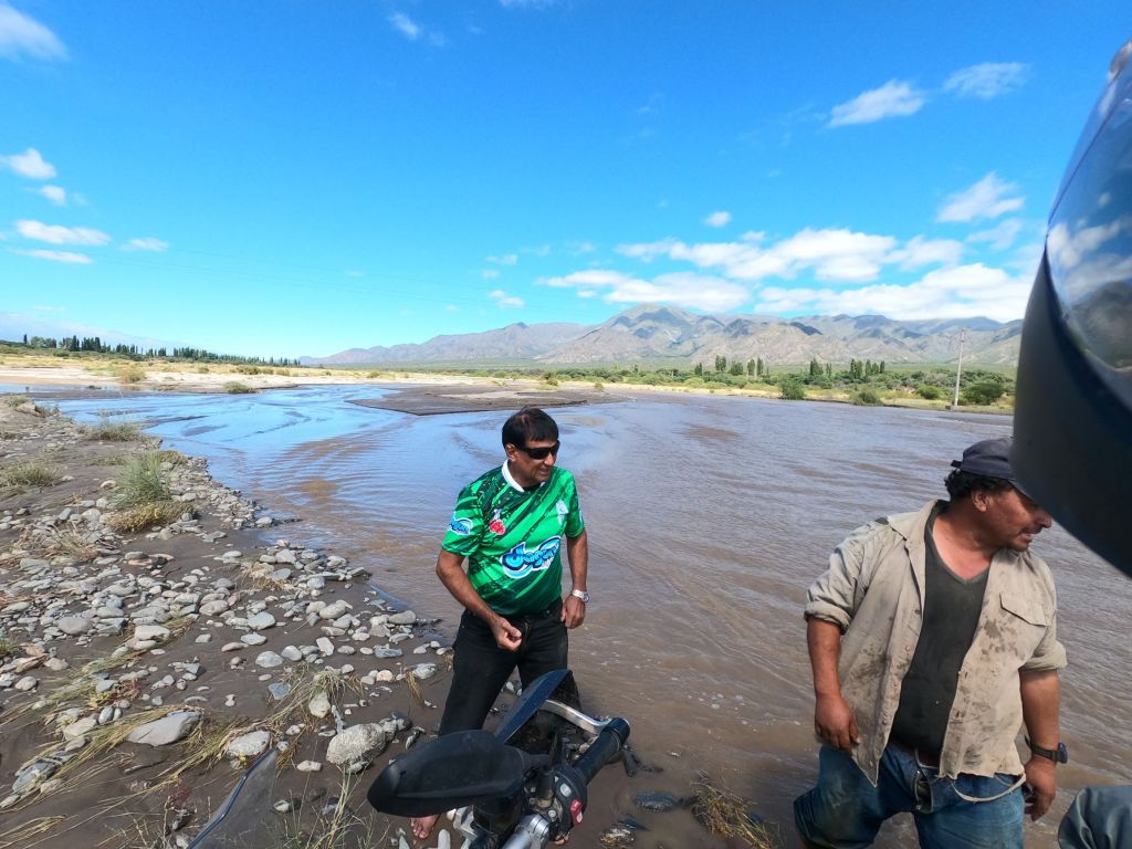
As I approached the opposite bank, the bank was about six inch above the water. However, the water at that point was about 18 inches deep. I gunned the bike and hit the bank and bounced backward, over and into the river! I picked myself up out of the water, turned off the bike and started to try and get it back on two wheels in 18 inches of water. As I was working my butt off to make this happen, Mr. Local #1 comes over and starts giving me instructions in Spanish but won’t help out because he claimed to have a bad back. Mr. Local #1 is in the green jersey. The good news Mr. Local #1 waved down another guy near the river, Mr. Local #2, who ran from the other bank and helped me get the bike righted and put me in a position to get out of the river. What struck me about Mr. Local #2 was that he was strong as a bull and not only was his zipper wide open, but I don’t think there was a zipper…he was flying free. Mr. Local #2 saved my bacon and the only damage was my two boots were full to the top of river water. Otherwise, no harm, no foul.
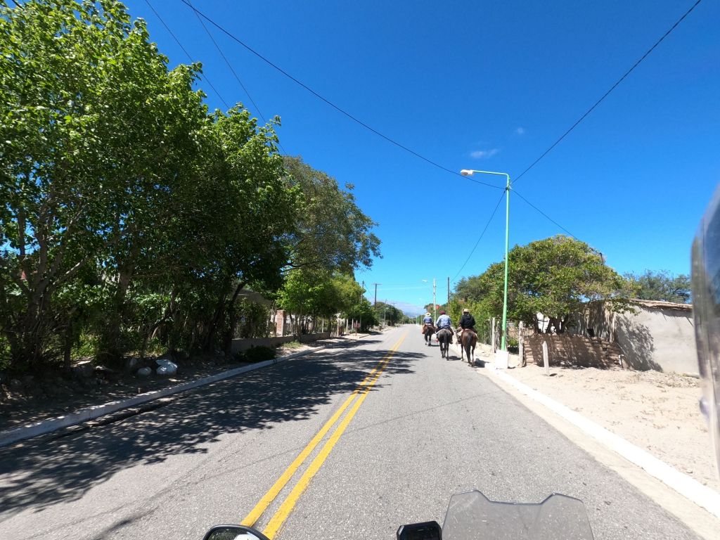
I got back on Ruta 40 and continued from town to town. Below is a photo of a typical scene on the road…very small town, rural environment with a number of men out on their horses taking a ride.
Later that morning, I made a detour onto the old Ruta 40, which can be seen below. Dirt road! Today, it is mostly paved in the North. In the South, where I am headed tomorrow, it’s a different story there are hundreds of kilometers at a stretch that are still dirt. There was a cool old sign on the way into Hualfin (C on the map).
DCIM\100GOPRO\GOPR0618.JPG
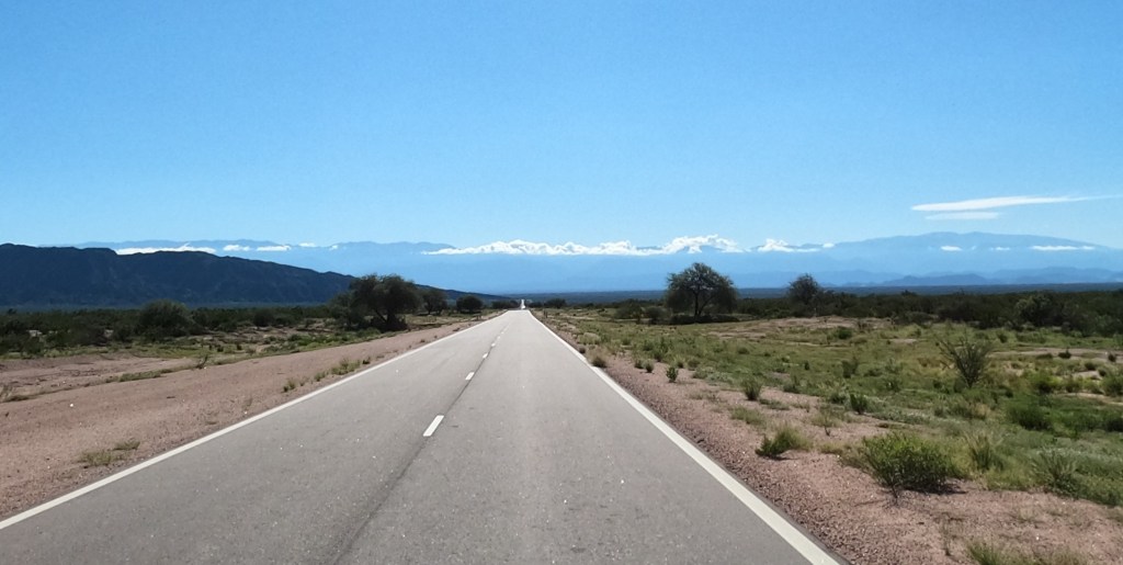
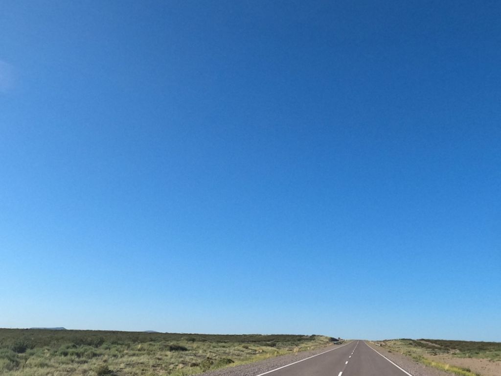
I have included the pic below to give you some perspective on the straight stretches of road that I often encounter on Ruta 40. Sometimes, I can see for what seems like 10 miles ahead of me without there being a turn. This road didn’t turn until I met the mountains in the far far distance. I used to think Nebraska was the most difficult place to drive through…this overwhelms it by orders of magnitude.
DCIM\100GOPRO\GOPR0624.JPG
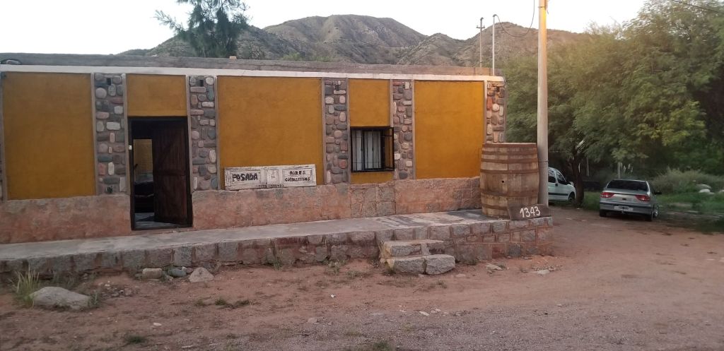
After my sleepless night in Cafayate, I have decided to stay in rural locations and smaller homes/hotels. Tonight is the first time for this. I stayed outside of Chilecito, which itself is a small town, in Miranda, which is nothing more than about 30 homes along Ruta 40. Below is a photo of the place. It ended up being very nice and managed/owned by a woman named Ani. When I asked Ani for a restaurant suggestion nearby she told me she would cook me dinner, which she did. Ani made empanadas and opened up a bottle of local red wine…all on the house. No more cities for me based on this experience.
Feb. 24 – Miranda to Albardon
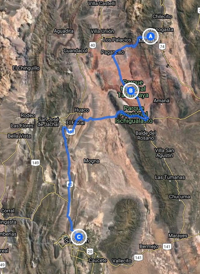
Below is Ani and she is holding a cup of mate as I get ready to leave. Mate is the national beverage of Argentina, highly-caffeinated and prepared by steeping dried leaves of yerba mate. I plan on trying some when back in Argentina. Mate is a big deal for many in Argentina and they take their mate cup or guampa with them everywhere as well as related gear.
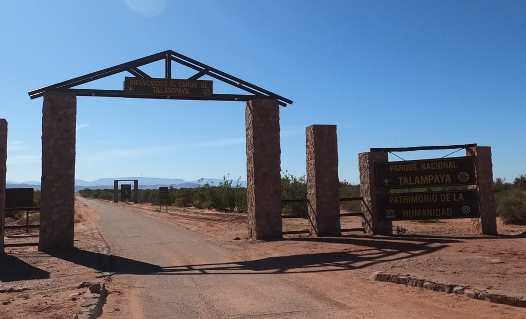
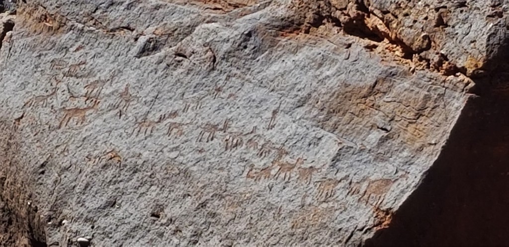
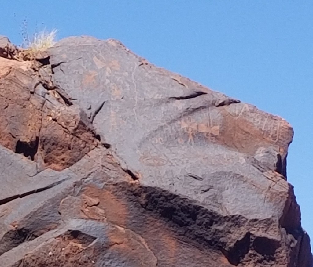
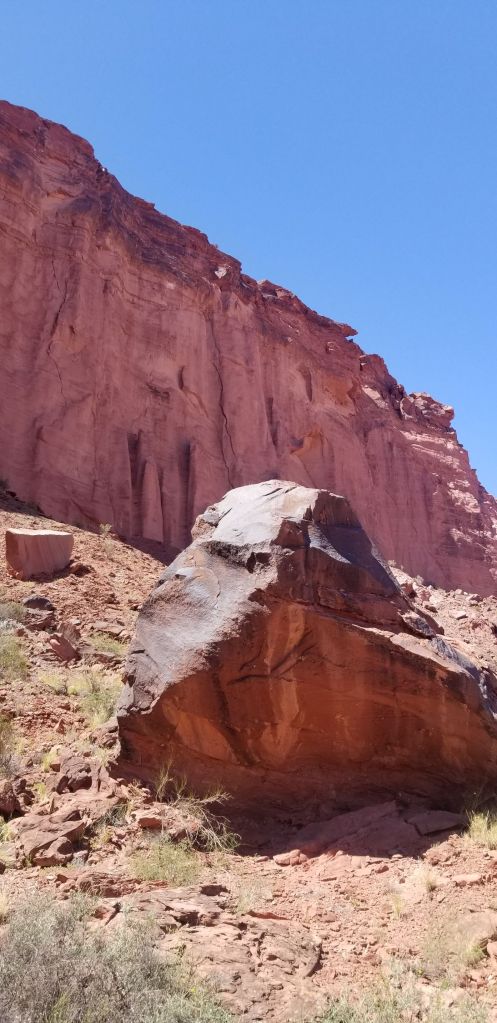
Based on the advice of Luciano (see my post below), I decided to take a detour and spend time at Parque National Tamalpaya (B on the map), which is a UNESCO World Heritage Site. Many fossils and petroglyphs have been found in the park.
DCIM\100GOPRO\GOPR0639.JPG
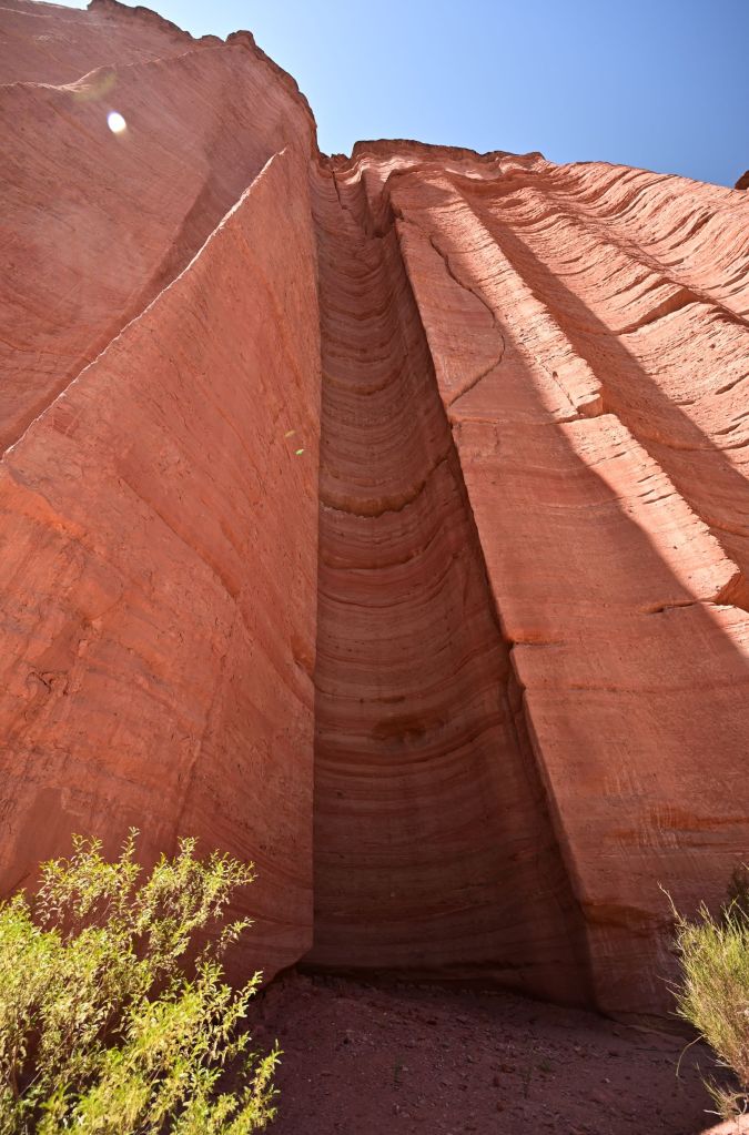
The park consists of a huge canyon guarded by reddish stone on either side and at its widest about 100 yards. Below are a number of pictures of the canyone. Below is a series of chimneys created in the canyon wall.
The end of the canyon opened up to a sizeable mesa with interesting rock formations.
Below is a photo of a guanaco, that ran by us. Guanacos are camelids and closely related to llamas.
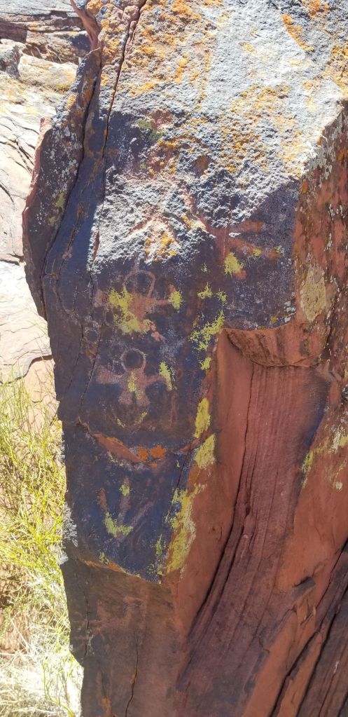
There were extensive petroglyphs in the area. The petroglyphs are estimated to have been created starting about 500 BC and extending into the 1500’s. The petroglyphs were at the base of the canyon wall and supposedly were at the top section of the wall before breaking off and falling into the canyon. You can see the top of the canyon from which they came six photos down.
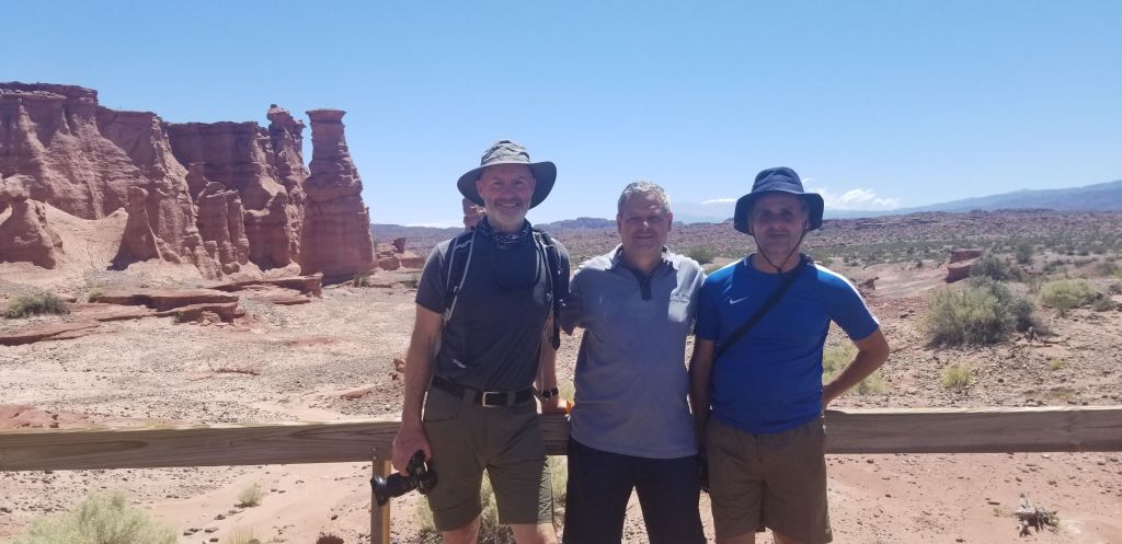
I met several people on the tour of Tamalpaya, two of which decided to befriend me; Pedro and Javier.
I then made the trip to Albardon, which is a rural encampment outside of San Jose. I had chosen a place off of Bookings.com that was a highly rated B&B. Unfortunately, I showed up and there was no one to greet me. I called the number given by Bookings.com and it was Pedro from Buenos Aires, who owned it. It was 8:30 PM and I was beat and he told me 15 minutes and the manager would be there to let me in. At 10:00 PM, the manager showed up and I was too tired to argue about the situation. The house was under renovation and the only two rooms that were close to inhabitable were the bedroom I was supposed to be sleeping in and a breakfast room. I had to clear the considerable cobwebs away from the door to the bedroom before I walked in and when I looked into the bathroom, the floor of the shower had three one inch, dead bugs in it….at this point, all issues that I could overcome. The good news is that the manager, Nora and her husband Pablo were very sweet and accommodating. Pablo gave me a ride to a local restaurant and offered to sit and wait for me to have dinner to drive me back. I refused and walked. It wasn’t a bad night…
Feb. 25 – Albardon to Mendoza
Below is a picture of the breakfast room, which I sat in by myself. Kind of creepy but clean.
Pablo insisted I park my motorcycle in the interior courtyard of the house. I almost killed myself getting it in there and getting it out. Not a good idea.
The trip to Mendoza was short and not much to report.
Feb. 26 – Mendoza Rest Day
I took a rest day in Mendoza. Mendoza is the capital of the wine business in South America. There are a number of notable wineries here and many owned by the French, Spanish or Americans. Most notable are their malbecs, which I tried several of which and all were great…much better than American malbecs I’ve experienced. Went to a couple of vineyards for tours and I literally was the only person there. Today was the first day of school for the new school year in Argentina, so all the summer vacationers had cleared out. At Alta Vista Bodega, a picture of the cellar from 1892 is below, Paula, gave me a private tour and tasting.
Feb. 27 – Mendoza to Paso de Pehuenche
In my new theme of not staying in the larger cities, I actually stayed outside of Mendoza in Chacras de Corea, which is a small enclave to the south of Mendoza. I would characterize it as what St. Helena would be to Napa. Beautiful, with very friendly people a quiet atmosphere. I meet a couple over lunch from the neighborhood and they asked me what my plans were. As it turns out, they drive from Chacras de Corea to Pucon every summer, so gave me detailed instructions on the most scenic route and places to stop. So I took their advice. I headed out Ruta 5 south for about five hours and it was a highly diverse ride with respect to environments. It went from lush agricultural zones to open planes to desert and desert canyons.
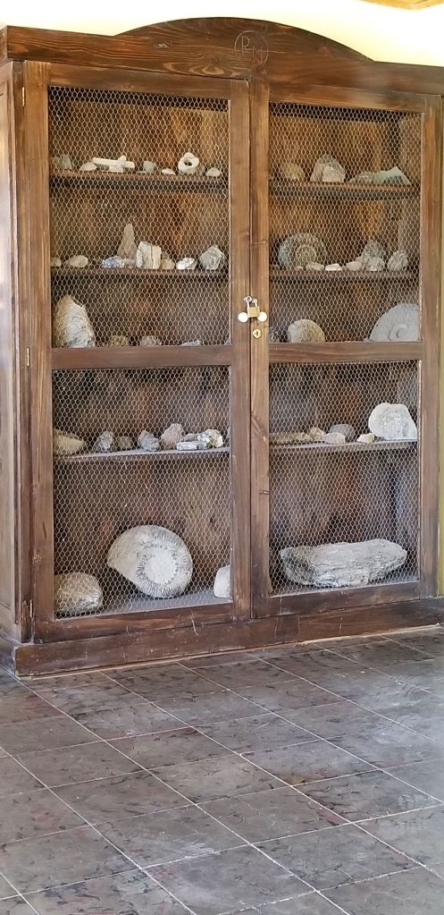
I stopped for lunch in a tiny place called Bardas Blancas (B on the map) and found my way to the town’s only restaurant, which is below called Ruca Mahuida, which means Mahuida’s Hut, I think.
DCIM\100GOPRO\GOPR0656.JPG
Interestingly, I was the only only customer there and a ~80 year old man came out and started talking to me in Spanish. Had a hard time understanding him but we got through it and I ordered what was being cooked after being dragged into the kitchen so he could show me what I would be getting…Beef Milanese, which was great. Anyways, he kept talking to me like I understood everything he was saying. This is one of the many times I really wish my Spanish was much better. I would have loved to talked with this man so as to better understand his story, town and business.
The place was also filled with cabinets and wall hangings of fossils and artifacts. If you look below, may of those in this cabinet looked to me to be museum quality.
From Bardas Blancas, I got on Ruta 145 and began the ascent to Paso Pehuenche (C on the map), which tops out at about 8,400 feet. Beautiful ride through a desert canyon to high planes and back into Chile.
Along the way, after passing into Chile was a large waterfall (D on the map) with access at the top of the waterfall. I filmed the video below. The water captivated me because of the way it danced in the wind that was coming up the canyon wall and forcing much of the water back up into the air as well as the angle of the sun and how it refracted light in the late afternoon.
I decided to camp out tonight and picked out a spot alongside the Rio Maule. After I parked my bike, several people walked by and up the stream below and I asked them if there were hot springs ahead and there were, so off I went. It was about a two mile hike to about 10 pools of highly mineralized, hot springs emanating from the earth. There were several families out there and assorted others hanging out in the springs. However, when I went to check out the springs and get in, they were less than what I had expected…dirty, smelly and highly unsanitary…lots of cow turds and human terds around them as well as assorted clothing, as you can see below.
Oh well, back to my campsite, which was special, right by a rapid in the stream. Had a great night here and the stars were spectacular.
Feb. 28 – Paso de Pehuenche to Pucon
Got up early and made the run to Pucon, which was about six hours on Ruta 5 in Chile, which is essentially a superhighway. Had to do it, so got in with it and got it over with.
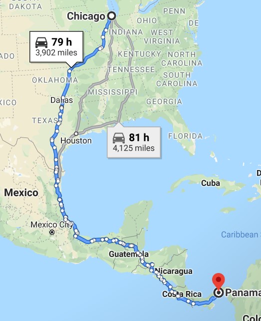
Pulled into Pucon and got my stuff together so I could turn in my bike. Since I picked up the BMW f800GS on 2/9, I’ve put 6,366 kilometers on it or 3,956 miles, which is the equivalent of traveling by road from Chicago to Panama City, Panama (according to Google Maps)…that is some mileage!!!
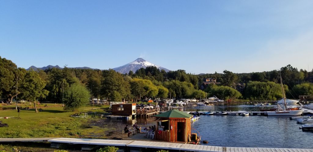
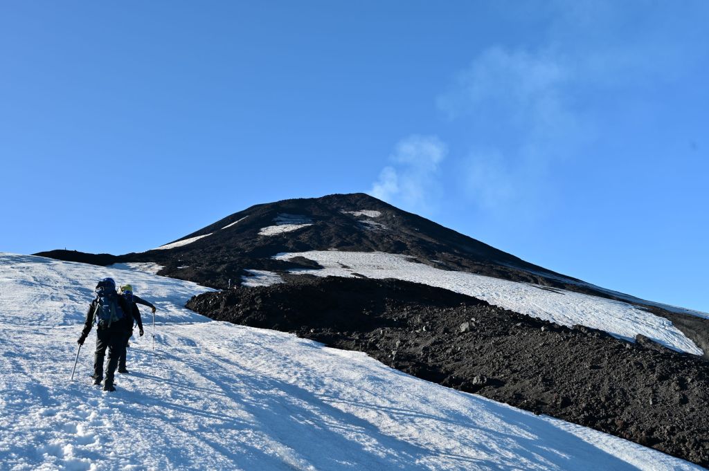
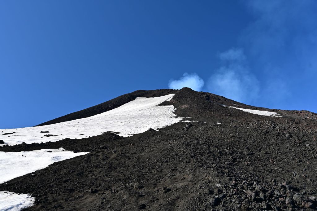
Pucon is pretty much the center of adventure travel in Patagonia, so I did some homework as to what was available for tomorrow and decided to climb the Villarrica Volcano. A photo of it from the shore of Pucon on Lago Villarrica is below. The volcano is still active. A sulfur cloud spewing out of the crater is visible below. It is 9,340 feet high at the rim and ringed by glacier fields. Should be an interesting climb!
Looks pretty calm today, but this is what it looked like in 2015.
Feb. 29– Pucon and Climbing Villarrica Volcano
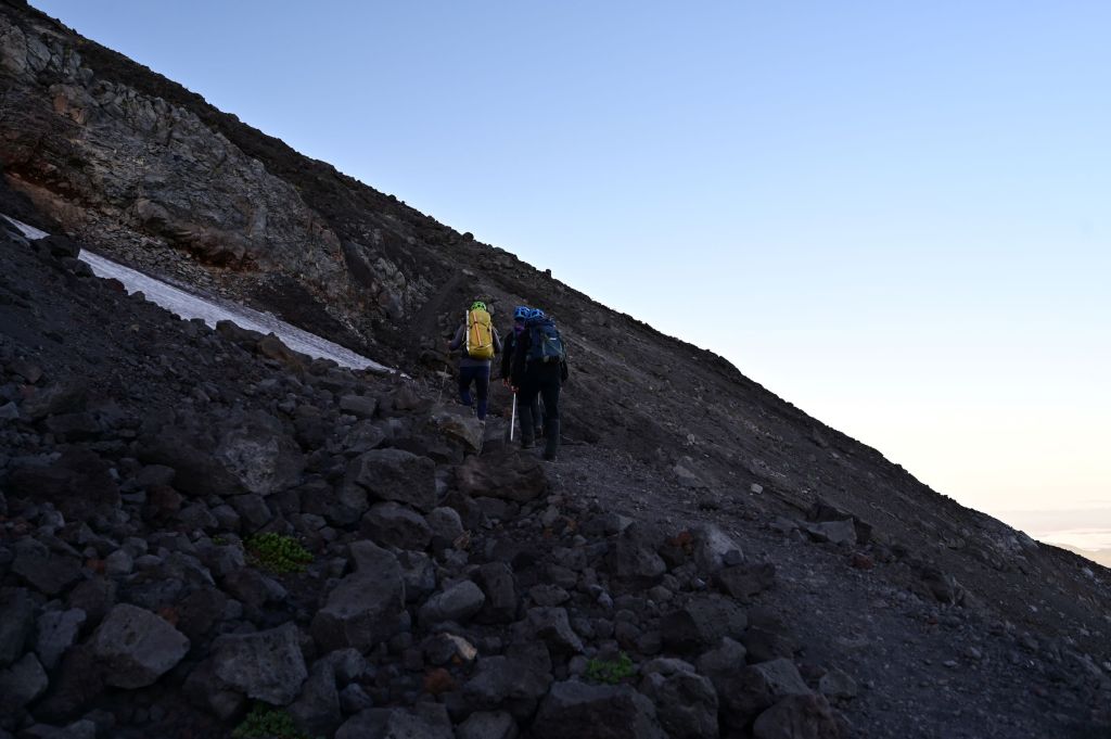
I signed up with Antu Tours which is owned by Joaquin Figueroa Lara who is in his 40’s and has lived in Pucon his whole life. He is an avid climber and climbs Villarrica about 100 times a year guiding tours. Our group was a couple in their 30’s from Uruguay, Veronica and Javier, Joaquin and me. We started out at 6:00 AM and were on the volcano at 6:30 as first light was appearing.
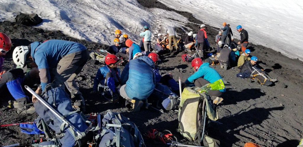
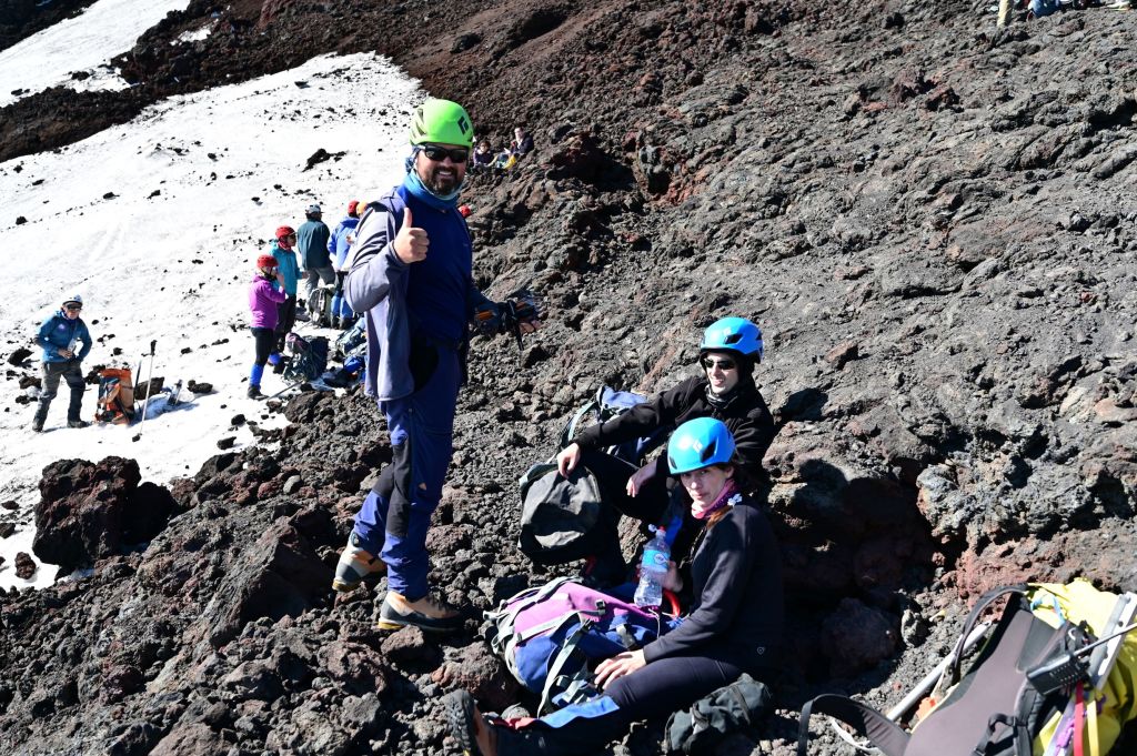
Below is a scene of the several groups finishing the hiking section and putting on crampons to climb the glacier.
Joaquin selfie time.
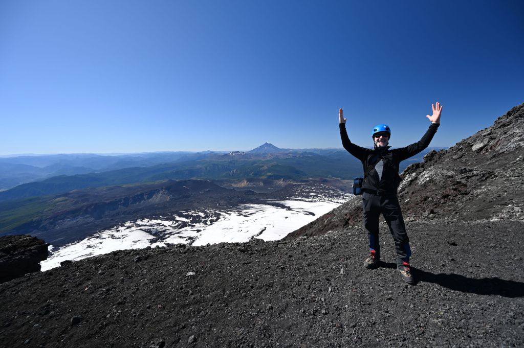
At the end of the glacier, we took off the crampons and hiked up the remaining 500 or so feet.
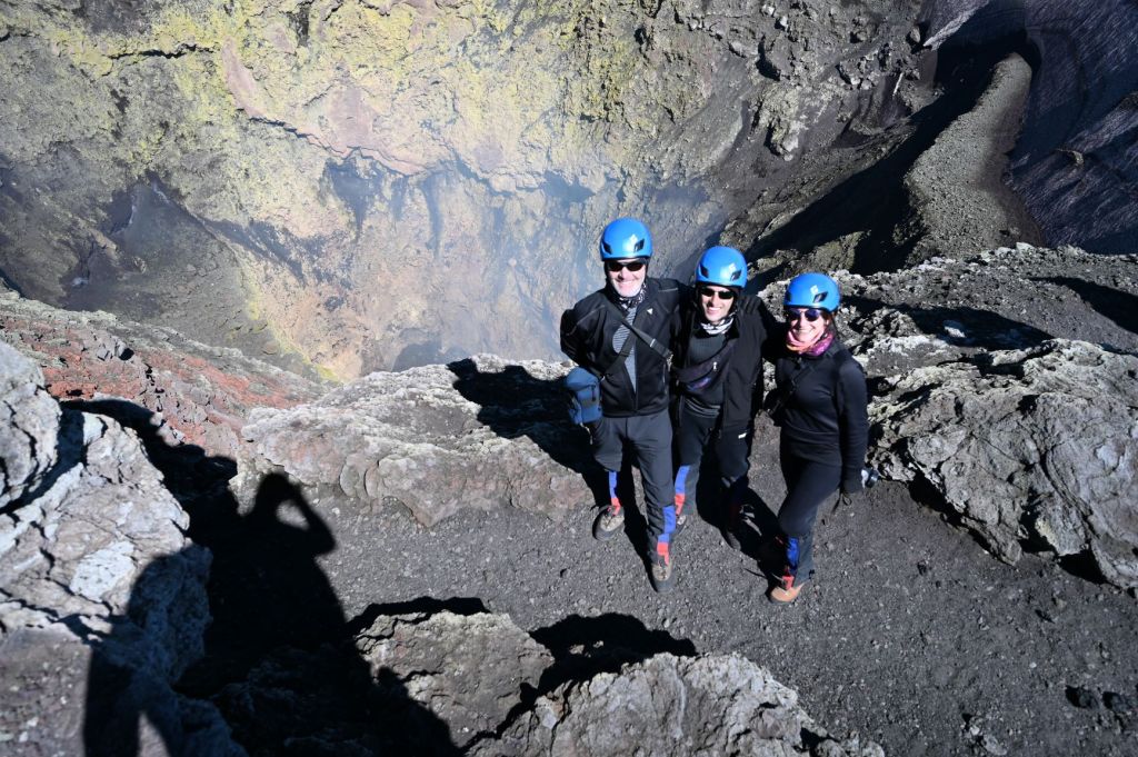
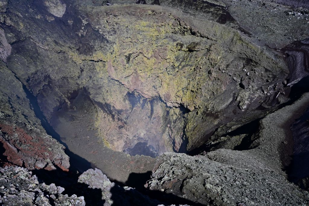
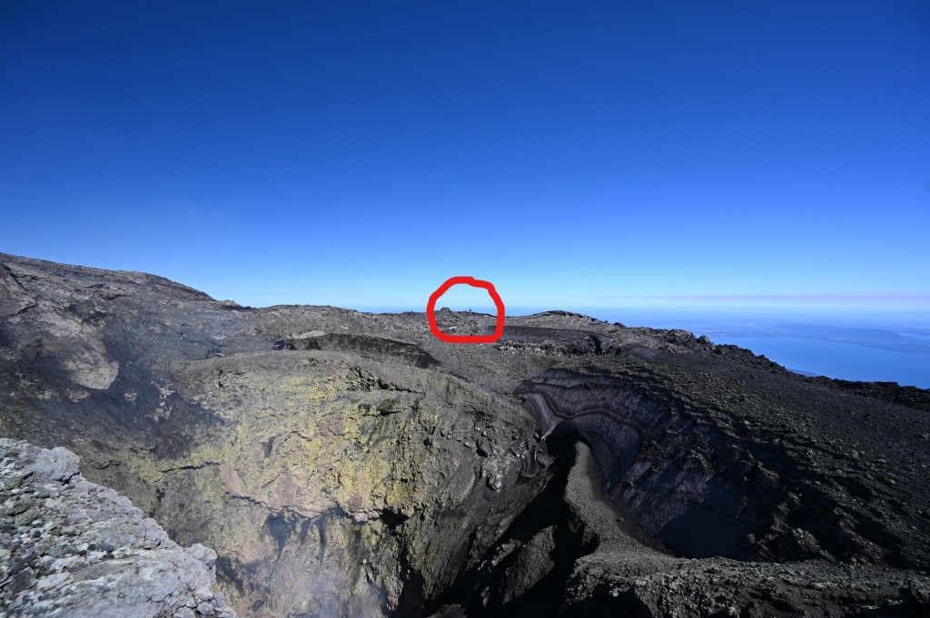
The crater was a huge gaping hole in the earth as you can see from the two photos below. The red circle in the second photo are two people on the opposite side of the crater.
Below is a short video of activity in the crater.
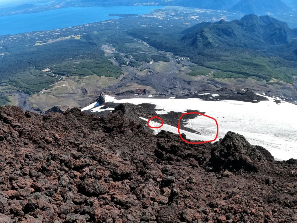
To get down the volcano, we slid on our butts over the glacier. There were essentially toboggan shoots carved into the glacier from prior hikers. You can see a couple of hikers in the left red circle and the shoots in the right circle. Was a ton of fun, as the video shows.
Near the end of the remaining part of the hike down, there was a chair lift hut that is in use. Doesn’t exactly give one confidence in the ability of the chair lifts to make it up and back!!! There were people on this lift coming up the volcano during the day.
I’ll try and be more timely with future posts. Tomorrow, I meet up with the group I will be traveling with to Ushuaia and we leave Pucon on 3/1. Very much looking forward to this part of the trip. Cycling through Patagonia is supposed to be one of the greatest experiences a motorcycle adventure rider can have. Much more to come in the days ahead!
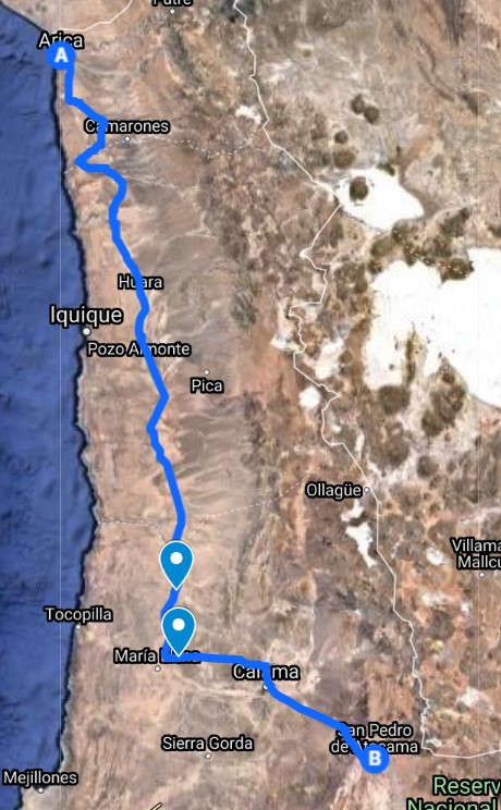
Arica, San Pedro de Atacama, Purmamarca, Jujuy and Cafayate
Feb. 16 – Arica– Day Off the Bike
I stayed in a VERY funky hostel in Arica called Hostel Sunny Days. It is owned and run by Russ who is a Kiwi and about 70 years old. The place was a few blocks off the ocean and composed of two houses mashed together. There were nick knacks everywhere and it was very run down. However, it was full the two nights I was there and Russ was very friendly and accommodating. The folks staying there ranged from a Brazilian family of five to a German in his 50’s who was in Chile visiting his son. He had been camping every night for about six weeks. In the two days I was there, he never once changed his clothes and he smelled as if he hadn’t showered in a week plus. In addition, there were several surfers, six 20 somethings from Israel and several others who came and went but I never met. I lifted a pic off Hostel Sunny Days website, which kind of says it all. Russ is the gentleman on the right.
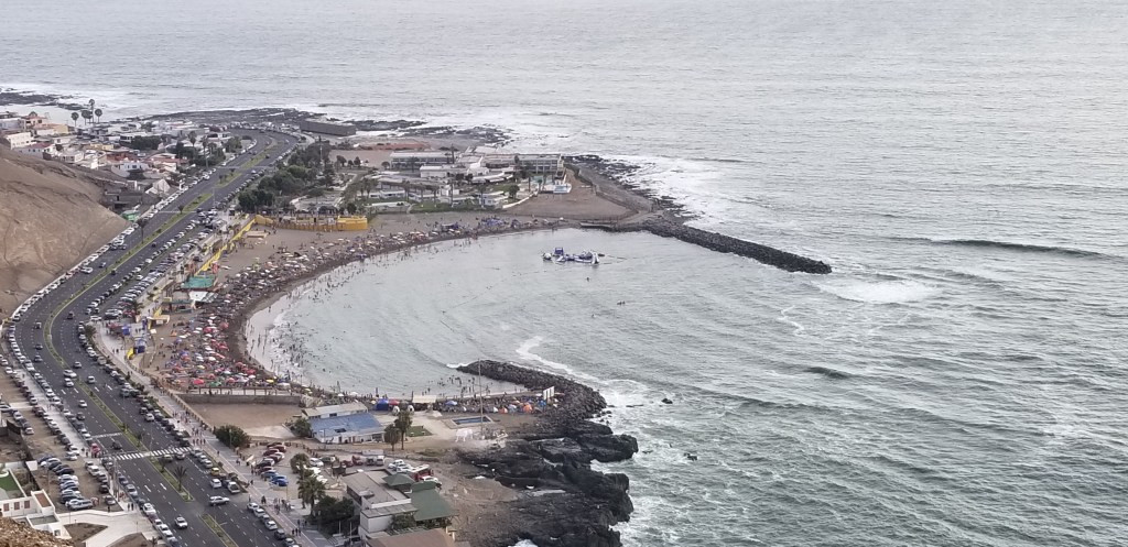
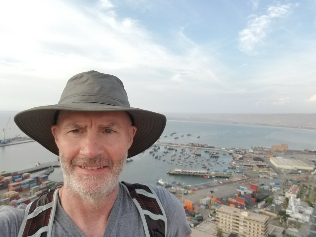
Sunday, I got up relatively late and organized all my gear, walked the city and then headed to the beach. As you can see below, the beach was packed with families and kids enjoying an ideal Sunday in the sun. I then walked to and up the hill that defines the southern end of the city. It was a good day to collect my thoughts and get some rest.
Feb. 17 – Arica to San Pedro de Atacama – Meeting Jose and Luciano
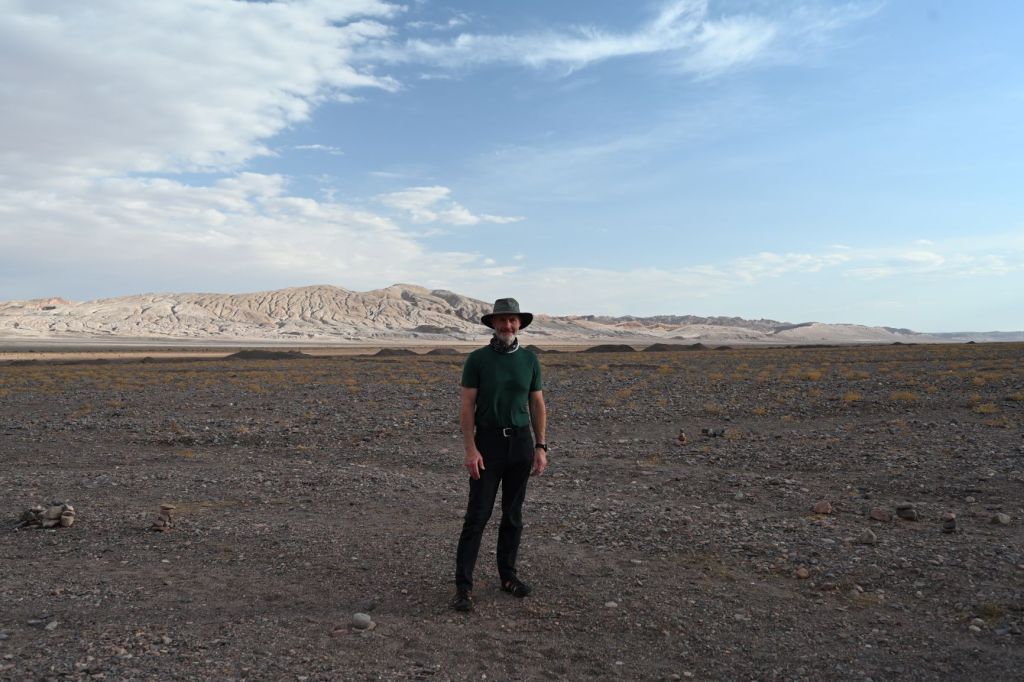
Monday, I started my southern journey. Arica, as you can see on the map above, is at the northern most edge of Chile and is surrounded by desert. The ride from Arica to San Pedro de Atacama was completely in the Atacama Desert. Part of the drive, I had already covered in the trip up to Arica, which was not my plan. I had intended to go from Arica east to Putre, into Luaca National Park and then take a dirt road south through the mountains along the border of Bolivia. However, it is rainy season in this part of the world. Upon checking in with a couple people with regards to my route, they thought the road I had planned to take would probably be impassable due to the amount of rain recently received. As a result, it was south on Ruta 5.
As I had described before, the Atacama Desert is one of the driest places on earth. The earth is baked, scorched and everything is either brown or sand colored…driving through it is tough and boring after about 15 minutes and I had about six hours ahead of me….ugh.
About 60 kilometers before the turnoff of 5 onto 24, there was a depression in the highway created so that a river can run over it. These are common in Chile and Argentina and are used instead of building a bridge. When I pulled up to the edge of the depression, it was filled with a sludge lake about 75-100 yards long and in places about two feet deep. Trucks and cars were carefully making it through but coming out the other side totally covered in muck. There was no way around this spot other than turning around and probably driving a 100 kilometers or more out of the way. So, I got up enough speed to ensure I didn’t stall out in the muck and went for it. As a result, I was covered in muck from head to toe and the bike was totally covered, as you can see from the picture below. Luckily, the gear I have is designed to withstand this type of situation. I looked like hell, but it didn’t really matter much.
Almost immediately after I turned off 5 onto 24, there was a line of cars stopped and a barricade blocking the road. A construction crew had attempted to explode some rocks off the side of the road and they fell into the road, making it impassable. I was sitting in the line of cars, baking in the 90 degree heat in all the gear I had on and I looked over and there were five guys, of which four were on motorcycles, in the only shade for miles created by a 40 foot by 30 foot sign talking very expressively. I went and joined them. As soon as I pulled up, they all came over and started talking to me in Spanish, of course. However, one of the five started talking in English and explained to me what the others were saying. Luciano, a 30-year old from Argentina, was the English speaker. In the group of six, there was one Argentinian, Luciano, one Spaniard, Jose, one Chilean, one Colombian, one Peruvian and me. We spent three and a half hours sitting under the sign until they reopened the road. Luciano and Jose were both headed to San Pedro so I rode with them. Luciano also took care of me and got me into the hostel he was staying. Jose was staying down the street. We got together for dinner and had a great night talking about travel and motorcycles and life. Both Jose and Luciano have been riding for years. Jose, has ridden through 56 countries on motorcycles and takes two months of every year to go off and travel around on a bike. He’s also married and has kids. Jose asked that I take the photo of him below on the next day, which is another story…total character!!!
JoseLuciano
Below is a photo of the passageway made so we could get by the exploded section of the road…maybe a little overzealous with their dynamite!
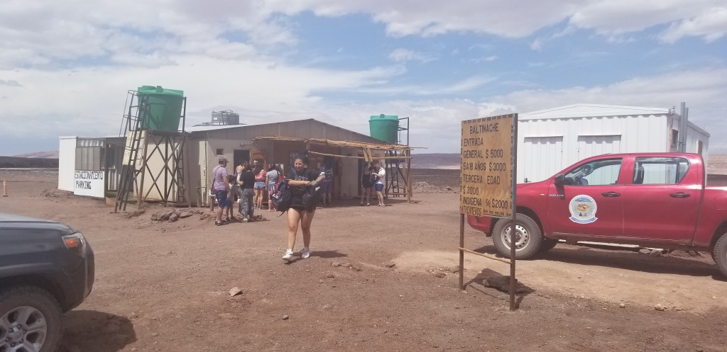
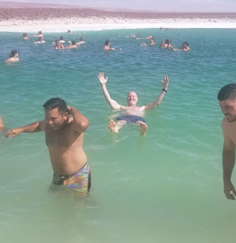
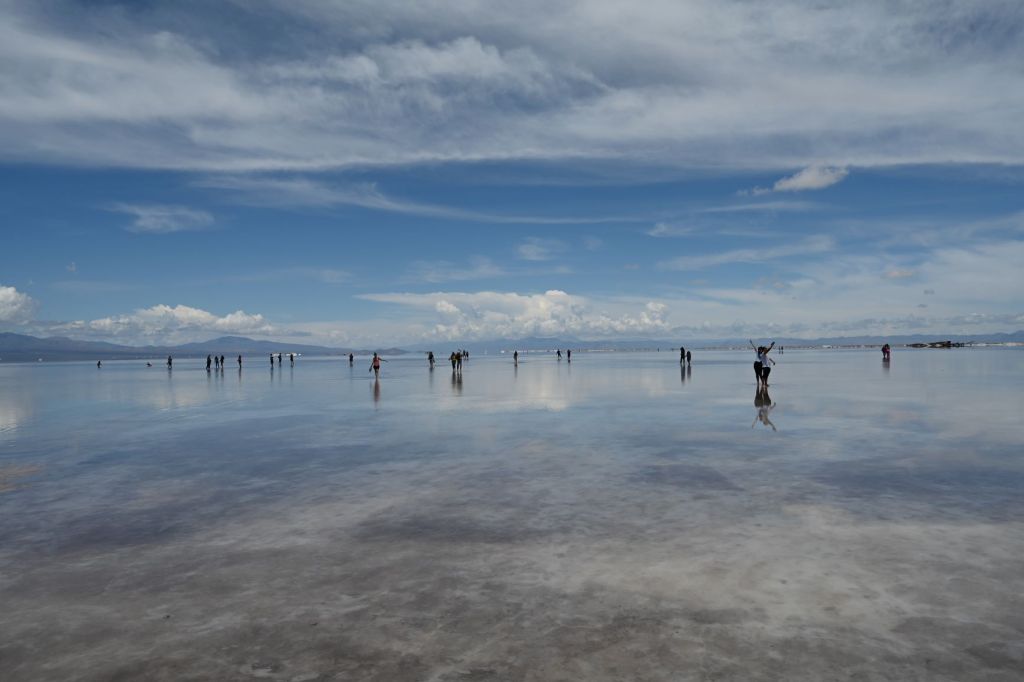
Feb. 18 – San Pedro de Atacama – Day Off the Bike and Swimming in Baltinache
San Pedro is a tourist city populated by mostly 20-40 year olds from South America who are there to explore the nearby mountains, deserts and salt flats. It appeared everyone was taking an organized tour of some sort on everyday they were there. The city reminds me somewhat of Santa Fe in that it is mostly one-story adobe buildings with a heavy tourist presence. The streets are all dirt. The scale of the town is very manageable. We decided over dinner that Jose and I would take a tour of a salt flat and swimming hole about 50 kilometers outside of town. Luciano was going to take a day to rest and clean up his bike and gear since both Jose and he had to also cross the muck lake on Ruta 5.
On Tuesday, Jose and I headed off to Baltinache, a salt flat and salt pool. There were about 75 people there for a swim. Below is the entrance and the only facility available for miles around. It was a real scene about 90 minutes after this as about 100 people tried to take showers in this building to clean the salt off their bodies.
The water in the pools in the salt flat supposedly have a higher salt content than the Dead Sea. The color of the water was such a contrast to the rest of the environment. The photo below starts to capture this.
It was a funny scene with 100 or so folks swimming out in the middle of a salt flat.
After swimming, we headed out into the desert, had a few cocktails and watched the sunset.
Feb. 19 – San Pedro de Atacama to Purmamarca
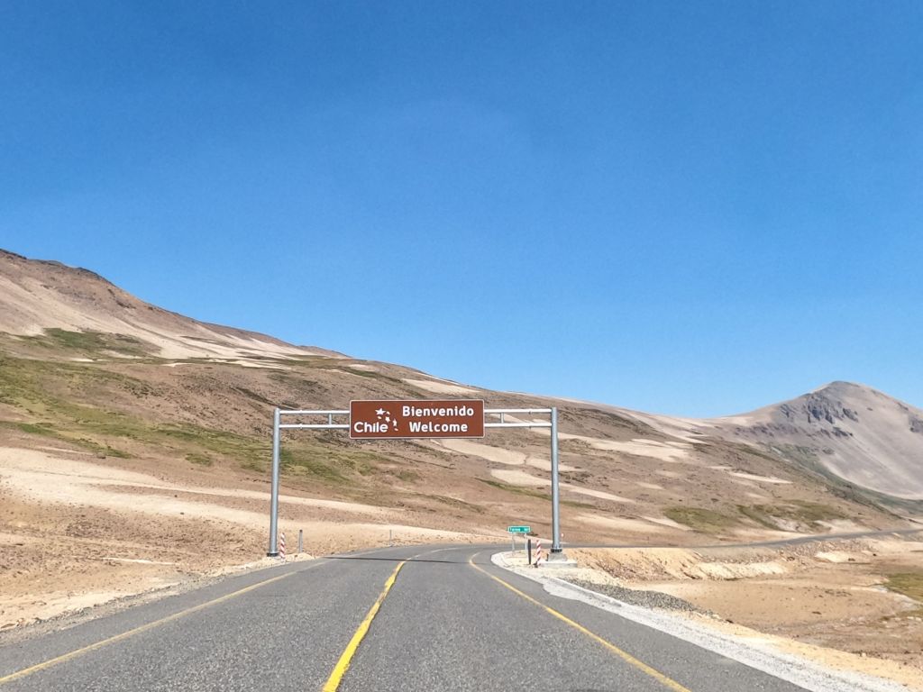
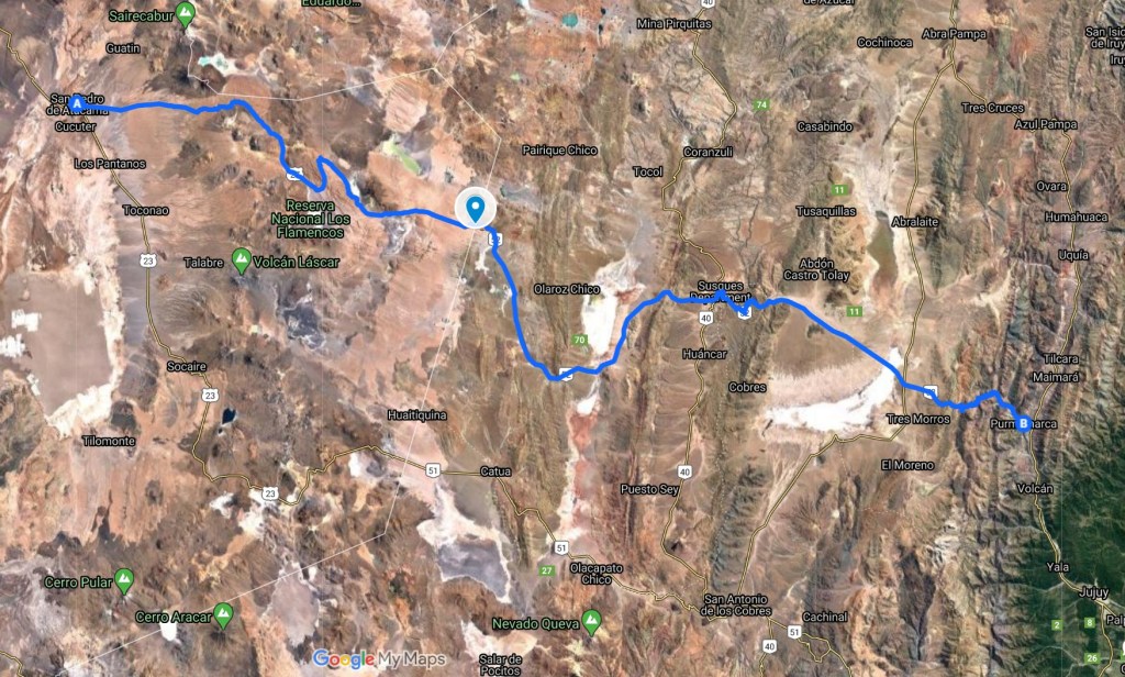
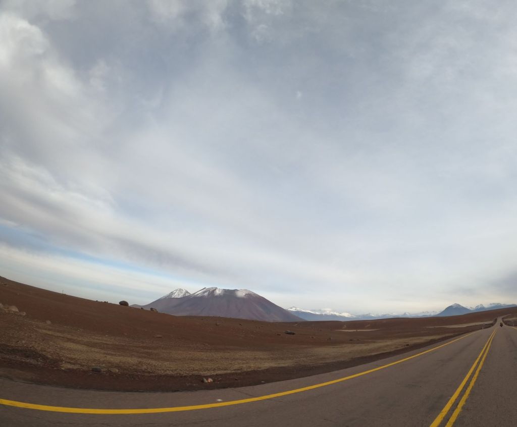
On Wens. morning, Luciano and I headed east into the mountains over Paso de Jama, across the Chile Argentina boarder to Purmamarca. Jose headed east to meet up with a friend in Iquique.
Paso de Jama is a high alpine pass with a peak elevation of 15,850 feet, making it one of the highest highways in South America. We made the passage early in the morning and it was probably about 15 degrees Fahrenheit. As Luciano said before we left, make sure you wear everything you have in your bag to stay warm! It was cold! Below are a few photos that try (poorly since we were hauling butt to get through the cold and not willing to stop and take pics) to capture the surreal landscape of the area.
The image below is of a lake that we passed. You can’t see it here but the edges of the lake were steaming from geysers that ringed most of it.
DCIM\100GOPRO\GOPR0562.JPG
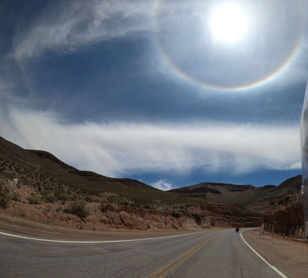
After we crossed the boarder, the landscape changed rather dramatically. For about 30 minutes there was a rainbow encircling the sun called a 22-degree halo (because the ring has a radius of approximately 22-degrees around the sun) and is caused by light refracting off of ice crystals contained in cirrus clouds…gorgeous scene!
Herd of llamas crossing the road below.
DCIM\100GOPRO\GOPR0572.JPG
We passed by the Salinas Grandes salt flats on the way to Purmamarca and stopped for lunch. The flats were covered with about two inches of water and created a surreal scene. People were walking out 500-1,000 yards on the flat and were clearly visible as you can see below. What is interesting is that the combination of the reflection off the water and light creates a loss of perspective.
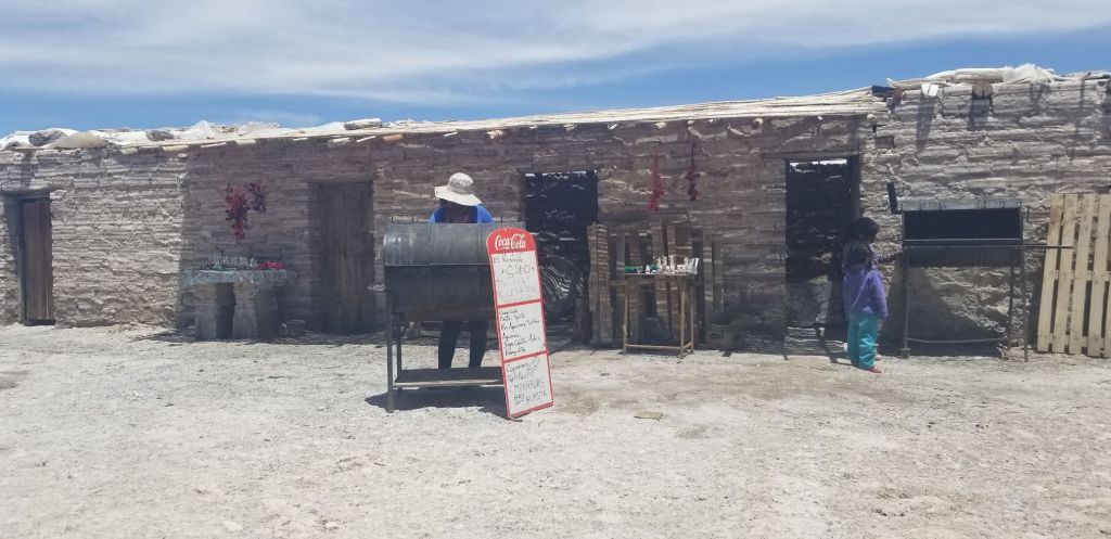
At the edge of the flat, Luciano and I stopped for a lunch of empanadas. As you can see below, our chef was a local woman and was working out of a building constructed of salt. Blocks of salt were cut out of the flat and stacked together like bricks. The empanadas were great!
Below is a photo of a section of the road close to Purmamarca. A ton of fun to ride on a motorcycle.
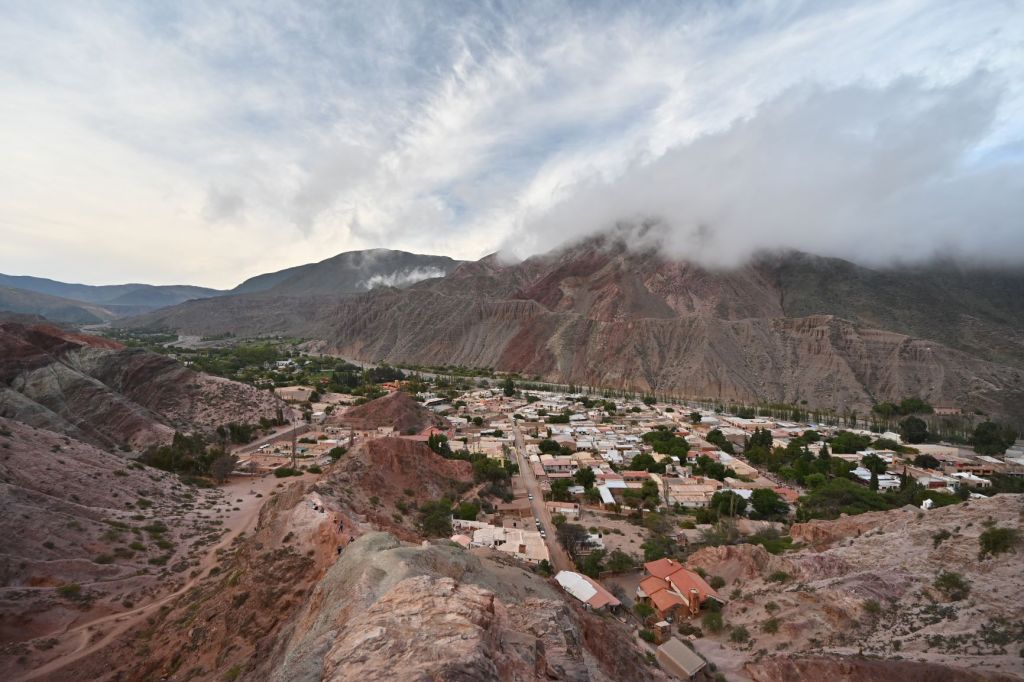
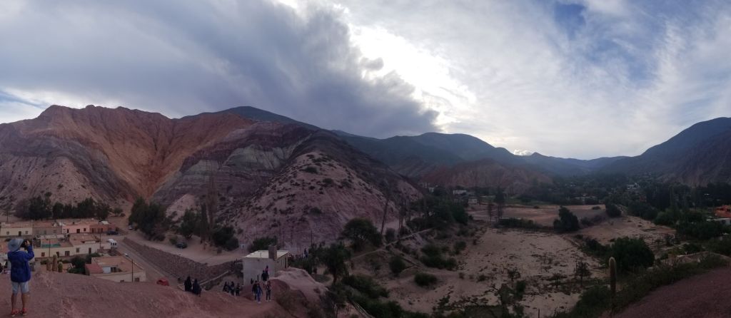
Luciano and I pulled into Purmamarca and said our goodbyes. Luciano was headed back home and I had to stay and make a phone call. After I freed up, I walked around the town and took several photos, which are below. The rocks in the mountains around the town are brightly colored and provide a great backdrop for the town. Below is the entirety of the town.
I was waiting to pay to make the climb above and a family of Argentinians came up and inadvertently cut in front of me. Once they realized it, they paid my entrance fee and we started up a conversation. Below is a picture of a father and son, which were part of the group. The father, Jose, had been a professional soccer player in Italy and had lived there for three years. Jose, didn’t speak English, but his son, whose name I didn’t get, did and we were able to chat. Jose turned to me and asked my why I was in Argentina and I told him about the trip I’m on. He thought about what I said and then said that Argentina is a mess, politically and economically. When he said this, his expression conveyed sadness, resignation and a bit of despair. It was a very poignant moment. In the next, his son told me that his father had been very strident in ensuring he learn English so that he would have a better future. This all happened in a couple of minutes before the photo below was taken. Those few moments communicated to me a significant amount about Argentina and its issues.
The Catholic church below, Santa Rosa de Lima, sits on the side of the town square. It was built in 1648.
Feb. 20 – Purmamarca to Jujuy with a Visit to Humahuaca
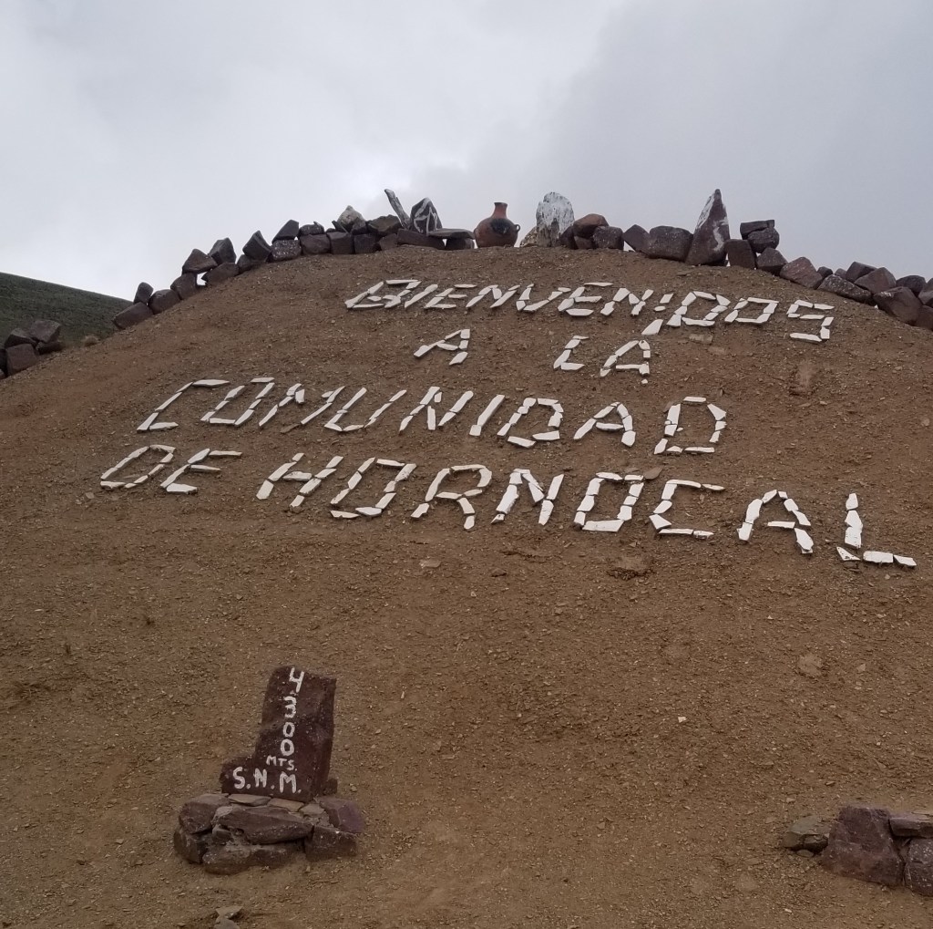
I headed north out of Purmamarca to visit a spot that Luciano said was a must see. Luciano has become my guide for Argentina. He sends me WhatsAp messages daily with suggestions for my routes and where I should stop and detour. His suggestion for Thurs., Feb. 20 was Hornocal o Cerro de 14 Colores, which is a mountain that supposedly has rocks composed of 14 different colors. It was considerably out of the way I was going, but given the advice, I went with it. It was an interesting drive on the section that goes east. It was a dirt road up a mountain, and there were very few other vehicles, all four wheel drive, on the road. Ton of fun getting there and back in the dirt. When I got there the sign below was interesting to me because of the elevation indicator.
I had to pay a few pesos to enter and the woman below was manning the gate.
The trip was worth it. The views were fantastic and there may even be 14 colors of rocks in those mountains.
Feb. 21 – Jujuy to Cafayate – Driving Ruta 68 and Quebrada de las Conchas
Stayed in an interesting house outside of Jujuy (pronounced hoo hooiey). I am now trying to stay out of the cities since it is quieter and easier to park my motorcycle and ensure it is safe. The house was converted into several small apartments and there were people staying in all of them. The owner was a 30 something from the town and he and his buds came over and we chatted through cell phone translation apps. Interesting experience.
The drive was probably the best so far. It was raining lightly so not too bad an intrusion. I was taking Ruta 9 to 68 which would then merge into 40. Ruta 40, which is the famous route that goes pretty much the length of Argentina and is considered to be one of the great motorcycle rides in the world. Ruta 9 is a secondary road and not much traveled. At times it is just about one lane wide, more of a bike path. It twists and turns around the side of a mountain in a temperate rain forest. Below is a photo and a video of the ride. Interesting end of the video so stay with it.
Later on in the day I entered into Quebrada de las Conches, which is a desert canyon with the Rio las Conches running through it. I stopped for lunch at the stand on the side of the road and met Pedro, who is pictured below. Pedro lives in Cordoba, Argentina and left on Dec. 8th on his motorcycle, headed south to Ushuaia and is now headed north to Anchorage, then east to Chicago and Toronto, then south to Miami and then back home to Cordoba. Pedro will be gone for about a year and living on his motorcycle. His English and my Spanish were equivalently poor, but we were able to carry on a conversation over lunch. As it turns out, Pedro loves the Blues, hence the trip to Chicago. We hit it off after finding this out. I will be Pedro’s host in Chicago for a Blues tour sometime in 2020. Pedro also fought in the war with England over the Falkland Islands.
Panoramic views of the Quebrada below.
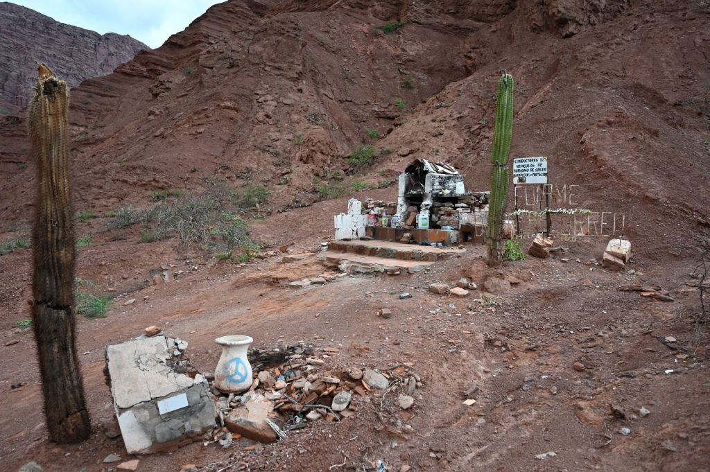
Throughout Chile and Argentina there are roadside shrines to those that have been killed at that spot on the road. They range from very small crosses to buildings constructed with bricks and blocks and whole cars encased in them. I thought the one below was interesting since it was so forlorn with empty Coke bottles and other assorted junk, dying cacti and the sign in the back which translates roughly to “drivers of salta tourist vehicles appreciate your protection.” Not sure if there is some irony being communicated there.
I pulled into Cafayate, which is the center of a significant wine production area and had a splurge dinner at the winery below, Bodega El Esteco…very nice place!!!
Feb. 22 – Cafayate – Day Off the Bike
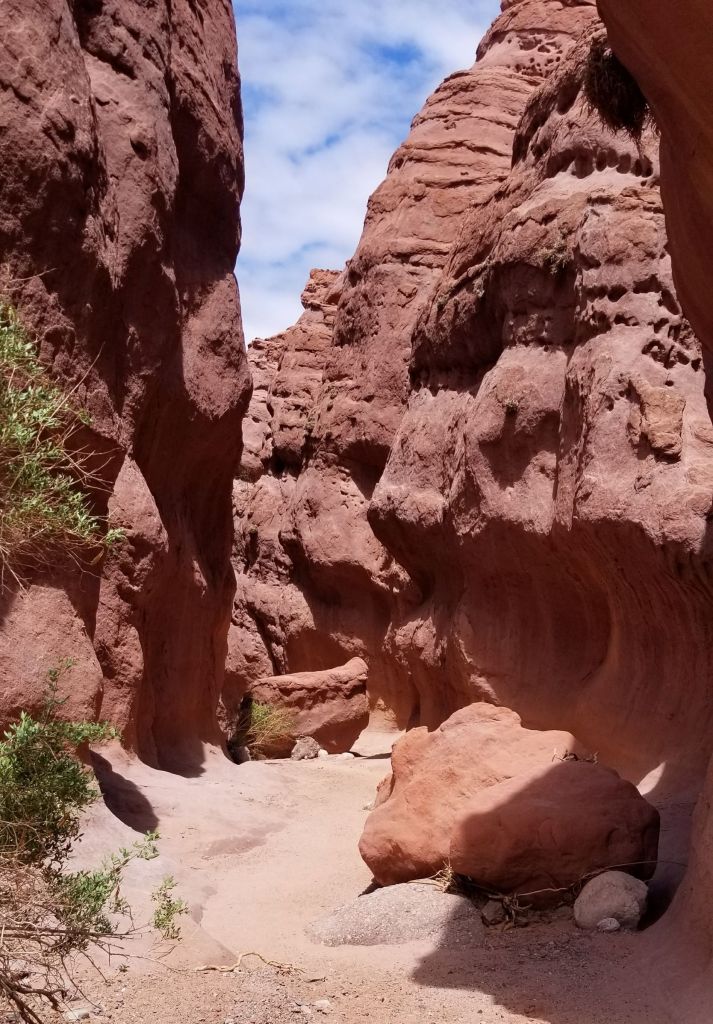
I took off the 22nd and hiked the Los Estratos trail just outside of Cafayate in the Quebrada. Below are some photos I took on the hike. The hike is rated on of the best in Argentina and I was the only person on the trail that day. The trail was difficult to follow for the first third of the track, since it is in a dried up river bed. In the river bed were a number of tracks from one or more pumas, which definitely put my head on a swivel.
The trail then headed into a slot canyon. Below are several photos that show the trail through the slot canyon.
There were also some beautiful rock formations along the way with multicolored striations in the rock. Below are a few pictures that attempt to capture the coloring.
I got back to Cafayate and was hoping to get a good nights sleep and head out early the next morning. However, there was a three day musical festival going on that was somehow combined with Carnival. Below is a pic of a couple of the participants, which is a good proxy for how most of the town looked when I got back.
The music festival literally went on 24 hours a day for three days. There was an outdoor concert space about three blocks from my hotel and it sounded to me like the MC was in my room. The MC was a very enthusiastic guy with a booming voice and he woke me up maybe six or seven times that night. Once, he went on for a solid hour… When I got up to go the next morning at 6:30 there was a TV in the breakfast room showing the concert and there were 4,000 people going at it. The Argentinians love to party…and loudly!!!
Getting My Motorcycle Legs Underneath Me, the Atacama Desert and Arica
Since I started the riding section of the trip, each day has been an adventure…but probably not in the manner you are assuming. It’s been six days of riding so far and I would describe it as follow.
Day 1 – TOTAL MAYHEM. Getting used to the bike and understanding its balance points and limitations has been and continues to be a challenge. On the 12th, I was all over the place, stalling out repeatedly and a danger to everyone around me. I was scared and in over my head with the load I am carrying, particularly when I was trying to navigate to the hotel in Valparaiso, which is up on the side of hill…think of trying to get to the top of on of the hills in SF on a motorcycle and having to shift and stay on the road with about 100lbs of baggage on the bike. Because the experience was so new, everything was all moving very very fast and I was challenged processing all the new information. Luckily, I made it in one piece with only one fall (which I would characterize as minor given it was me not yet understanding the bike’s balance limits). THANK GOD!
Day 2 – Confusion and Ignorance. First having to work through the gearbox issues (and losing most of the day) and then being caught in traffic but eventually making it to Pichidangui. I would characterize the trip as a gear shakedown. I got up to speed with all the motorcycle stuff, my helmet communication gear, navigation software, cameras, etc. There was a lot of pulling over to the side of the road and reading manuals to ensure I was developing a comfort level with all the technology.
Day 3, 4 and 5 – These have been long days in the saddle. However, the benefit is a developing comfort level and confidence in what I can safely take on and where I should draw some boundaries. I went off road for the first time. It started as a packed dirt road, then turned into sand and lead to inclines that had been reinforced with stones so that it was ride-able. I was terrified of falling off the bike given I was in the desert with no one around and if something happened, I would be reliant on my Spot to call for help, which is not where I should be. I’m going to wait for the off-road stuff until I am with the group in March and have others with me that can rescue my butt when I get out over my skis.
February 12 – Pichidangui to Huasco
Left Pichidangui early. Pichidangui is a very small beach town populated with families on summer vacation. Chile’s February is the equivalent of our August. I walked around last night and it was all families just doing the summer vacation routine, except Chilean style which is more or less the same as what we do.
Got on the road early and below is a photo of my view as I got on the bike. I don’t think you can see them here but there were several men riding horses down on the beach.
Traveled from Pichidangui to Huasco, which is a little over 500k and took me about seven hours. I’m attempting to stay on Highway 1 as much as possible but there are inevitable detours around areas not passable or where the route is broken up. I didn’t take any pictures since I was sufficiently challenged just staying on the bike and keeping my wits about me.
Pulled into Huasco, which is a gritty, small, mining town. Mining seems to be the primary industry all along the Northern Pacific Coast of Chile. Each of the sizeable towns sit aside a mine or mining shipping port or processing facility.
February 13 – Huasco to Mejillones to TalTal
Left early out of Huasco and had a wonderful drive along the coast through National Llanos de Challe Park. Off to my left for hundreds of kilometers was breaking surf and to the right mountains dropping into the sea. The landscape then changed as I entered into the Atacama Desert. It is hard to describe the scale of the Atacama. My frame of reference is the steppes of Kazakhstan and Mongolia and this is very similar. Miles and miles of sand, rock, scrub, flatness interrupted by mountains and hills. Below iare two photos that attempts to capture this, but don’t really capture its scale.
Stopped for lunch in a Chilean resort town called Bahia Inglesia. Had a great lunch sitting by the beach. Below is the scene in front of me.
After lunch got my first real taste of Highway 5, which the Chilean leg of the Panamerican Highway. Today in the desert, there were high winds, maybe 20+ mph, which was a challenge on the bike.
I pulled into a town called TalTal and stayed at a nice little hotel run by a very friendly husband and wife. They took good care of me. The town was less gritty than Huasco but still had its seedy side. Sunset below was beautiful.
The photo below is lead in to my next story. As you can see, the dogs own the beach and pretty much all aspects of the towns I have been in. They are ALL OVER THE PLACE and THERE ARE A LOT OF THEM! The residents feed them and treat them nicely and they seem to behave pretty well most of the time. However, I was coming back from dinner and one of them snuck up behind me and bit me in the heel…just to show me who’s turf I was on! Then the hound just stood there and looked at me as if to say, get off my turf.
The other story from TalTal is the nightlife. After being bit by the dog, I went through the towns Plaza de Armas, which every town has, and there was a stage with live acts and a small crowd having a good time. This started up at about 9:00 and there was a rapper on stage really going for it. I’m disappointed I didn’t get a pic. Anyways, the shows went on and on and on until 4:00 am, live and loud and I was about a block away and it could have been in my room for all the distance mattered. The Chileans love to party and they are night owls…getting started aroung 9:00-10:00 and going until 1:00-4:00, almost everynight!!!
I sort of discussed this with the owners the next morning and they laughed and acknowledged this was true.
February 14 – TalTal to Tocopilla
Got an early start but with a minor hiccup. Couldn’t get my bike out of the enclosed parking area because of another car that parked there. Had to have the owner work with me to push it backward while his wife laughed at both of us sweating and struggling to get it out. I’ve learned to choose wisely where to park the beast.
As I pulled North out of TalTal, the scene below hit me. I will be traveling along this coast for most of the day. Beautiful morning and what looks like a great road ahead.
The ride was interrupted for certain stretches by going up and into the desert, which I again tried, rather unsuccessfully, to capture the scope of below.
The Atacama Desert is one of the driest places on earth, I believe only drier than the polar ice caps. Further, parts of it are very high, in the 15k-20k foot elevation. As a result, there are a number of observatories that engage in serious research. I went by one of them, Cerro Paranal Observatory, and took a detour to check it out. The observatory is at 8,645 feet and there is NOTHING around it for many many miles. I took the first photo but then downloaded a very cool pic off Wikipedia after doing some research.
The afternoon was a long ride, in high winds, in the desert. There were stretches that I could see a straight road for miles ahead of me with no cars/trucks on it…just immense and ugly and beautiful. The ugly part was going around Antofagasta a mining center in the middle of the desert. It was huge, smelly, gritty, ugly, etc.
Pulled into Tocapilla, another very gritty port town. Stayed in seedy little hotel, the Royal Hotel, of course (and all I could think of when entering the room is that Royal Tenenbaum and Pagoda would have been right at home here), with nothing other really of note to report.
February 15 Tocopilla to Arica
Got out of the hotel parking area without any incidents (celebrating the little victories) and headed out along the coast line. The ride was glorious…sunny, temp was good, beaches all along the way. The Chileans love to camp and many of the beaches have scenes like the one below. Extended families setting up camp on the beach and enjoying the summer…fishing, hanging out and partying.
As I turned the corner on a stretch of highway, I was faced with the image below. The line sloping up and to the left on the dune ahead is the highway. I measured the distance of that line on the ride and it was more than two miles, to give you some perspective on the scale of these mountains. As I went over the top of the pass and entered into the next “cove”, I could see the road ahead of me for over six miles!
A bit later in the morning drive I entered into, went through and then above the city below, Iquique. The western edge of the city is bound by a huge sand dune, pictured below. When riding through town there were maybe 20 hang gliders in the air above the city coming off the road I was on.
The afternoon ride was the most difficult yet through for the most part flat featureless desert and salt flats with high winds coming at me from all directions. The winds were so high that at times I had to cant the bike 5-10 degrees to counter the wind and sometimes the wind would push me 2-3 feet from side to side…scary at times.
Alongside the road in a couple spots were ancient geoglyphs, which are prehistoric works of art placed on or worked into the landscape. They are found on hillsides and valley floors throughout the Atacama Desert, but they are always found near ancient pre-Hispanic trackways marking llama caravan routes through the difficult regions of the desert connecting the ancient people of South America. The oldest were created in the BC period and they are believed to have continued to be created into the 1500’s. Below you can see a couple pics I took of them. The first has a sun in the upper left and another image, I can’t make out. The second, speaks for itself. The hill it is on reaches about 500 feet into the air!
I went through a series of huge canyons near the end of the ride that were 2,000-4,000 feet deep with the road winding up and down with no guardrails for protection. Humorously, the Clileans had left several vehicles positioned at particularly difficult turns wrecked as a warning…no lack of subtlety here. Below is one of the more picturesque canyons I went through. Mostly, they were barren and stark and foreboding.
Interesting sign below…never thought I would encounter this set of metrics.
Arica, where I am staying for two nights and one day is a beach community and considered to be the center of the surfing scene in Chile. I went to the beach after I arrived and encountered a seven-on-seven rugby beach tournament. I didn’t know rugby was a thing in Chile, but it is.
Great sunset from my dinner table.
Walking home along the beach, the city had set up a stage and there was an outdoor zumba class going on with about 100 people participating. 9:00 pm on a Saturday and getting ready for the night out!
I’ll be back in touch soon. Taking tomorrow off the bike to get some rest, beach time and catch up on stuff. Hasta leugo!
A few folks have asked if I ride a motorcycle…well…kinda of. Before this trip only twice in my life. The first time was in 1980. Kathy, my wife, and I rode from Notre Dame to Lake Michigan to watch the sunset on our first date and I borrowed Paul Duggan’s motorcycle. Paul taught me to drive it that afternoon and agreed to lend it to me with the knowledge that I had never driven a motorcycle before. What are good friends for? More importantly, what does that say about Kathy’s judgment???
The second time was in December of 2019. I attended a five-day motorcycle off road training camp run by RawHyde Adventures in Castaic, CA. You can learn more about RawHyde here: https://rawhyde-offroad.com/. This was baptism by fire for me. Riding a BMW f800GS in dirt, mud and sand with a group of about 25 others, all of whom were expert riders to start with. On the first night of the trip we were all in the bar together and were required to introduce ourselves, say a few words about our background and describe our riding experience and the motorcycle(s) we owned. Everyone of the people in the group had been riding for years and owned one or more bikes. My turn came up near the end of the introductions and I told the above story and then described my “motorcycle” which is pictured below.
The bar erupted in laughter at my expense… Anyways, it was an interesting five days and I learned a ton from Owen and the other coaches and had a great time. I was riding a BMW f800GS, which is the bike I am riding in South America. Unfortunately, for RawHyde, I put the bike down four or five times per day during the camp learning how to handle it in the dirt. We rode from Castaic into the Mohave Desert and back and spent a good deal of time off road in some beautiful terrain.
Getting ready for this adventure has taken a considerable amount of preparation. I’ve had to educate myself on the motorcycle and related gear, buy all the necessary “stuff”, rent a motorcycle in Chile, plan out a rough route and learn a bit of Spanish. It’s been fun and challenging to get ready, but I’m thankful I’ve had the time and the support of Kathy in embarking on this journey.
I picked my motorcycle up late on Sunday, Feb. 9th and rode it back to my hotel and started the process of packing it up and getting all the details in place. On Monday, I was ready to head out. Below is a picture of me getting ready to leave.
A bit up an upgrade from my Vespa!!! I’ve got with me about 100 lbs of gear in the two panniers and two top bags.
First stop is Valparaiso, Chile, which is about a two hour drive mostly west on the highway from Santiago. It took me about four hours because of traffic, and I decided to stay off the highways so that I could get comfortable with handling the bike with all the extra weight I’m carrying.
Rather uneventful trip except that about 45 minutes away from Valparaiso, I was stopping at a red light and I misjudged my balance and fell off the bike, luckily towards the curb. I must have been an interesting and funny sight rolling around on the pavement. Then came the challenging part, getting the bike back up on two wheels with the extra weight I’m carrying. Luckily a very nice woman on a motorcycle stopped and gave me a hand lifting the bike up. I love Chilean people!
I stayed in a unique hotel in Valparaiso. It is built entirely out of steel shipping containers. Below is a photo I took of the hotel.
The WineBox Hotel is perched up on hill in Santiago and as you can see, covered in street art. The rooms all have street art on the walls. The city of Valparaiso is teeming with street art, more than any other place I’ve been and the quality overall is high.
Valparaiso is the busiest seaport on the Pacific in South America with a population of about 800,000, is built on several hills and has a Mediterranean climate. Today, it is a center of education in Chile with four major universities here. It reminds me somewhat of Chilean version of San Francisco. Above was the view from the rooftop terrace of the hotel at Sunset.
I spent most of the morning of the 11th taking advantage of the first quality internet coverage available since the start of my trip and catching up on my blog. I was able to get on the road at about 1:00. By 1:15, I had a problem…my motorcycle wouldn’t shift out of first gear. I pulled off of the busy road I was on into a residential neighborhood and started attempting to fix the problem. After about 30-minutes of futile attempts, I resorted to calling the group I rented the bike from and the owner, Thomas, rode from Santiago to Valparaiso to see what he could do. We worked on it, but for some reason the gearbox was seizing up and refusing to shift smoothly. After about 30 minutes of essentially cranking the shifting pedal, it started to release more smoothly. So, after three hours of waiting for Thomas and then jerking around with the bike, it was 5:00. Thomas suggested I should ride to Pichidangui, about 2 hours and 160 k up the coast, which is where I am now.
Whitewater Rafting and Kayaking on Rio Futaleufu, Espolon and Azul and Hiking to Obsession Lake
Outside of the town of Futaleufu. The Futaleufu River, one of the premier whitewater rafting rivers in the world, is above.
Just got back to Santiago from Patagonia. I had an enriching and eventful week with a great group of people. We spent seven days whitewater rafting and kayaking, hiking and mountain biking. There were 10 people in our group and six employees of Earth River Expeditions guiding our trip.
Earth River is an organization that organizes and guides whitewater rafting and kayaking trips primarily in Canada, the U.S. and South America. Our lead guide was Kyle and he was assisted by Umberto, Cade and Teal. Emily and Tieg were in training so assisted with whatever was needed. Kyle, Umberto, Cade and Teal are highly knowledgeable about the Futaleufu Valley, whitewater and managing the safety of their clients. I can’t say enough about the Earth River team. Every person I encountered from Earth River was professional and competent. Cade and Teal provided great color and entertainment throughout the trip. Both are in their twenties and living remarkable lives focused on the rivers in Canada, the U.S. and Chile. Umberto is a Chilean from the Santiago area who moved to Futaleufu to live a life focused on his family while providing entertainment and joy to all those he encounters on the river. Umberto is also a microbrewer and provided much of the beer we drank during our trip. If you are ever in Futaleufu and in need of a beer, make sure you ask for la cerveza Umberto…you won’t be sorry. Kyle is total pro, always taking charge and providing leadership and measured enthusiasm, but cautious to never provide a hook for the group to hang their doubts on or call his judgment or knowledge into question. You can learn more about Earth River here: https://www.earthriver.com/. If you have any interest in engaging in a whitewater trip, Earth River should be your partner.
The people in our group consisted of (moving from North to South, sort of) Gail from Toronto, Barb from Maryland, Elaine from Milwaukee, Dan and his son, Jay, from Oregon, Cheryl and Tom from Boulder and Christel and Keith from South Carolina. Below is a little bit of flavor on the team members. Gail owns and operates a 10-acre farm outside of Toronto and is very talented woman with a strong spirit and deep soul. Barb is in computer operations, very pleasant and tries hard to engage with everyone and be a positive presence. Elaine is a grandmother of four, is an avid climber and this was her sixth trip with Earth River. Elaine is an amazing and special woman. Her email address says a lot about her: adventuregma@…. She loves her cheese and her grandchildren. I enjoyed getting to know Elaine a bit and totally appreciate our time on the raft together and around the table chatting. Dan was on the trip as a 60th birthday gift from his son, Jay. Dan comes from a very large family and has six grandchildren. Jay is in his 30’s with three kids and is a very successful sales and marketing executive. Cheryl and Tom are recently retired from a business they started up and have turned over the operation of to one of their children. Previously lived in Minneapolis and are avid outdoors people. They had a summer cottage in the Boundary Waters and spent a good deal of time in Quetico Provincial Park, which I’ve been to maybe six or seven times on fishing trips with my grandfather and with Nick Schneeman, Perry Thomey, Jack Mueller and others once on a pontoon boat with too many kegs of beer and an untimely visit from a bear…a whole other story! Tom is a talented photographer and very interesting character. Christel and Keith live in the Low Country of South Carolina. Christel is a beautiful southern woman with a delightful, slightly mischievous and subtly sassy personality. Keith runs an environmental restoration engineering firm and grew up in the Baltimore area. As a result, they are avid Ravens’ and Orioles’ fans. Each of the team members were a pleasure to be with and I greatly enjoyed getting to know each one of them over our nine days together.
Jan. 31
Flew from Santiago to Puerto Montt, Chile. Met the group over dinner.
Feb. 1
Flew from Puerto Varas to Chaiten on two small single engine planes. Great views of the Pacific and the Andes, which hug the coast of Patagonia. Snow-capped peaks as far as one could see with many glaciers in the distance. Drove from Chaitan down the Carretera Austral Highway, #7, to our drop in point on the Futafeula River. The Futafeula River is considered one of the best whitewater rafting rivers in the world with Class III, IV, V and VI whitewater. Class III rapids are rapids with moderate, irregular waves which can swamp an open canoe. Class IV are intense and powerful rapids requiring precise boat handling in turbulent water. Strong eddies and powerful current effects can be found, particularly on large-volume rivers, which the Fu is, and risk of injury to swimmers is moderate to high. Class V rapids are extremely long, obstructed, or very violent which expose a paddler to added risk, drops may contain large, unavoidable waves and holes or steep, congested chutes with complex, demanding routes and may continue for long distances, demanding a high level of fitness. Class VI rapids…forget about it…you just look at them and gape at the energy mother nature can generate.
The Fu is a pristine river with a beautiful bluish green color and crystal clear. The Futaleufu Valley is stunning and ringed by peaks that are in the 8,000-foot range. The area is a temperate rain forest. The weather is very dynamic given the valley’s topography, proximity to the ocean and elevation. What is also special is that it is so sparsely populated, and the tourism burden is almost non-existent. It’s hard to get to and there is only one small lodge that I would characterize as high-end, expensive. The season to be here is Dec.-Mar., when the sun shines and the temperatures are moderate. It can get into the 40’s at night and into the 80’s during the day but is more likely in the 60’s and 70’s. Interestingly, its latitude is about the same as Chicago’s.
As we arrived and were getting ready to gear up, the winds picked up to about 50 mph and the rain came at us horizontally. This led to a rather comical scene of all running to the van and then trying to gear up in wet suits, booties, gloves, helmets, etc. together in a very small, steamy space. It was an entertaining way to get to know everyone quickly…so much for being shy about personal space and undressing and dressing in front of the group. In the rain and wind, which had let up considerably, we got into the boats.
We were divided into two boats with five clients to a boat and one guide. We had Kyle as our guide and in our boat was Dan, Jay, Barb, Elaine and me. The other boat was guided by Umberto and had Gail, Tom, Cheryl, Keith and Christel on board. We had two safety pontoon boats manned by Cade and Teal, which always were ahead of us to catch anyone that may fall in the river and get into danger.
Today was a training day so the guides navigated us into the easier routes down the river in the Bridge to Bridge section which consists of Class III and Class IV rapids, enabling development of coordination among the team on each boat and techniques required to keep us in the boat and safe. That being said, all of us were challenged and exhilarated by the ride as well as wet to the bone by the time we got off the river.
That night, we stayed at a small house converted into a B&B in the town of Futaleufu. Futaleufu is a town of 2,000-3,000 people centered around adventure tourism, which includes whitewater rafting and kayaking, fishing, mountain biking and hiking. Accommodations are predominately B&B’s or hostels. Got to know everyone better over a few beers and nice dinner.
Feb. 2
We packed up and then mountain biked to the Espolon River. The picture at the start of the blog is a lake outside of Futaleufu that we passed on our bike to the river. The Espolon River flows into the Futaleufu River so is somewhat smaller with Class II and III rapids in the sections we ran. For the Espolon, we were each provided with a one-man inflatable kayak. The guides call them Duckies as you can see why in the pictures below. Great day with warm weather and sunny skies. Learned a bunch about whitewater and kayaking.
The group getting ready to head out in inflatable kayaks on the Rio Espolon.
At the end of the day, we changed out of our wetsuits and then hiked to our hotel, the Uman Lodge. Interestingly, the dog below led us almost the entire way from the river to the lodge.
The Uman is a spectacular building, modern in design and perched up on the mountain side about 350 feet above the valley. Below is photos of the views. Spent the remainder of the afternoon in the hot tub and pool enjoying a bit of rest.
Feb. 3
Rafted the Inferno Canyon section of the Futaleufu. The Inferno Canyon section of the river is above the Bridge-to-Bridge section and is more difficult and challenging. There are two rapids which are Class V/V+, which required portaging around and are called Zeta and Throne Room. Below are a few pictures of Zeta.
We stopped for lunch at Zeta and had a chance to watch and appreciate its power and beauty. At the end of Zeta is a pool of water that is green in color (picture above) and highly aerated due to the churn in the rapid. The pool is guarded by two rock cliffs. Jay, Dan and I jumped the rock cliff which was about 35 feet above the water. Below is a video I took of my jump and at the end you can see Jay’s.
Throne Room was a long and awesome stretch of river. In each of the portages, the guides had to float the boats down unmanned and then catch them downrapid. While this was going on at Throne Room a group of about five kayakers ran the rapid and I got a video of the last one, which is below. It conveys a sense of how challenging this section of the river is to run.
We stayed at Loncanao Cottages on Lago Loncanao, a spectacular lake ringed by mountains, a picture of which is below.
Feb. 4
We ran inflatable kayaks on the Rio Azul, which is a glacier fed river that feeds into the Fu. The Azul is smaller, shallower and narrower than the Fu with Class III and IV rapids. Kayaking the Azul was challenging and only one of us, Dan, didn’t end up swimming once or twice. I swam twice which is the end of the video below. It was an entertaining day that challenged us all and provided great laughs and excitement.
We topped off the day with a great dinner prepared by the guides with leadership from Cade. It was a Peruvian stir fried beef dish, lomo saltado. Further, we enjoyed cerveza Umberto and had time to chill out, take some pictures and enjoy the Lago Loncanao.
Feb. 5
We returned to the Bridge to Bridge section of the Fu today, but ran the more challenging sections of the river. Great day with much more of a challenging ride. We then moved onto the Peuma Lodge, which has a great wooden hot tub on a large deck with a fantastic view of the Andes. The hot tub view was rated top 10 by National Geographic, supposedly. All of us jumped into the hot tub with a cocktail/beer and enjoyed the view.
Feb. 6
We were supposed to hike up to Obsession Lake today but due to rain in the forecast a game time audible was called and we returned to the Bridge to Bridge section of the Fu. However, we ran beyond the Bridge to Bridge section into two Class V rapids, Mas-o-menos and Casa de Piedra. These last two rapids provided a challenge to each of us and we lost Dan in one of them. There is a great clip of this happening posted by Jay on YouTube. You can access it here: https://youtu.be/JSQh22IzP80. I’m sitting in the front left of the boat and had to literally catch Barb when she was in the air headed out of the boat.
Stayed another night at the Peuma Lodge. This is what my view was as I woke up.
Feb. 7
We got up early and hiked out the back of Peuma Lodge up to Obsession Lake. The hike was three miles long and 3,000-feet up. Obsession Lake is an infrequently visited site, which the guides claim has probably had less than 1,000 visitors in total, of which almost all have been brought to the lake by them. The Earth River team carted two inflatable kayaks and an inflatable paddle board up to the lake and stored them there. About 180 degrees of the lake was ringed by a glacial bowl consisting of rock and snow and the other 180 degrees was open to the Futaleufu Valley. The view of the Valley is one of the most impressive sights I have seen in my life…just spectacular and large and goes on forever!!!
We spent about three hours at the lake of which I spent about two hours taking photos.
Cade brought along a drone and and when I have better internet access I will load one of his videos.
This afternoon we headed out to the Yelcho Lodge on Lake Yelcho. Had a great last dinner with everyone and enjoyed a full moon over the lake.
Feb. 8
Off to the airport at Chaiten, then a flight to Peurto Montt, a layover in the summer vacation town of Puerto Varas, a flight to Santiago and back to the CasaSur Hotel in Santiago.